In the Footsteps of Forbes: how the Alps have changed since 1842
Professor James Forbes is probably the most significant mountain explorer you’ve never heard of. In this piece, first published in the summer 2015 edition of Mountain Pro Magazine, I’d like to show how studying his pioneering work led me to appreciate the enormous changes that have taken place in the Alps since the 19th century.
Most people with an interest in the history of Alpine mountaineering will be familiar with the names of climbers like Whymper, Carrel, and Professor Tyndall. The 1850s and 60s saw an explosion of interest in climbing for the sake of climbing, and most of the 4,000m peaks of the Alps saw their first ascents in that period. However, none of those ascents would have been possible without the work of the true explorers in previous decades: scientists, map-makers and local guides who ventured deep into the Alps in a time of ignorance and superstition. While climbers focused on Mont Blanc to the exclusion of most other peaks, something far more interesting was happening elsewhere.
James Forbes, a native of Edinburgh, was a geologist and glaciologist active in the 1830s–50s. He refused to accept the common theories relating to glaciers at that time, most of which were still struggling to reconcile modern ideas with the Biblical deluge tradition. The theory of an ice age was still new and controversial. Forbes was one of the first to apply rational scientific techniques to the Alps, not only to make better maps but also to understand the physical properties of the glaciers themselves.
His greatest work was conducted in 1842. After surveying the Mer de Glace above Chamonix, he conducted a lengthy journey on foot through the Pennine Alps including the circumnavigation of Mont Blanc, the inspection of several glaciers, and the crossing of many passes. It was an impressive achievement long before modern outdoor clothing and equipment. The ice axe hadn’t even been invented — if you wanted to climb steep ice or hard snow, you had to cut steps with the same hatchet you might have used to collect firewood further down the mountain. Ropes were so heavy and unreliable that many guides didn’t use them. And if it rained, you would most certainly get wet.
Forbes quite literally redrew the map of the Alps during his journey. Without his detailed observations and corrected charts, the life of a Victorian summit bagger decades later would have been a lot more difficult! For the modern historian this body of work is a precious resource because Forbes details the Alpine glaciers at a time when their conditions were very different to how we find them today.
The crossing of the Col Collon
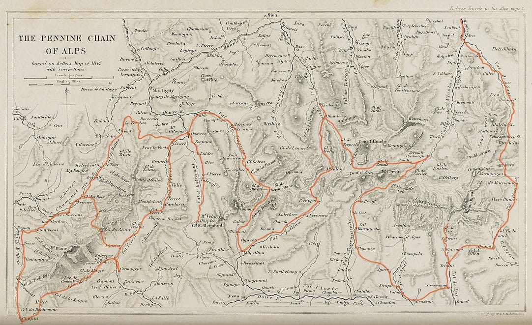
Forbes wrote up his adventures in a book with the snappy title of Travels Through the Alps of Savoy and Other Parts of the Pennine Chain, which he published in 1843. The book is a gem of 19th-century mountain literature, combining the storytelling skill of Whymper with the analytical thoroughness of Tyndall — but written long before either of those men set foot on an Alpine peak.
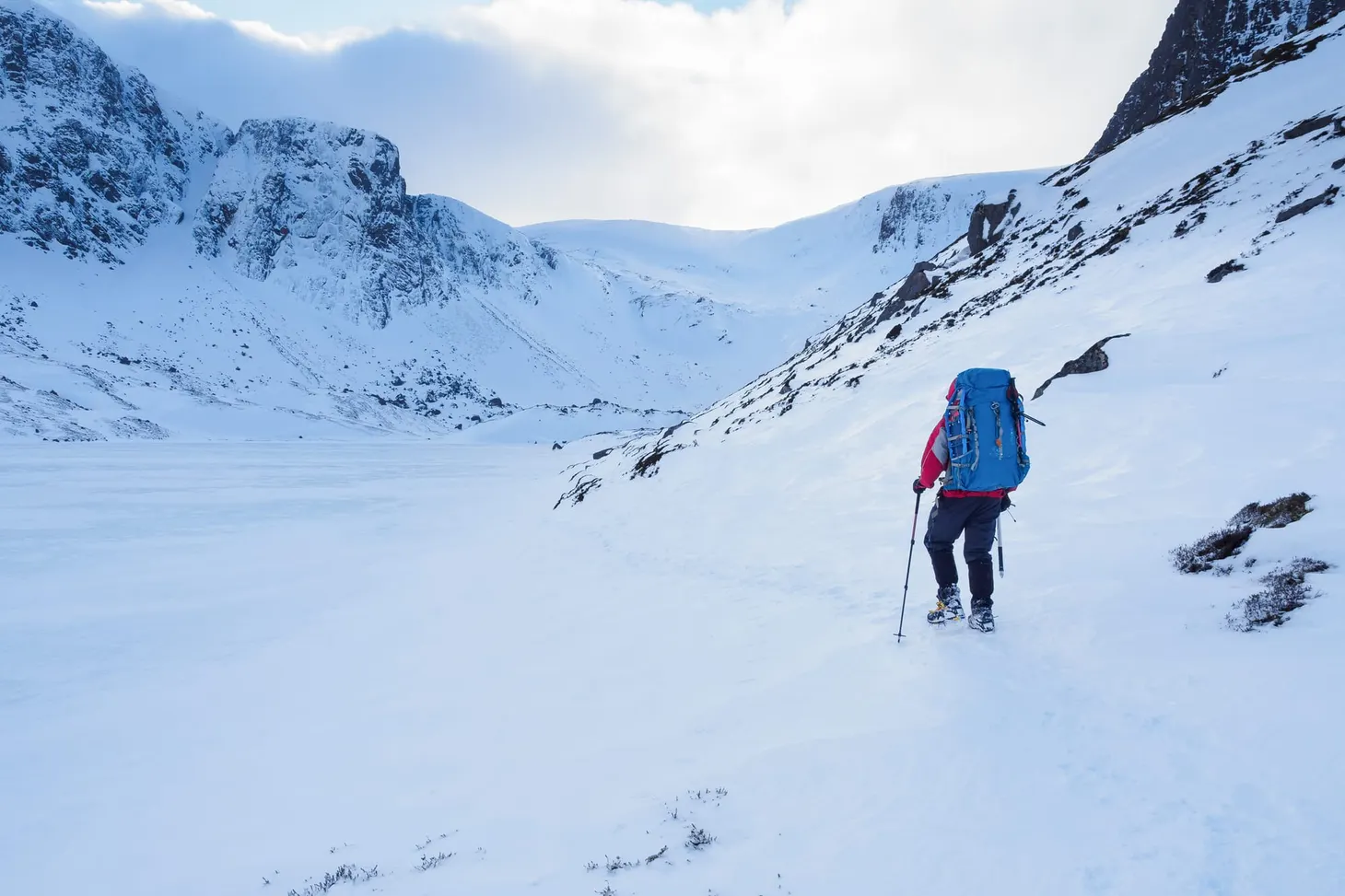
My favourite section of this book concerns the crossing of the Col Collon, which is a glaciated pass between Valpelline in Italy and Val d’Herens in Switzerland. In July 2014 I set out to walk that section of his journey myself. My aim was to traverse the Col Collon and record the changes to have taken place there since 1842.
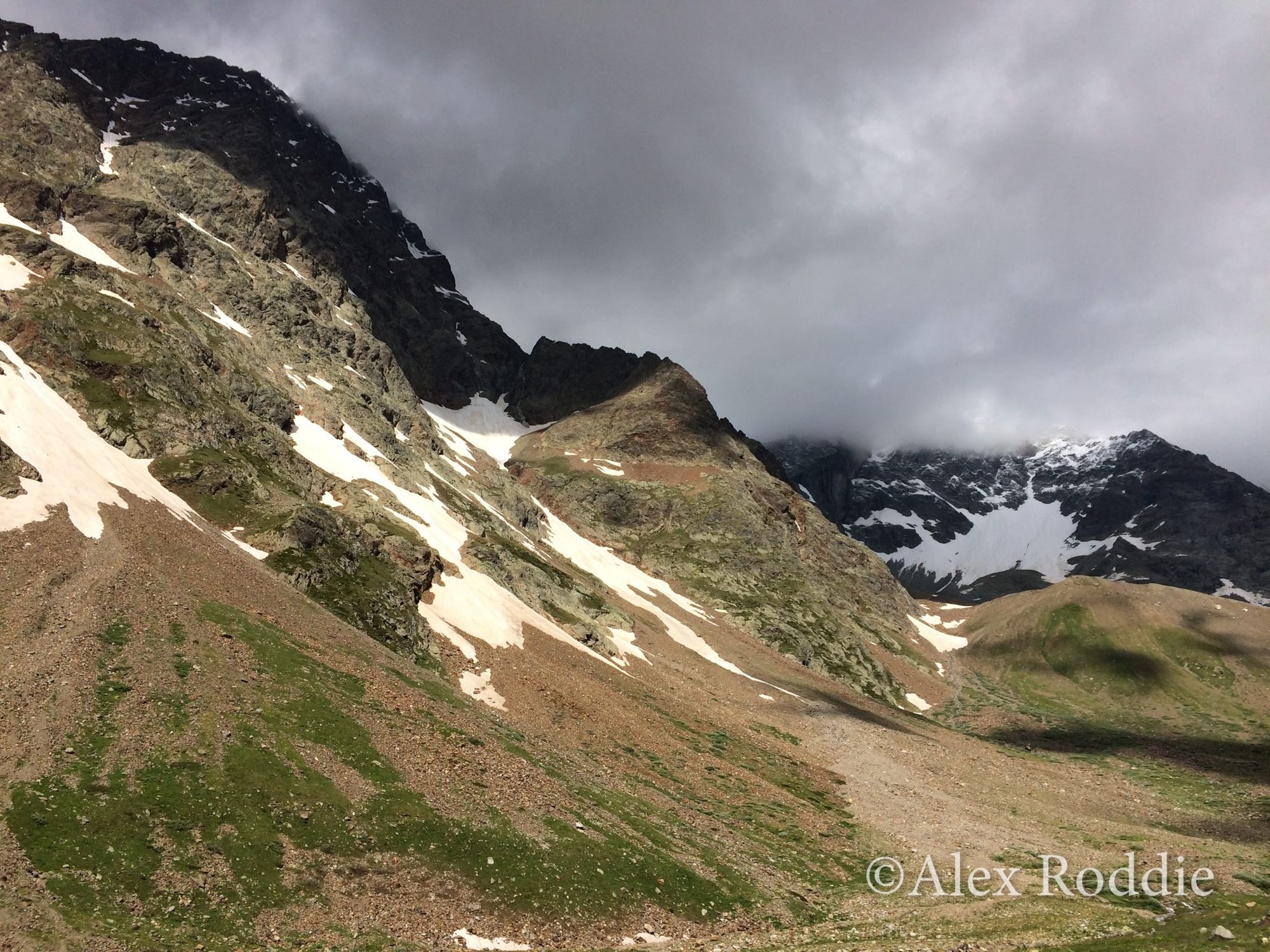
Glacial Retreat in the Comba d’Oren
A day and a half after leaving Aosta on foot, I found myself in the silent bowl of the Comba d’Oren. This is the valley Forbes and his companions used to access the Col Collon from Valpelline, and it remains a delightfully quiet and secluded little cirque, occupied only by a few ruined livestock shelters.
I followed the path through stands of larch and Arolla pine, occasionally pausing to admire the marmots that scurried to and fro between their burrows or sunned themselves on flat stones. After an hour of walking I sat down for a rest and dug out my copy of Travels Through the Alps to remind myself what Forbes had to say about the location.
It was an hour’s walk to the commencement of the glacier, which fills the top of the valley, and which descends directly from the great chain. Having gained an eminence on the south-east side of the valley which commanded the glacier, I saw that the ascent of it must be in some places very steep, though, I should think, not wholly impracticable.
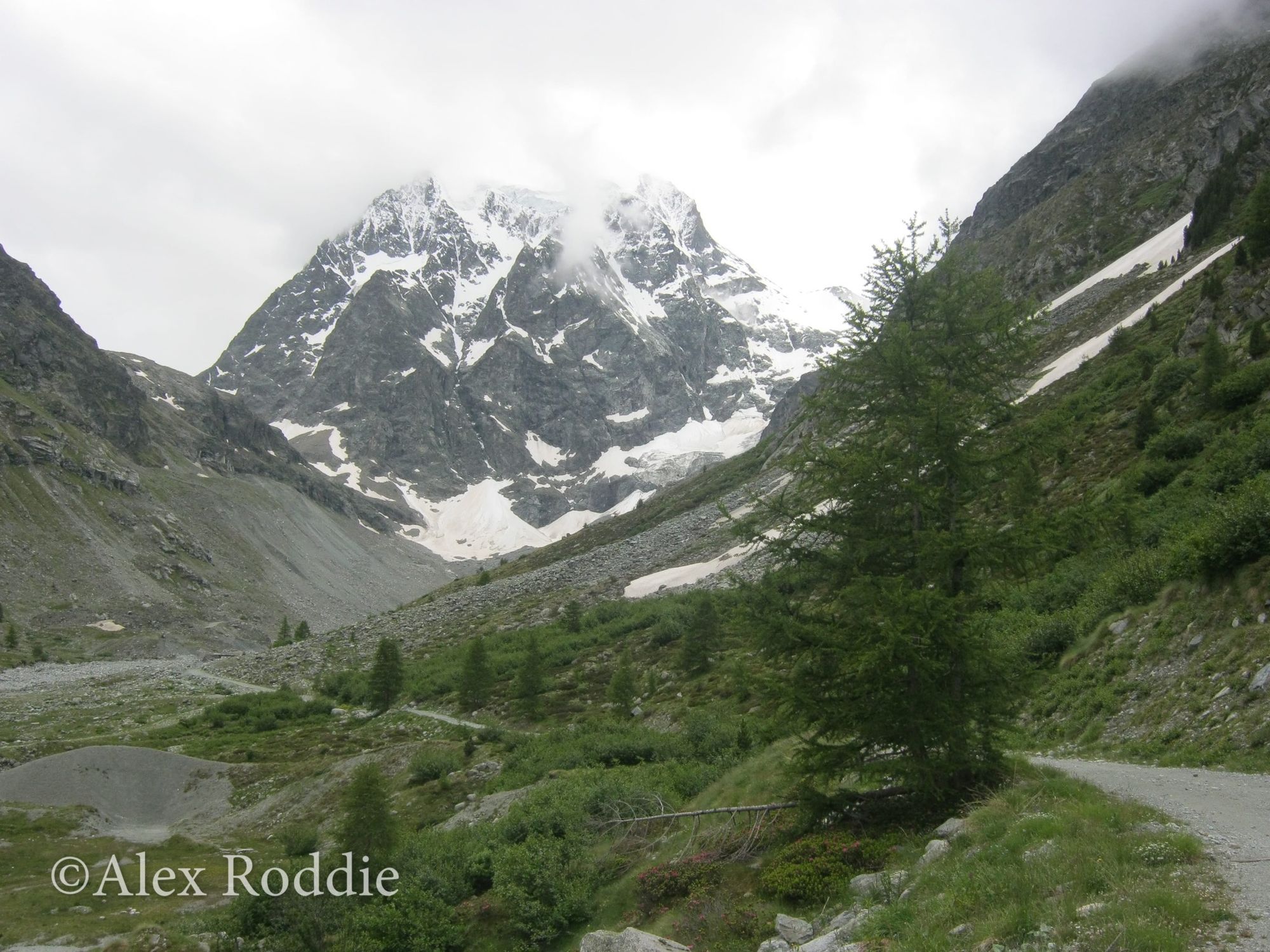
Several 3,000m peaks dominate the head of this cirque: La Singla (3,714m), Pointes d’Oren (3,525m), and the spiky pyramid of L’Eveque (3,716m). I could see plenty of snow up there in the clouds, but where was this glacier that ‘fills the top of the valley’?
I searched for evidence. Glacial debris filled the flat bottom of the Comba d’Oren, and numerous moraine ridges could be seen coming down from the snowfields closer to the ridge line. My map showed two tiny glaciers on the west side of the valley (Glacier d’Oren Sud and Glacier d’Oren Nord), but nothing at the head of the cirque where Forbes said a glacier should be.
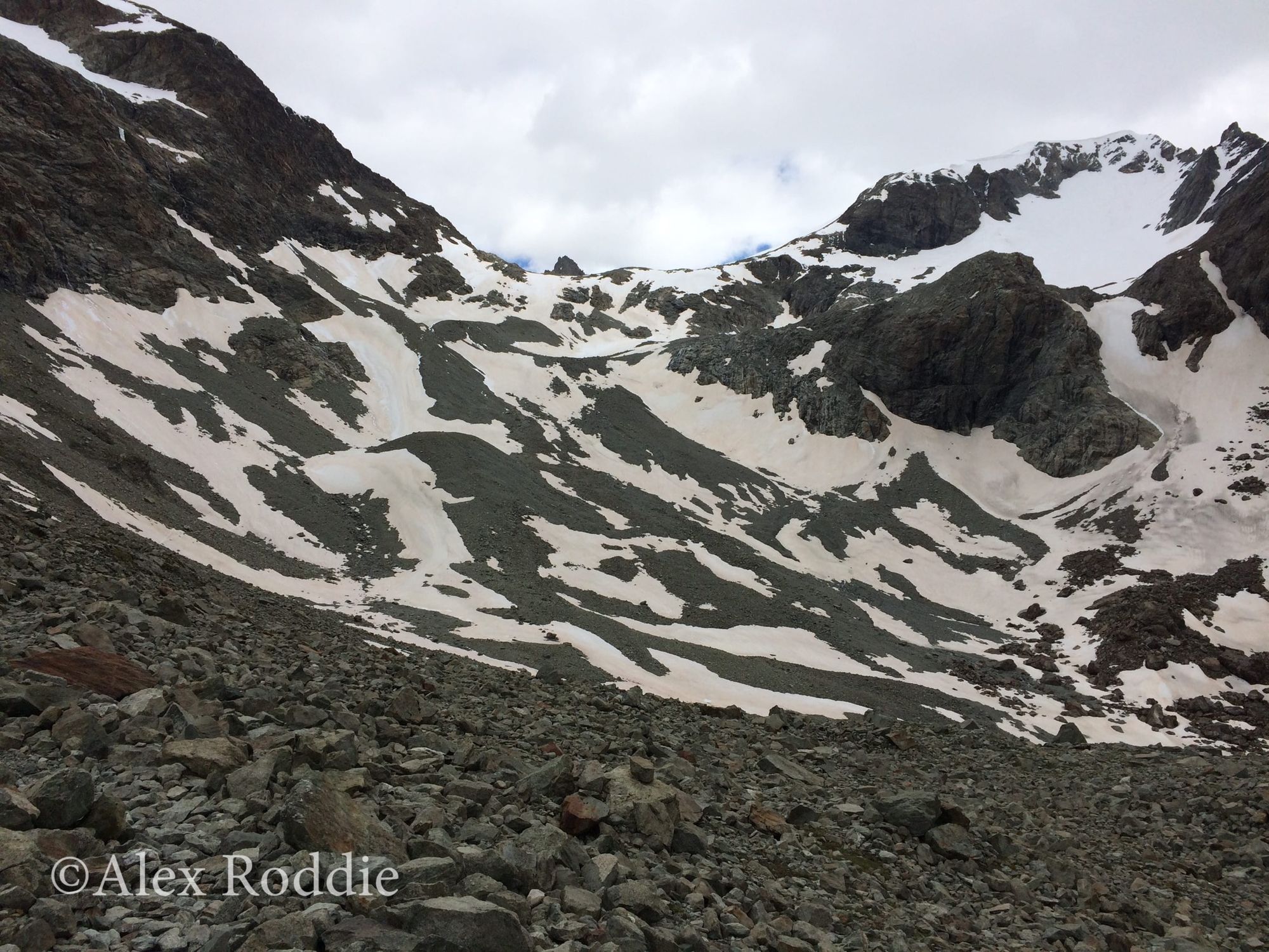
As I hiked uphill I saw the basin where the glacier had once resided. In the present day it’s no more than a corpse of a glacier: a great collapsed heap of old moraine, dashed with snow patches and streaming with meltwater torrents.
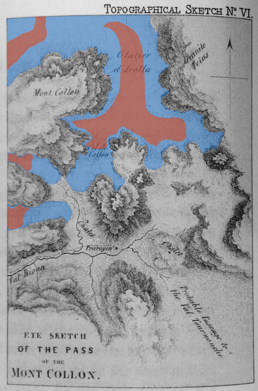
Forbes drew a sketch map of the Col Collon pass which quite clearly shows the glacier extending SW from ‘Col de Collon’ to beneath the 2,700m contour. All this ice has gone since 1842. As I held Forbes’s map up and surveyed the landscape, comparing it with my modern Swisstopo map, I was astonished by the damage.
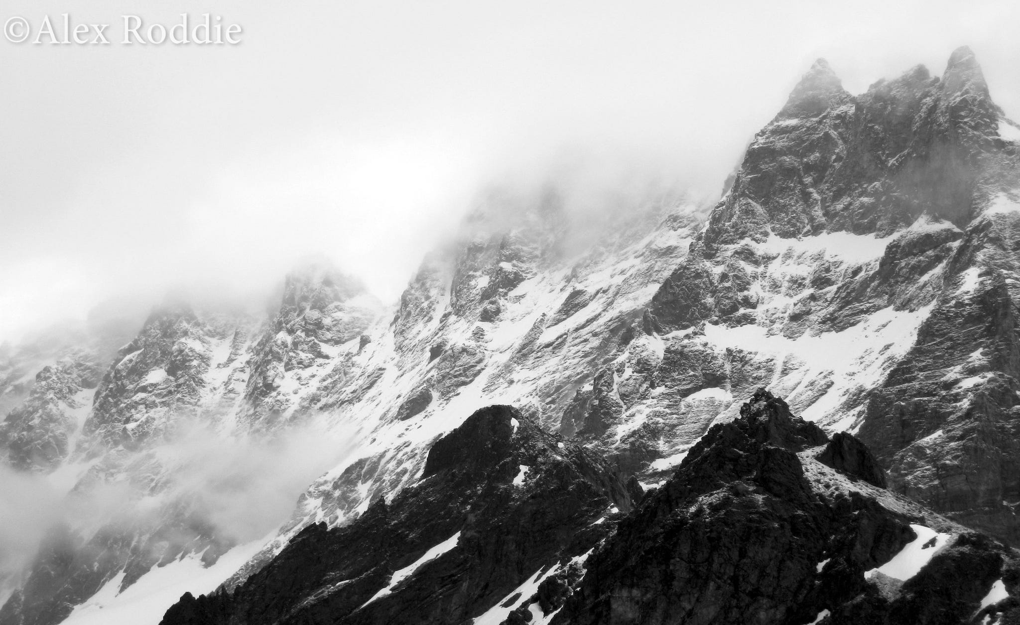
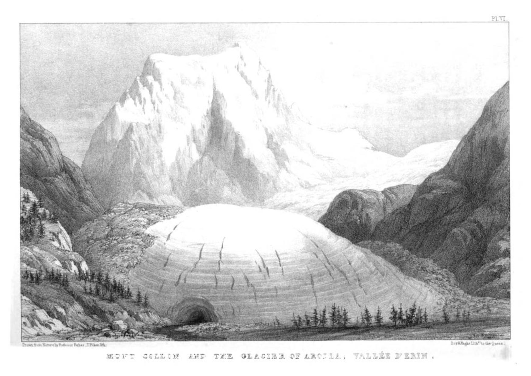
The Glacier d’Arolla
After an overnight camp on the Col Collon, I spent the next morning descending the Glacier d’Arolla in poor conditions. Here are Forbes’s observations of this glacier:
The glacier on which we now were stood is the Glacier of Arolla, that which occupies the head of the western branch of the Valleé d’Erin [Val d’Herens]. It is very long … The lower extremity is very clean, little fissured, and has from below a most commanding appearance, with the majestic summit of Mont Collon towering up behind.
I tried to imagine how Forbes and his companions must have felt, standing on that wild plateau beneath the cliffs of L’Eveque and wondering if they were the first to see those views. Their wonderment must have been short lived for they soon found the skeletons of three people on or near the col, and the guide Biona was so overcome by superstitious dread that he stated he would never cross that pass again. Forbes later concluded that, although he was probably the first scientific person to cross the Col Collon, it must have been in frequent use by local people.
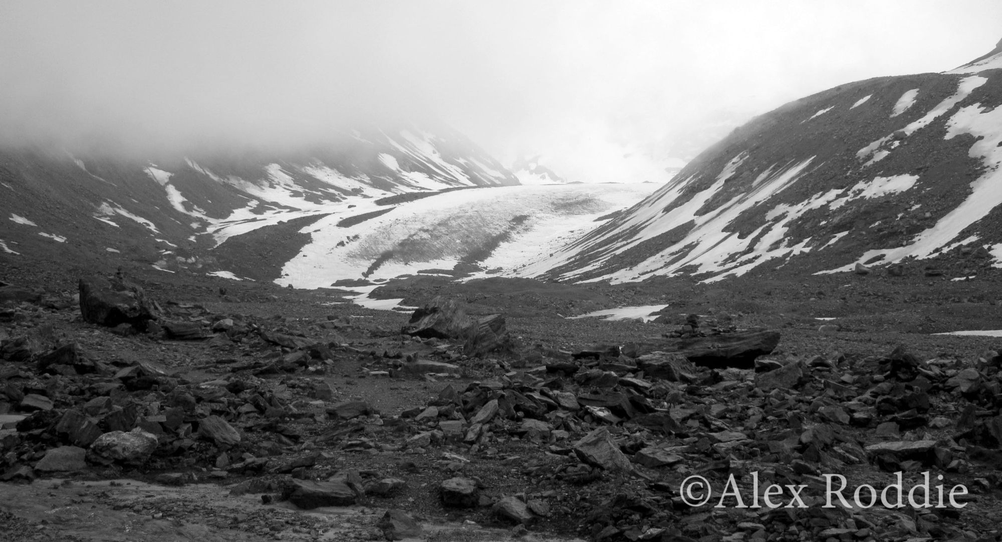
Once again I was astonished at the extent of glacial retreat. Forbes described the glacier as being long, clean, ‘little fissured’, and of ‘a most commanding appearance’. In the present day it can still, perhaps, be described as little fissured but none of the other terms still apply.
Forbes’s map clearly shows a single Glacier d’Arolla coming down from Col Collon and merging with the ice north and west of Mont Collon. Today there are two Arolla glaciers, Haut and Bas, and the upper glacier terminates in a wasteland of moraine and stagnant pools at an elevation of around 2,700m. As I descended from the col to the village of Arolla I was surprised by how much ice had disappeared. The nature of the entire valley has changed since 1842. Where Forbes and his friends had romped down easy-angled ice for miles, I had to follow steep and crumbling paths on the endless moraine long after I had left the ice behind.
The Bas Glacier d’Arolla is particularly anaemic and is now little more than a tottering ruin. The difference is especially striking from the bridge over the torrent at 2,089m. If you compare Forbes’s illustration with my photograph from a similar viewpoint, you will see that the glacier is not even visible in the present day.
A Changing World
We all know that climate change is affecting the world we live in, and that the Alpine glaciers are retreating. Until July 2014 I was aware of that fact only in an abstract sense, and had not considered that climate change might have already affected my enjoyment of the Alps. Climate change was, for me, some day — it wasn’t yet here and now.
Following Forbes’s route, and examining the same glaciers he studied 172 years before my visit, made it all very real for me. The mountains have changed dramatically since the Golden Age of Alpinism when most of them were first climbed. Few photographs survive from that period, but artwork and books remain — and, with a little effort, it’s possible to travel back in time and see for yourself the enormous damage that has already been done to these beautiful and wild locations.
Further Reading
Travels Through the Alps of Savoy and Other Parts of the Pennine Chain by James Forbes is available as a paperback facsimile edition from the Cambridge University Press, and is an essential resource for all students of mountaineering history.
Alexroddie.com relies on support from readers like you. Please consider making a small donation on PayPal. Thank you!

Alex Roddie Newsletter
Subscribe here to receive my occasional personal newsletter in your inbox. (For the fun stuff, please consider subscribing to Alpenglow Journal instead!)