Hiking the Tour of Monte Rosa
A 100-mile walk around a huge mountain that straddles the borders of Italy and Switzerland, this Alpine trail deserves to be better known, says Alex Roddie
This article was first published in TGO Magazine, July 2016
There’s something beguiling about Monte Rosa. The name sounds graceful, but the mountain is not – it’s a complex behemoth of glacier and rock straddling the Swiss/Italian border, and one of the highest peaks in the Alps at 4,634m. I’ve long been fascinated by this mountain. Years earlier, when climbing Castor or Pollux, I’d looked up at the impossibly bright snowfields and longed to be one of those ant-like figures crawling towards the summit.
Over in France, the famous Tour du Mont Blanc is a backpacking trail encircling the Mont Blanc massif. When I heard of a similar 100-mile route offering a 360° tour of Monte Rosa, I knew this was the trail for me.
Surprises
I thought I had a pretty good idea of what to expect when I started my hike one sunny morning from Zermatt, but I soon discovered that the Tour of Monte Rosa is full of surprises.
The first came in the form of a big, scary sign warning of rockfall on the trail. The Europaweg, a high-level path from Zermatt to Grächen, has a gnarly reputation – but I just shrugged and asked myself ‘how bad can it be?’. The views down through unspoiled forests of larch and pine to the valley far below were stupendous, and every few minutes I’d turn around to gape in awe at the Matterhorn’s pinnacle thrusting up through the clouds and dominating the scenery in every direction. But after Täschalp things became more dicey. The weather closed in, and I found myself climbing ever higher into a wasteland of boulders and shattered gullies where nothing grew. The trail was exposed to stonefall for long stretches and it was unnerving to hear rocks crash and tumble through the mists, sometimes out of sight, sometimes shockingly close to hand.
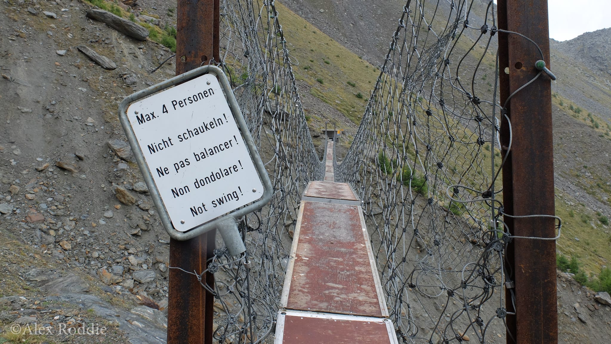
Then came the next surprise: a diversion to avoid a wrecked bridge across a gully. 750m back down, almost to the valley floor, then steeply back up again to the Europa Hut at 2,265m. I was quickly learning that a key feature of the TMR is its relentless gradient profile.
The Europaweg Hut was full, so I pressed on in the hope of reaching Grächen before dark. But my progress slowed as the trail became even sketchier underfoot. I found myself benighted and looking for somewhere flat to camp, eventually choosing marginal perch on the edge of another gully that rumbled and rattled with landslides all night.
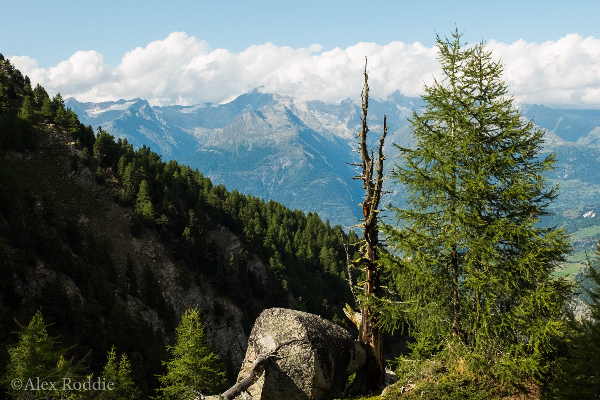
I enjoyed myself a little more after completing the Europaweg. The small town of Grächen is set amongst some of the most beautiful alpine forest I have ever seen. Golden eagles swooped overhead and called to each other on the warm summer breeze, and a passing hiker even claimed to have seen a lynx. Soon I’d turned the great prow of the Mischabel – one of Monte Rosa’s enormous satellite chains – and was hiking south along the Balfrin Höhenweg.
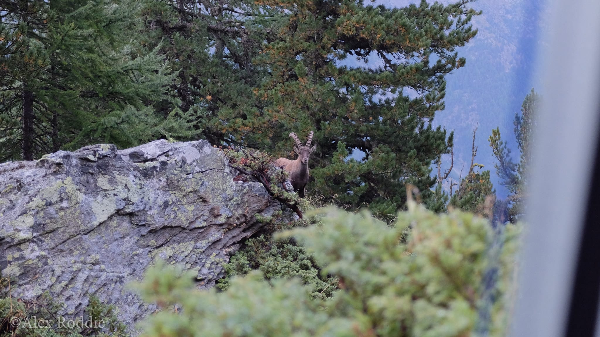
That’s when I started to see ibex. I spotted the first leaping expertly from rock to rock down the side of a cliff, but an hour later I was treated to the spectacle of two bucks battling it out only a short distance away. The clash of their horns echoed through the forest. It was a special moment. Traffic buzzed along the road a thousand metres below, and nothing moved in the sterile world of ice and rock above; but here, surrounded by the colours of late summer, everything felt just right.
Ups and downs
So far, Monte Rosa itself had been conspicuously invisible. I’d hiked deeper into Switzerland, then back towards Italy; soon I’d cross the border. When would I finally catch a glimpse of the mountain this trail was supposed to be all about?
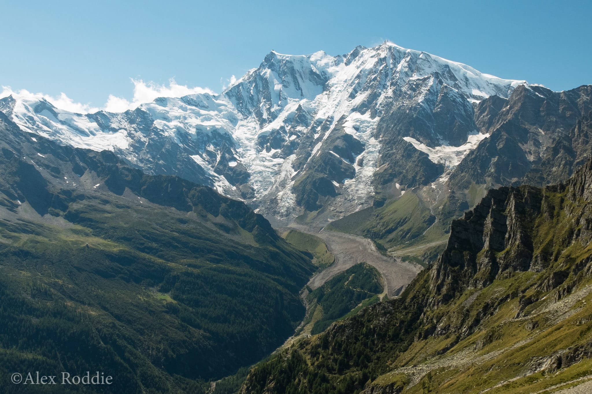
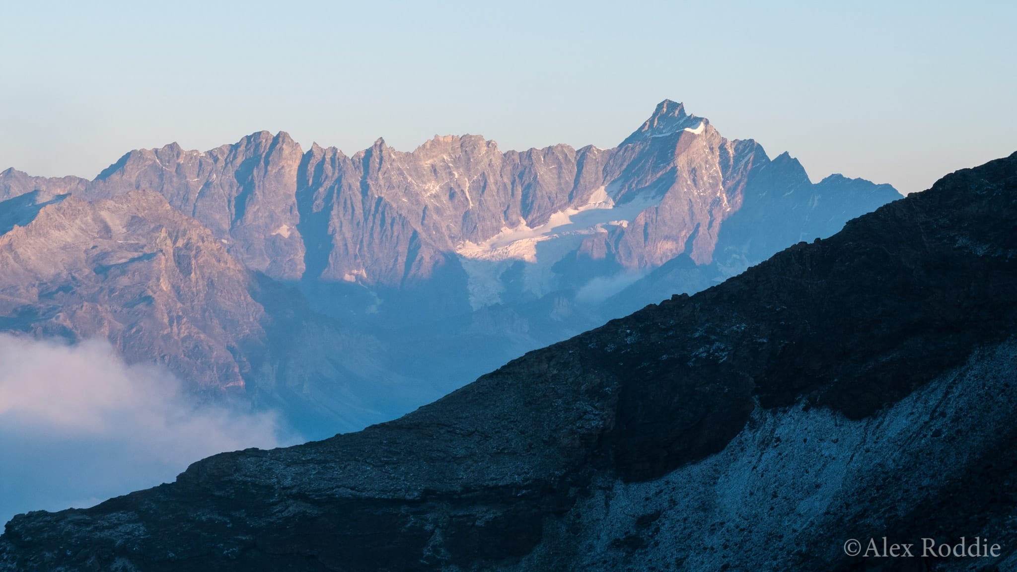
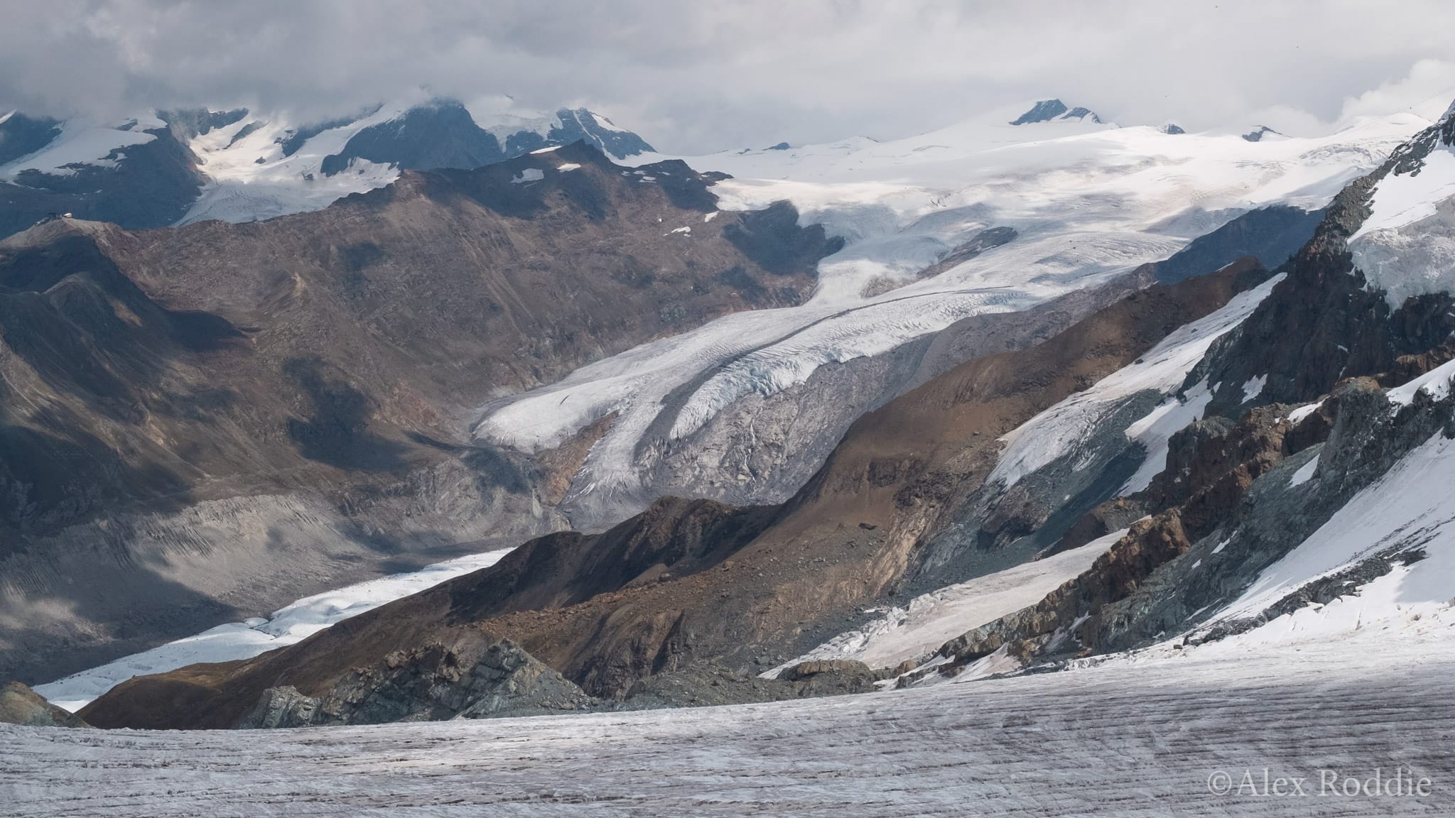
The Monte Moro Pass, an ancient trade route between Switzerland and Italy, proved to be the key. The Monte Moro Pass reaches 2,853m and is the hiker’s first taste of being amongst the bigger mountains. Early in the summer there’s a good chance snow might lie on the route, but it’s never especially steep and is a popular hike. On the day I crossed, I stepped on snow only once and was so preoccupied with the view back along the Saastal that I hardly noticed the new vista unfolding in front of me – until, that is, I reached the top, and the tremendous East Face of Monte Rosa was visible in all its splendour.
This must surely be one of the best moments of any alpine backpacking route. The East Face is like a Himalayan wall plucked from its homeland and dumped in the middle of Europe. All around, the slopes of lower mountains rise from deep valleys, passing through shades of emerald green before merging to the slate greys of the summits. But Monte Rosa burned with that white-hot intensity I remembered – a jagged monster of a mountain, all complex cirques and hard angles but not without beauty.
And that’s where the trail changed. For the next sixty miles I had col after col to cross, in a relentless game of up and down that had my knees screaming for mercy. I’d studied the map beforehand so had a good idea what to expect, but the reality of climbing and descending up to 2,000m every day was absolutely exhausting – even though the scenery was worth the effort, most of the time.
The TMR became a little less defined in Italy. Suddenly I was faced with choices. Go left down the valley and climb this col, or go right and climb that one? It was a balancing act between total ascent and quality of scenery, and I didn’t always get it right. The Colle del Turlo, following ancient Roman pathways out of the forests of the Vallee Quarazza, was a wonderful section and I enjoyed every moment. But after dropping down to the village of Alagna Valsesia, I started climbing up to the Col d’Olen and got lost in overgrown and abandoned farmland without a path to be seen. ‘Maybe I should have bought the guidebook after all,’ I muttered after losing the path for the fiftieth time.
The pinnacle
I’d been looking for a suitable target for a fly-by peak-bagging mission on my way back towards Switzerland. My map presented plenty of options, but most either required technical mountaineering equipment or were insignificant-looking bumps on satellite ridges. I wanted something better.
One option stood out. Testa Grigia, a 3,315m mountain standing between Val de Gressoney and Val d’Ayas, is said to command unrivalled views of the entire Monte Rosa chain. There’s even a Club Alpino Italiano (CAI) bivouac cabin near the top. The official Tour of Monte Rosa passes to the north, over the lower and easier Comba de Fourcare, but I decided the diversion would be worth it.
A monster day of over 2,200m of ascent saw me climb from the other side of the Col d’Olen down to Gressoney, then back up to the Colle Pinter before making a final loose climb to the Lateltin bivouac hut at 3,132m in the dark. I was exhausted, and it had begun to snow outside, but the cabin had everything I needed: a stove, warm bedding, even food supplies. I settled down for the night and set my alarm for an early start.
I woke at dawn. Ice and a dusting of fresh snow glazed the rocks, and I wondered if the climb would be feasible without winter gear. But when I stepped outside the cabin and witnessed one of the most stunning temperature inversions I’d ever seen, I knew it had to be worth a shot. Cloud boiled a thousand metres below me, and shafts of sunlight cut through the mists to paint delicate pastel colours on the upper slopes of the mountain.
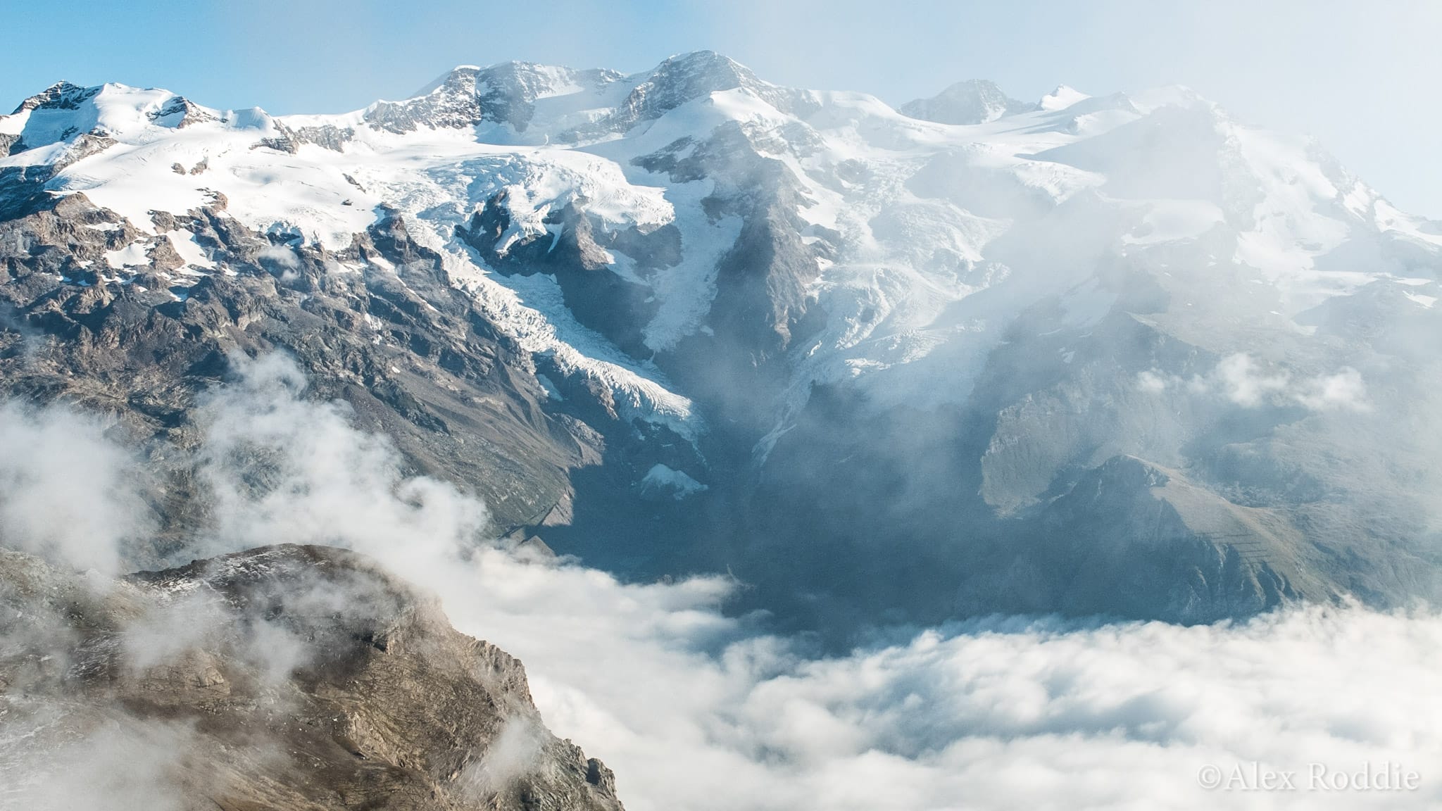
Even with a little black ice here and there, the scrambly ascent was safe in my trail shoes and the early morning sun melted off the snow soon enough. When I reached the summit at 3,315m, the vista over the Monte Rosa chain was everything I had hoped it would be: a grandstand view of one of the highest and best mountain massifs in the Alps, seen at the best time of day and from the best angle. Every summit stood proud and clear against the bluest of skies. Glaciers tumbled in chaos from the snowfields where they formed to the moraine where they melted and metamorphosed into rivers. It was a complete picture of mountain beauty, and the high point of my Tour of Monte Rosa experience.
Tip-toeing back to Switzerland
It wasn’t exactly all downhill after the ascent of Testa Grigia, but I’d broken the back of it. One final pass to go; one final chance to climb up into the mountains before the long descent to Zermatt.
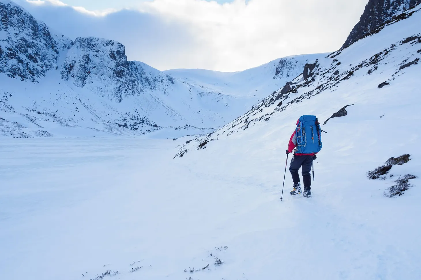
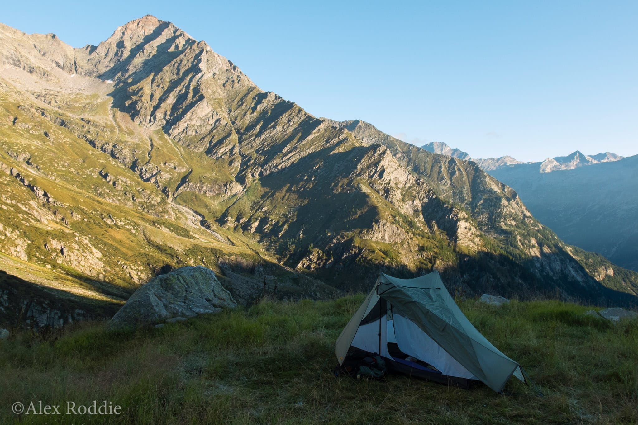
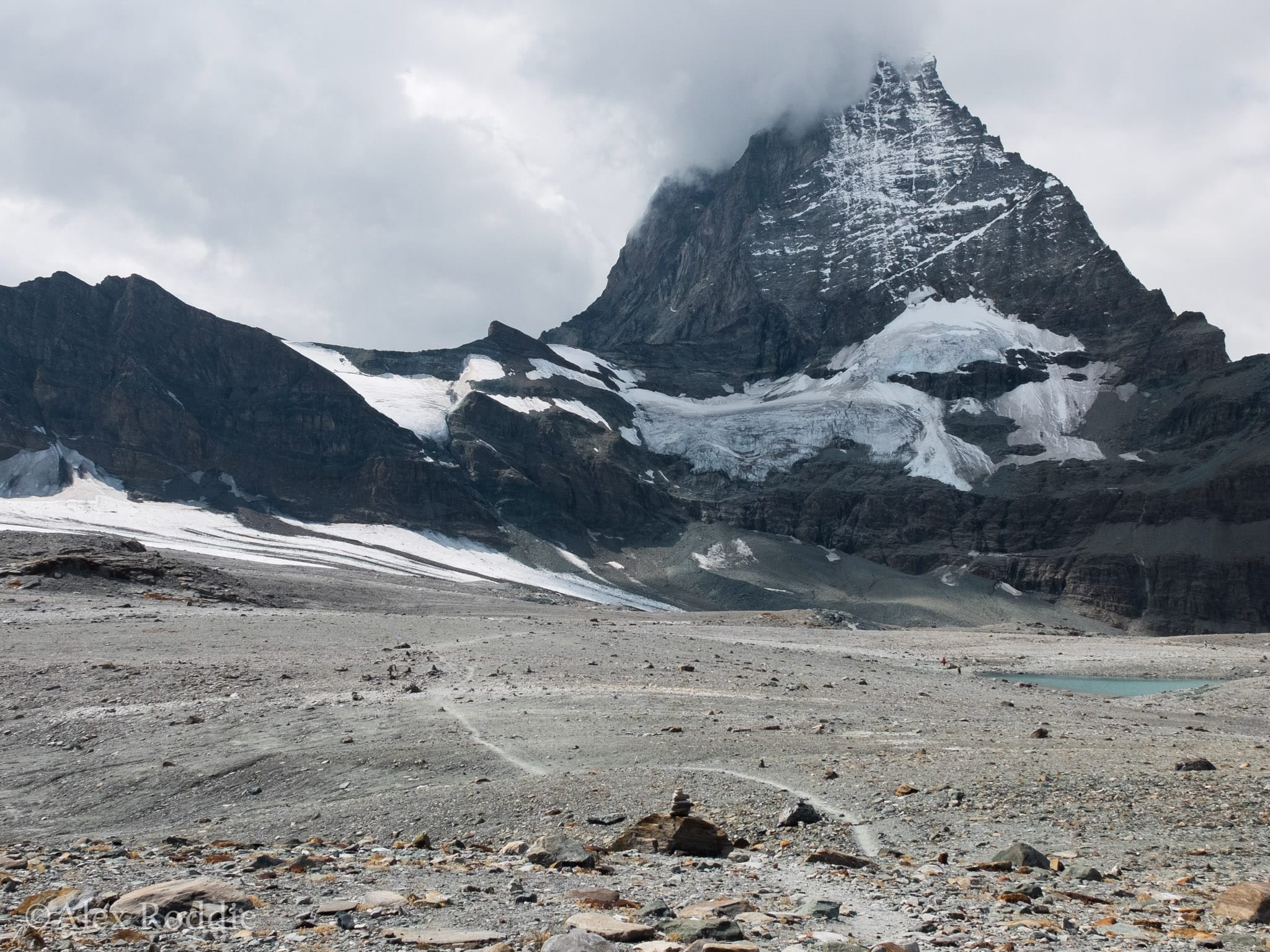
The Theodul Pass is the highest point on the official TMR at 3,295m, and the only place where you have to set foot on a glacier. Until you get to the Cervinia ski complex, the walk up to the glaciated col is a delight: scenic paths through semi-managed woodland, followed by grassed-over ancient moraine that strongly reminded me of the Scottish Highlands. I took my time wandering through this mountain playground before finally camping beside the blue waters of the Grand Lac at 2,806m.
I’d been worrying about the glacier crossing. There’s only a short section of ice before a romp down the ski piste, but I’d heard conflicting reports about how steep the top section might be. Unwilling to carry ice axe and crampons over a hundred miles of hard trail just for one short glacier crossing, I hadn’t packed winter gear.
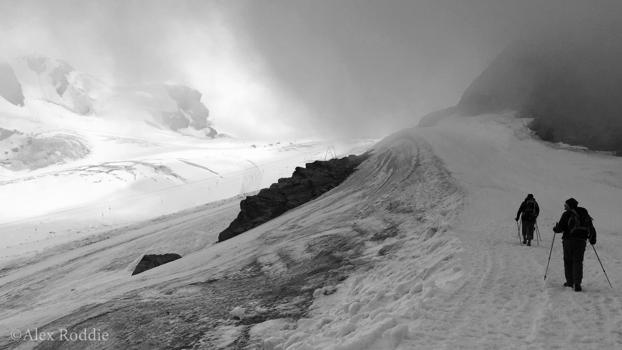
A freezing wind was blasting over the col as I stepped from rock onto hard-packed ice. The surface hadn’t melted as I’d hoped, and I prodded at it with the tips of my poles to gain purchase. Some other hikers were also about to make the short descent to the ski piste and we chatted about our adventures as they got out their ice axes. ‘We’re just returning from the Tour of the Matterhorn,’ they told me. ‘This is the first time we could have done with having crampons!’ Like me, they had chosen to save weight rather than pack spikes.
We zig-zagged down the glazed surface in single file, kicking and clawing with the edges of our shoes to get some bite, leaning on both poles for support. I would have been happier with some Microspikes – or just a slushy surface to allow me to kick steps – but in a few minutes we were off the slope and onto the well-groomed surface of the piste where the walking was easy.
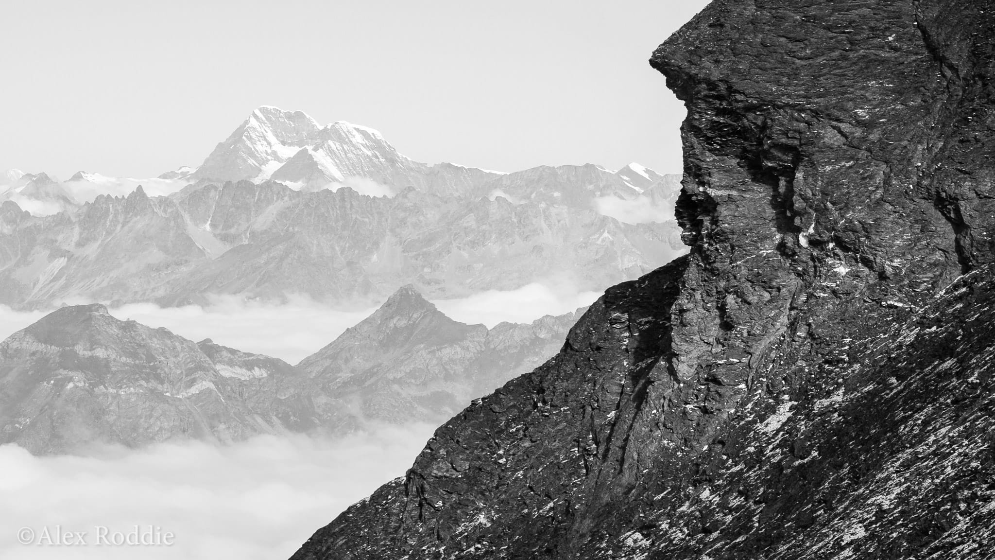
The views on the walk back down to Zermatt were superb. Beyond the peak of the Riffelhorn, at the head of a distant glacier, lay Monte Rosa once again. I’d now seen this iconic massif from every angle, come to appreciate its different moods. But the variety of Monte Rosa extends far beyond its contrasting faces. Every valley I had crossed on my journey could trace the source of its rivers to the ice of Monte Rosa. Every pass straddled one of its satellite ranges, like the limbs of an octopus. To see the whole mountain, to truly understand it, you have to do more than climb from the bottom to the top – you have to stay out a little longer.
Photographic notes
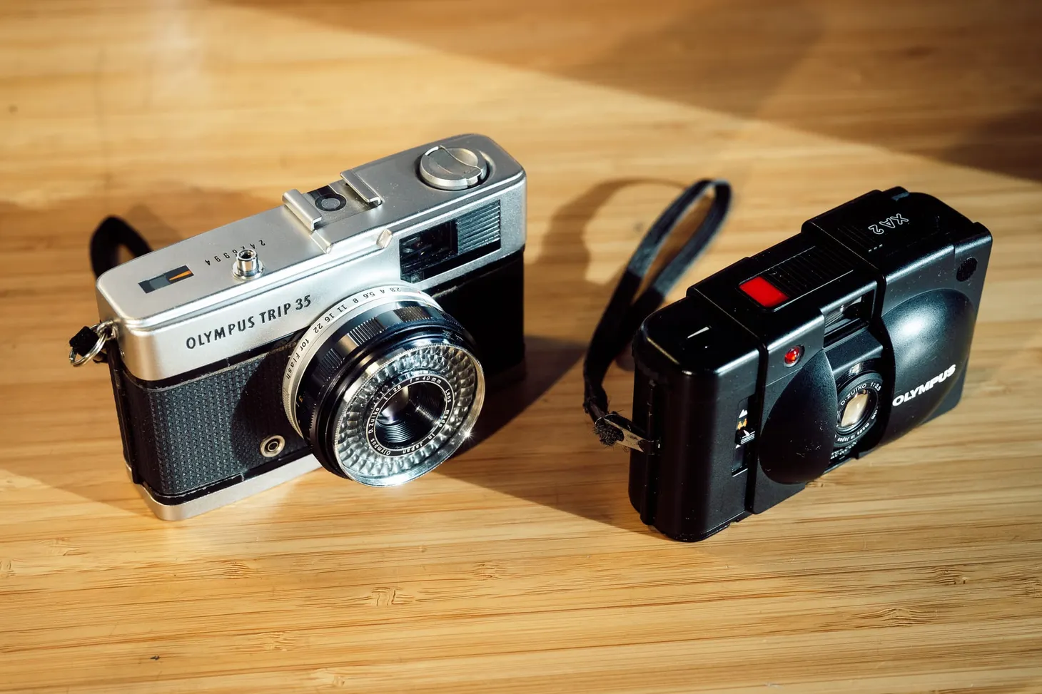
I used the Fujifilm X30 fixed-lens compact camera for this trip. Despite its small sensor, the camera performed well in a variety of conditions and the excellent zoom lens was a real benefit. I did not, however, attempt any night-time photography – it would have been impractical.

Alex Roddie Newsletter
Subscribe here to receive my occasional personal newsletter in your inbox. (For the fun stuff, please consider subscribing to Alpenglow Journal instead!)