Chased by Storms: 113 miles along the Haute Route Pyrenees and GR11 in 2016
Three long-distance routes traverse the Pyrenees: the GR10, GR11 and, most challenging of all, the Pyrenean Haute Route. In 2016, on the hunt for mountains and summer sun, Alex Roddie got a taste of each of them.
This feature was first published in the August 2017 issue of The Great Outdoors magazine.
‘What is your quest, pilgrim?’
The situation I now found myself in was unlike any I’d experienced as a backpacker. I was standing in a cave entrance, halfway up a mountain in the Pyrenees, talking to a man who looked a bit like Gandalf without the hat.
I mentally stopped myself from crying ‘I seek the holy grail!’
‘Er, I’m hoping to climb Vignemale tomorrow.’
That was my plan, at least. I had ice axe, Microspikes, and faith in my experience as a mountaineer, but I’d spoken to a French guide earlier that day who claimed the glacier was in a bad condition at the moment, and that a hiker had been hauled out of a crevasse by a rescue helicopter recently.
‘Not this week, monsieur. Conditions are bad.’
I nodded. He told me that he often came up to the Vignemale grottos – caves chiselled out of the rock by a 19th-century eccentric – and kept an eye on the pass to Gavarnie. I’d been in the Pyrenees for a couple of days, and already it was feeling like a radically different environment to anywhere I’d been backpacking before.
Like all the best trips, this one started with a question: where can I go in Europe to find both mountain wilderness and sunshine? After half an hour’s web browsing and a few email conversations with friends who had visited the area, I settled on the Pyrenees: a strip of high wilderness sandwiched between France and Spain. These mountains seemed to have everything I was looking for. There was even a family connection – my grandad Fred crossed the Pyrenees on foot in 1937 to fight Franco as part of the International Brigade.
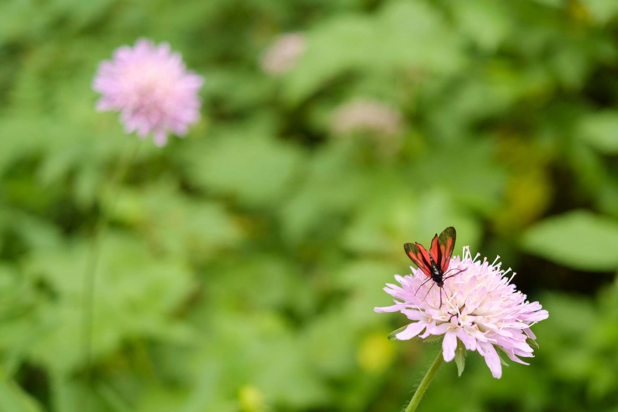
The Haute Route Pyrenees (HRP) caught my eye. Although I didn’t have time to thru-hike the entire 500-mile route from Atlantic to Mediterranean, I planned to complete one of the most interesting-looking sections in the middle. Here some of the wildest and most rugged mountain landscapes in the Pyrenees may be found. It’s an area renowned for wildlife as well as scenery – a habitat for ibex, marmot and vultures as well as rare plants and invertebrates. And the HRP threads a higher, wilder line between the popular GR10 and GR11 trails.
In a word: heaven.
Above the path on the way down to Gavarnie from Vignemale, you’ll find a series of caverns cut into the rock. They were put there by Henry Russell (1834-1909), an eccentric mountaineer who devoted much of his energy to exploring the Vignemale area. Keen to spend more time on the hill, he had a total of seven artificial caves dug out between 1881 and 1893. Today they are often used as emergency shelters.
“Frankly, Vignemale intimidated me. I had a loose plan to climb this mountain by the easy route around the back”
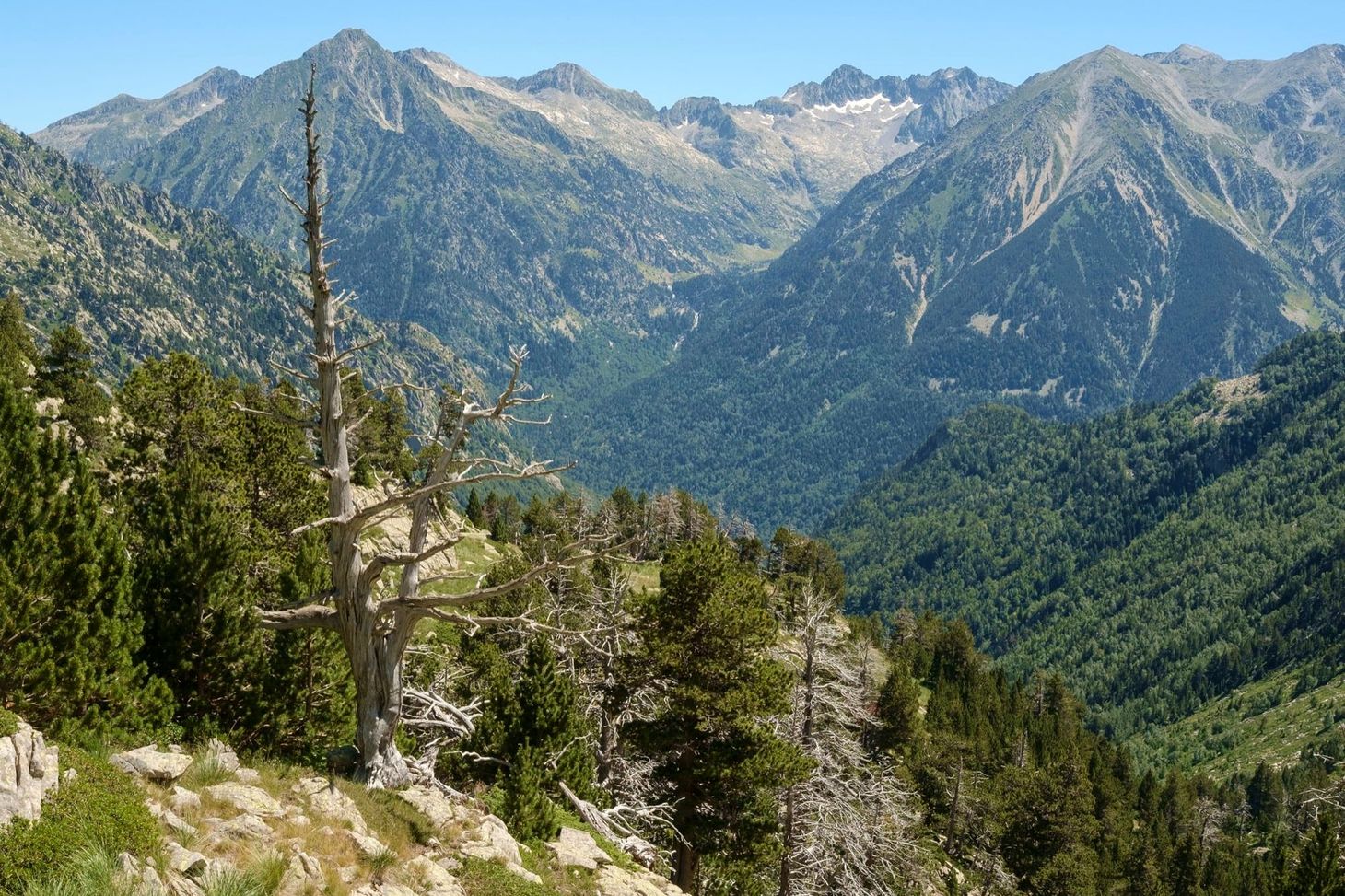
I chose Cauterets in France as my entry point for the HRP. I followed the GR10 through steep, forested valleys where only the occasional break in the tree canopy let me take in the wider view. I’d never walked amongst such densely forested mountains before. In many places the trees reached all the way to the peaks themselves, only breaking where the ground became too steep or rocky for life to gain a toehold. I sensed that I was walking through hills that had changed little for a long time.
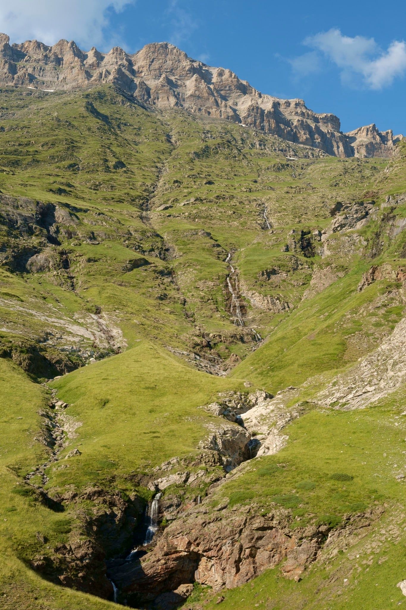
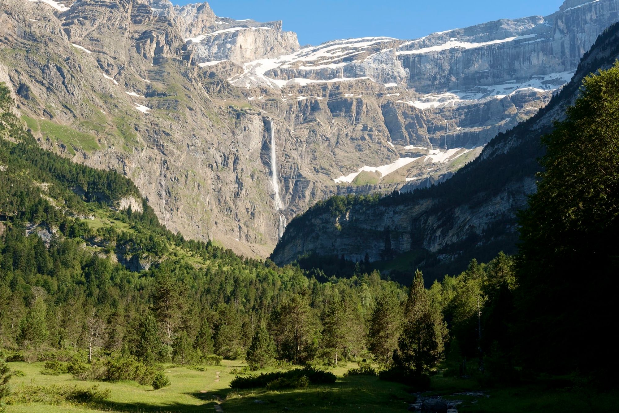
Soon I was climbing beside a torrent roaring down out of the mountains. On the other side of the river I spied a crumbling ruin; Roman, perhaps, but it reminded me of the fragments of ancient civilisation scattered around Tolkien’s Middle Earth. This impression grew when I crossed a slender bridge over one of the most beautiful waterfalls I had ever seen.
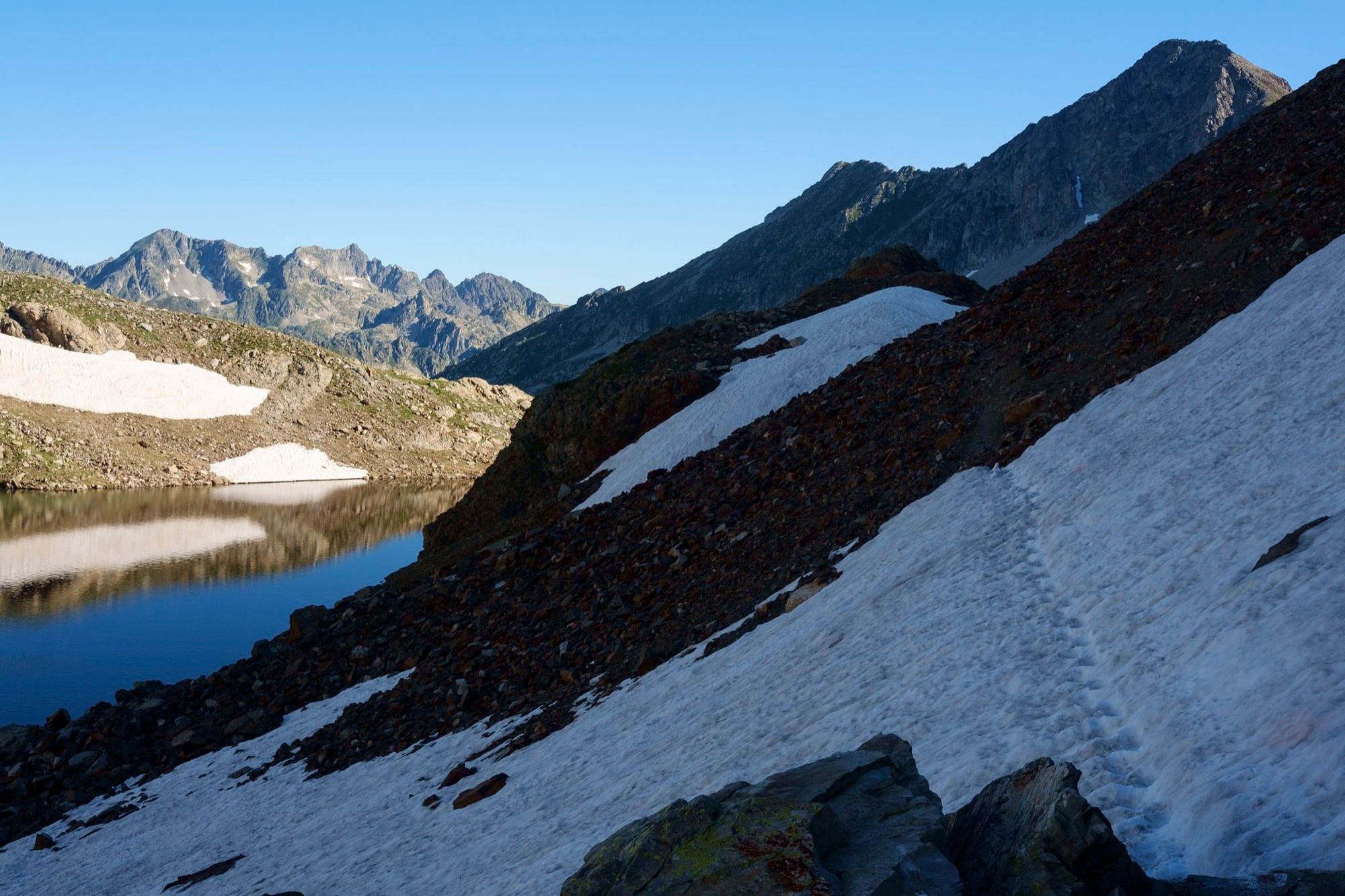
I camped in a magnificent location above the tree line, near the Refuge Wallon. Marmots called and scampered around me as I pegged out my Trailstar. Golden light reflected from the small snowfields left in hollows high on the mountains, and I drifted off to sleep to the music of cattle bells in the valley far below.
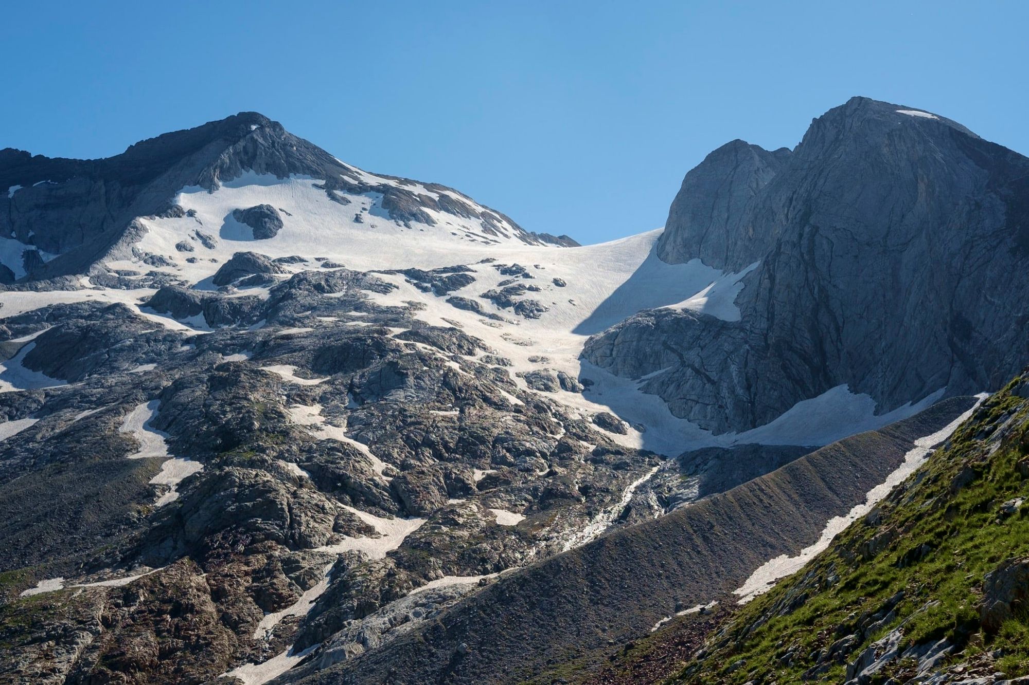
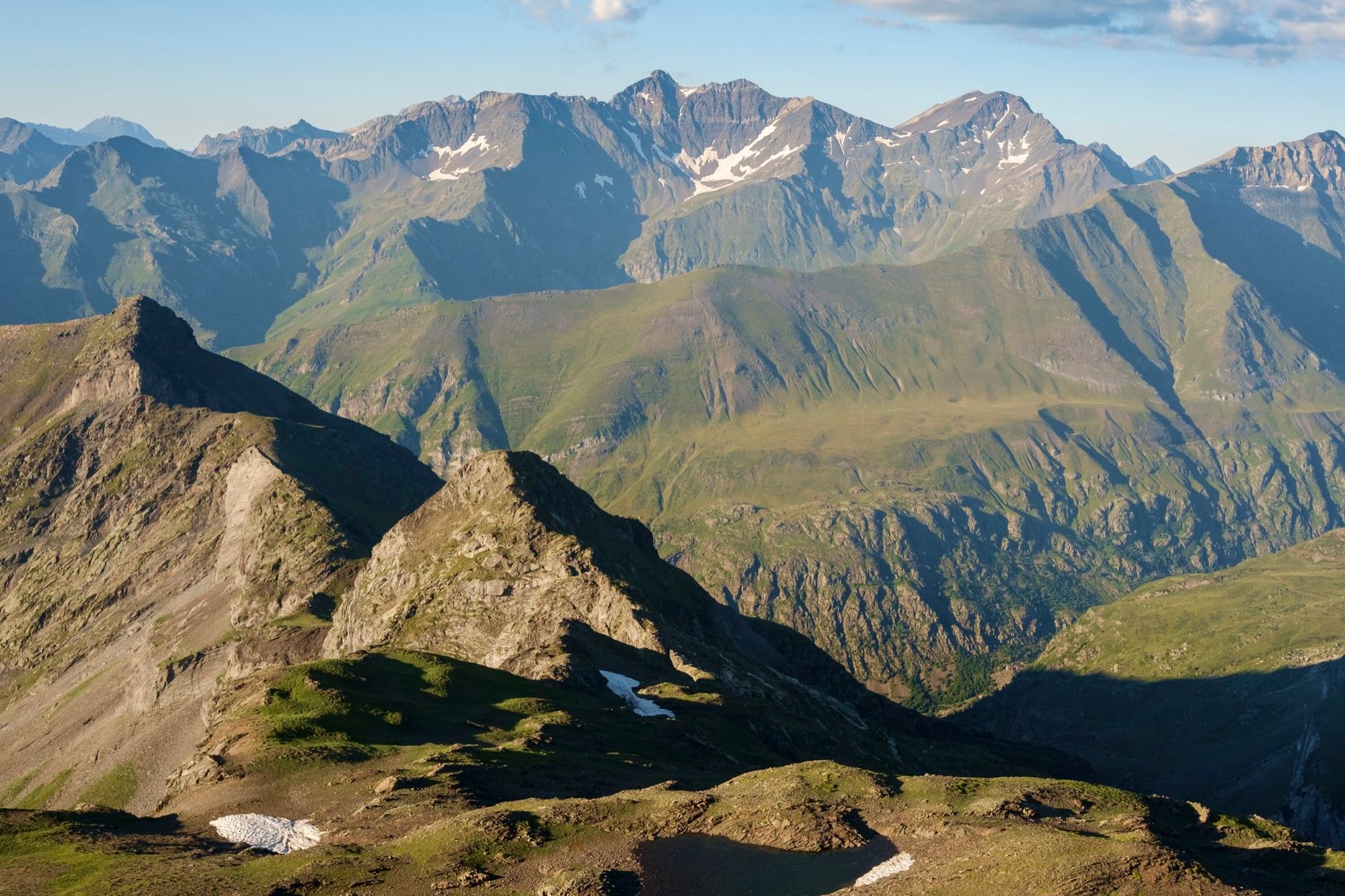
Not going to lie: the next day was pretty tough. I had three high cols to cross, all over 2,000m, and the sun was baking hot from the moment it peeked over the ridge and hit my Trailstar, blowtorching frozen condensation in seconds. I packed away my things and got walking. Soon I discovered that scale could be deceptive in these mountains. When I looked up to the Col d’Aratille, sandwiched between jagged buttresses and snowfields gleaming in the sun, I thought I still had 1,000m left to climb. In fact, the col was only 300m above me. My brain was used to the bigger scale of the Alps; here things weren’t quite so massive.
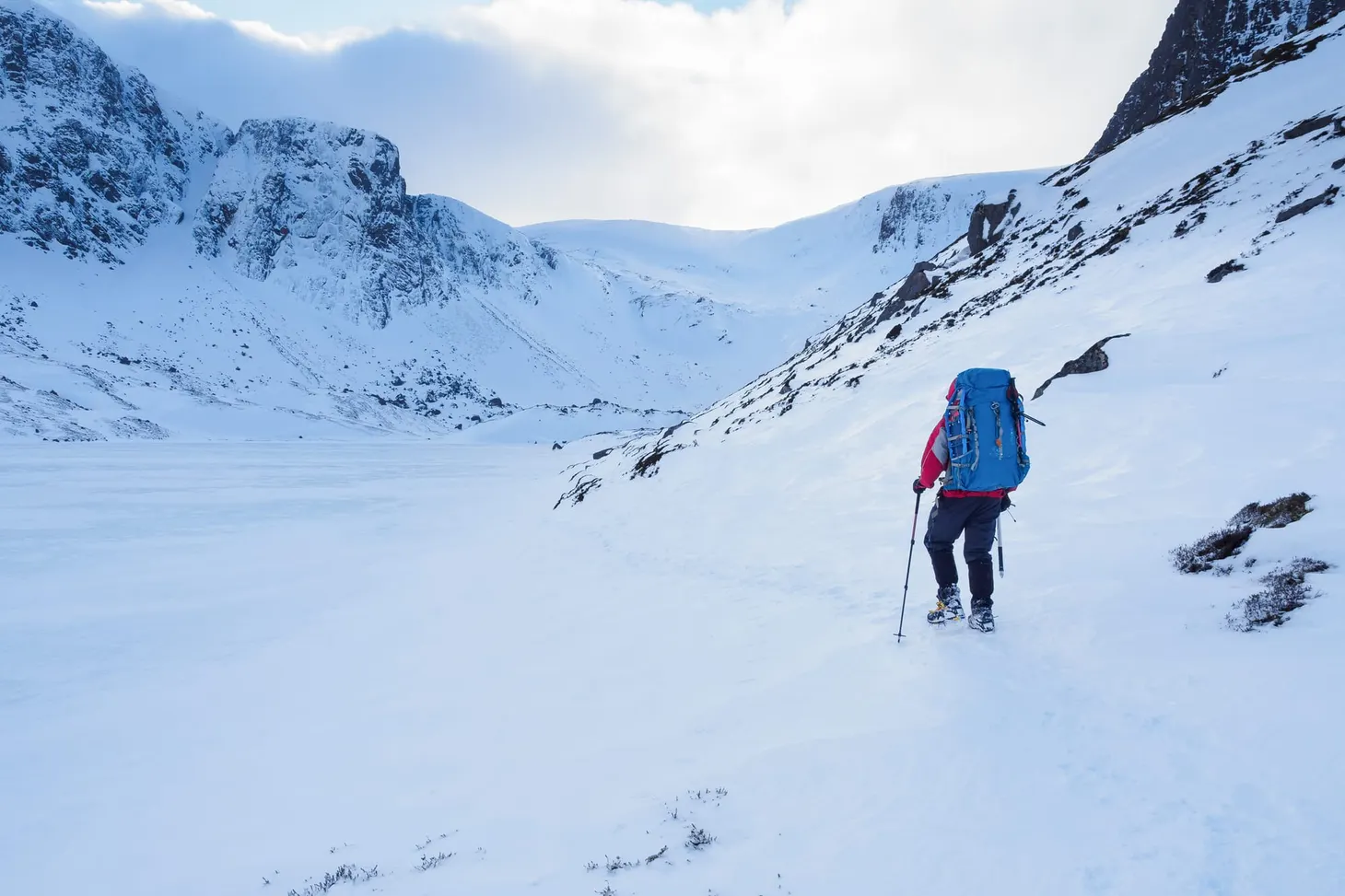
I had to get the ice axe and Microspikes out for the descent of a snow gully on the other side of the Col des Mulets. Other hikers slid and slithered down the slope, playing a game of chance with the boulders at the bottom of the run-out. I’d felt a little silly carrying an ice axe in sweltering heat the previous day but now my decision was justified.
The Haute Route Pyrenees crosses no major glaciers, but snowfields can be an obstacle well into July. Consider taking an ice axe and Microspikes or crampons (and the skills to use them safely). The HRP is a challenging route, more akin to mountaineering than hiking in some places, and you’ll need a real nose for route-finding in vague, rocky terrain. Scrambling skills will come in handy too. Watch out for afternoon thunderstorms – they often develop in spells of hot weather, and can be savage at altitude. The Spanish side of the range is drier than the French side.
If the HRP looks a bit too gnarly, there are two excellent long-distance alternatives: the GR10 and GR11. The first traverses the Pyrenees on the French side; the second on the Spanish. Both are less serious than the higher, more remote Haute Route, but you might find them more strenuous because they can involve more ascent and descent. On the HRP, once you’re high, you often stay high. Many walkers compose their own route by stringing together bits of the HRP, GR10 and GR11 as needed. There’s a lot to recommend this – it’s how I approached the Pyrenees in 2016.
At last I saw the mountain I’d been looking for. Vignemale’s north face dominated the head of the deep valley I was descending into – a rocky cleft as impressive as Rivendell (but with sunbathing hikers instead of elves). Frankly, Vignemale intimidated me. I had a loose plan to climb this mountain by the easy route around the back, but its north face looked so impossible – even to an ex-climber – and its summit so high above me that I lost heart. Doubts about snowfields and glacier safety crept into my thoughts. I’ll find my way to the Vignemale Grottos down past the next col, I told myself, and take it from there.
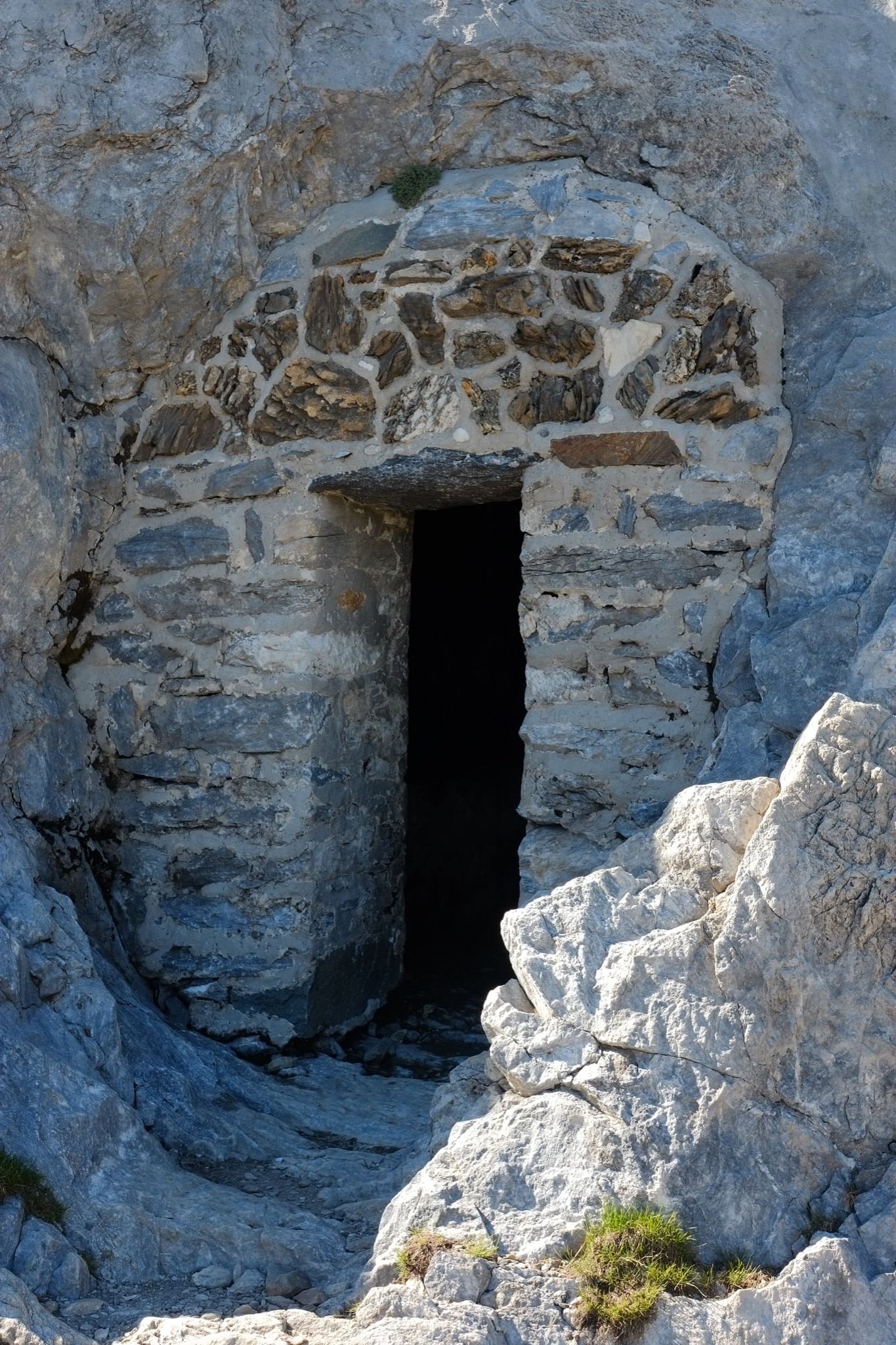
When I finally dragged my sweating body into the grotto, the last thing I expected to see was a Gandalf lookalike brewing coffee over an antique Primus stove. When he told me that Vignemale wasn’t a great idea this season, I was in no mood to argue. The Pyrenees had caught me off guard – the scale may be a little smaller than the Alps, but these mountains are no less fierce.
My first resupply stop came at the little town of Gavarnie. A popular tourist destination thanks to the unbelievably beautiful Cirque de Gavarnie nearby, a vast amphitheatre into which the highest waterfall in mainland France pours, I found myself enchanted by the beauty of the mountains surrounding this area. Besides, I needed half a day off to recover. I’d only walked thirty-odd miles so far, but the rising heat – combined with the rocky, arid terrain – was taking a lot out of me. I slept under the stars in the woods at the bottom of the cirque. It was a transcendental bivouac. The roar of Gavarnie Falls lulled me off to sleep, and every time I opened my eyes, I could see starlight shining on the celestial snows at the amphitheatre’s rim.
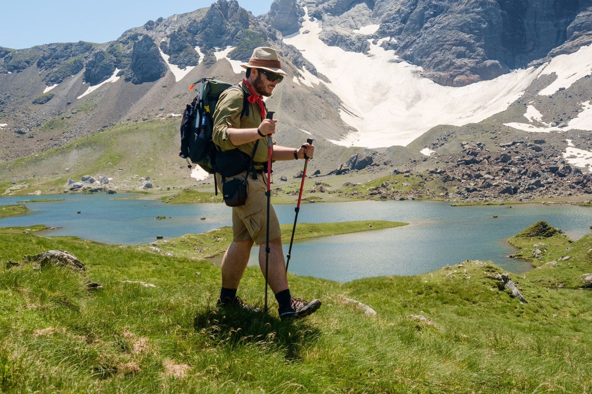
Pausing at Gavarnie gave me the injection of perspective I needed – a chance to catch up and get into the Pyrenean groove. Vignemale’s mind games may have psyched me out, but now I was hungry for a summit. Nearby Pimene, a satellite of the main chain of mountains, looked just right. At 2,801m, it was high enough to offer super views of the cirque, but not high enough to introduce glacier worries. I was keen.
Did you know that I send out weekly newsletters on adventure, writing, and adventure writing? Subscribe here to receive my Pinnacle Newsletter.
My ascent took place on an exhaustingly hot evening. I had assumed that it would be cool enough towards sunset, but I found myself slogging uphill with a dwindling water supply and the mercury still nudging 25˚C at 2,500m. Vultures circled overhead. But when I reached the summit after a pleasingly exposed ridge scramble, the views were worth it a hundred times over. That night I camped on a grassy knoll a few hundred metres below the summit and watched alpenglow paint the mountains gold.
Many mountain refuges in the Pyrenees have adjacent camping grounds, where it’s permitted to ‘bivouac’ (low-profile camp) for one night, sometimes for a small fee, and usually only between 19.00 and 07.00. Zero-impact bivouacs are encouraged within the National Park on the French side of the chain. In Spain, the situation is more complex – some areas welcome discreet campers, while in other places it is banned. You will often find trailside signage explaining the camping situation when entering a new area. Above all, respect the fragile ecosystem of the mountain environment.
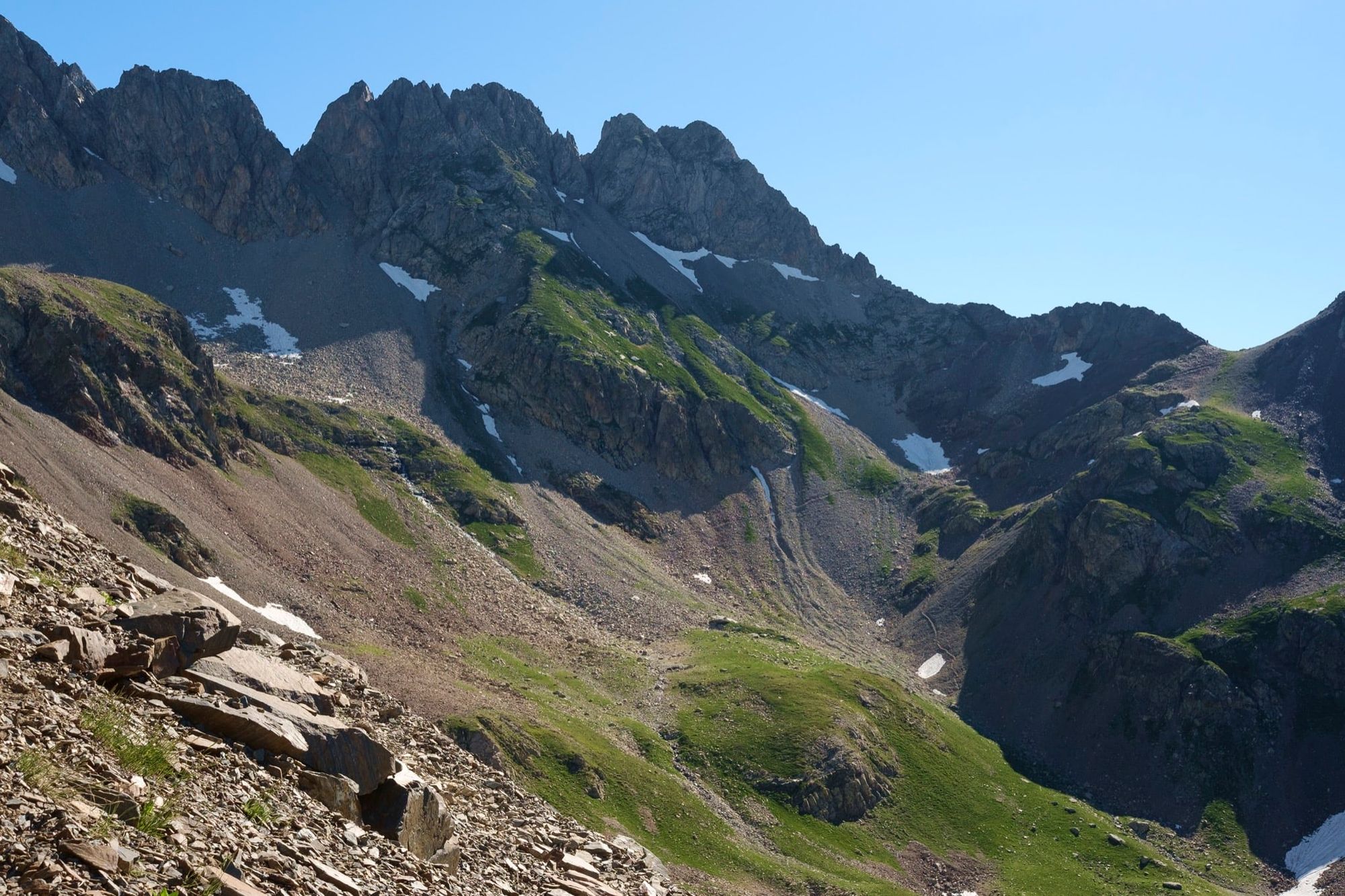
Climbing to Pimene’s summit was just what I needed to keep my motivation going. Over the next few days I crossed col after col, moving through this dreamlike landscape at once wild and surprisingly cultivated. It’s a world of circling vultures and golden eagles, chamois and wild boar, yet the bell-ring of cattle fills every valley and many of the forests are tamed. Most of all, I found it a place of sweltering heat – and apocalyptic thunderstorms.
The heat came to a head when I crossed over into Spain and I saw a thermometer at the rather Wild West village of Parzan record 35˚C. That afternoon, a massive thunderstorm system chased me over the 2,300m col of Paso de los Caballos. I’d diverted down the GR11 by this point – the threat of being caught in an electrical storm on the higher and more difficult HRP was unpalatable – and I found myself power walking uphill in stifling humidity, working hard to outrun the storm. It burst upon me when I reached the campsite at Viados. Sheets of water pummelled my shelter as I cowered beneath, disoriented by the lightning that seared abstract images into my retinas and the thunder that made nearby campers scream.
Although splendidly wild, the mountains were often dry and brown in the Spanish half of my hike, with less of the lush forest I enjoyed walking through so much. My stomach was starting to reject my stoveless diet too. I’d been unable to find much beyond bread, cheese and hard mountain sausage at the last resupply, and keeping these items fresh in my pack was impossible. When I reached the Spanish town of Benasque, I had to take a day off to recover from a bout of illness.
Feeling under the weather and still wary of the huge storms that attacked every couple of days, I stuck to the more southerly line of the GR11 for the rest of my hike. This turned out to be a fantastic trail in its own right and I particularly enjoyed the Val de Estos, a little slice of oasis sandwiched between the gaunt heights, buzzing with wildlife and flowing with water. But I hadn’t got over my stomach bug, and I knew it was time to get off the trail.
I left the Pyrenees at Vielha and spent a few days in the sunny town of Bagneres-de-Luchon before flying home. My introduction to the Pyrenees was bittersweet: I’d enjoyed some of my finest ever days on the trail, but also been spooked by thunderstorms and suffered from the high temperatures. Backpacking is never a completely positive experience. For every moment of wonder there is anxiety and drudgery and discomfort. But now, as I write these words and look through my photos, the good moments burn bright – and I know I’ll be back to the Pyrenees.
I’m returning to the Pyrenees in July 2019 to thru-hike the HRP from Atlantic to Mediterranean. Read about my planned route here.
About my route
Distance: 113 miles / 182km. The entire Haute Route Pyrenees is around 500 miles / 800km
Starting point: Cauterets, France. HRP starting point is Hendaye
Finishing point: Vielha, Spain. HRP finishing point is Banyuls-sur-Mer
Highest point: Pimene, 2,801m (an optional side-trail)
Maps: Rando Editions 1:50,000 maps are the best options on paper, but the ViewRanger Pyrenees map set is probably the best electronic choice.

Alex Roddie Newsletter
Subscribe here to receive my occasional personal newsletter in your inbox. (For the fun stuff, please consider subscribing to Alpenglow Journal instead!)