The Cape Wrath Trail days 4 – 6

The Cape Wrath Trail is a long-distance hiking route in Scotland. It links Fort William with Cape Wrath, the farthest northwest point of the British mainland. Renowned as one of the toughest long-distance walks in the UK, it is not waymarked, has no single recognised route, and there is frequently no actual path underfoot. Due to its informal nature, the length of this trail varies. Most thru-hikes are around 230 miles in length.
My hike of the Cape Wrath Trail took place between June the 3rd and June the 22nd 2015, and consisted of eighteen days of walking and two rest days. My route was 241 miles in length and was based on the itinerary laid out in the popular Cicerone guide by Iain Harper, with a few small modifications. I used the new Harvey Cape Wrath Trail maps for navigation.
The CWT is one of the finest foot journeys of its kind in the UK and takes the hiker through some magnificent wild locations. Its tough and frequently trackless nature makes the route I took potentially tricky in poor weather, requiring good navigational skills, a high level of fitness, and the ability to cope with hazards such as the crossing of swift-flowing rivers. But it’s also truly magnificent. In this series of blog posts I will tell the story of my CWT adventure.
Day 4 – June the 6th
11 miles
The previous day on the Cape Wrath Trail had seen me walk from Glenfinnan to the edge of Knoydart, pitch beside a beautiful high lochan, and struggle with some savage weather overnight. When I woke the next morning it was still raining so I packed up without getting out of my tent, only emerging at the last possible moment to strike camp.
On the advice of Colin Ibbotson, who had hiked the Scottish National Trail in May and suffered from wet feet, I had packed a pair of Sealskinz waterproof socks with me. Normally when hiking in mesh trail shoes the strategy is to let your feet get wet and simply make sure they dry out properly overnight, but when faced with continuously wet and cold conditions sometimes a little extra is needed. Temperatures were particularly low that morning – it didn’t get above ten degrees all day – and I decided that this would be a good opportunity to give the Sealskinz a try.
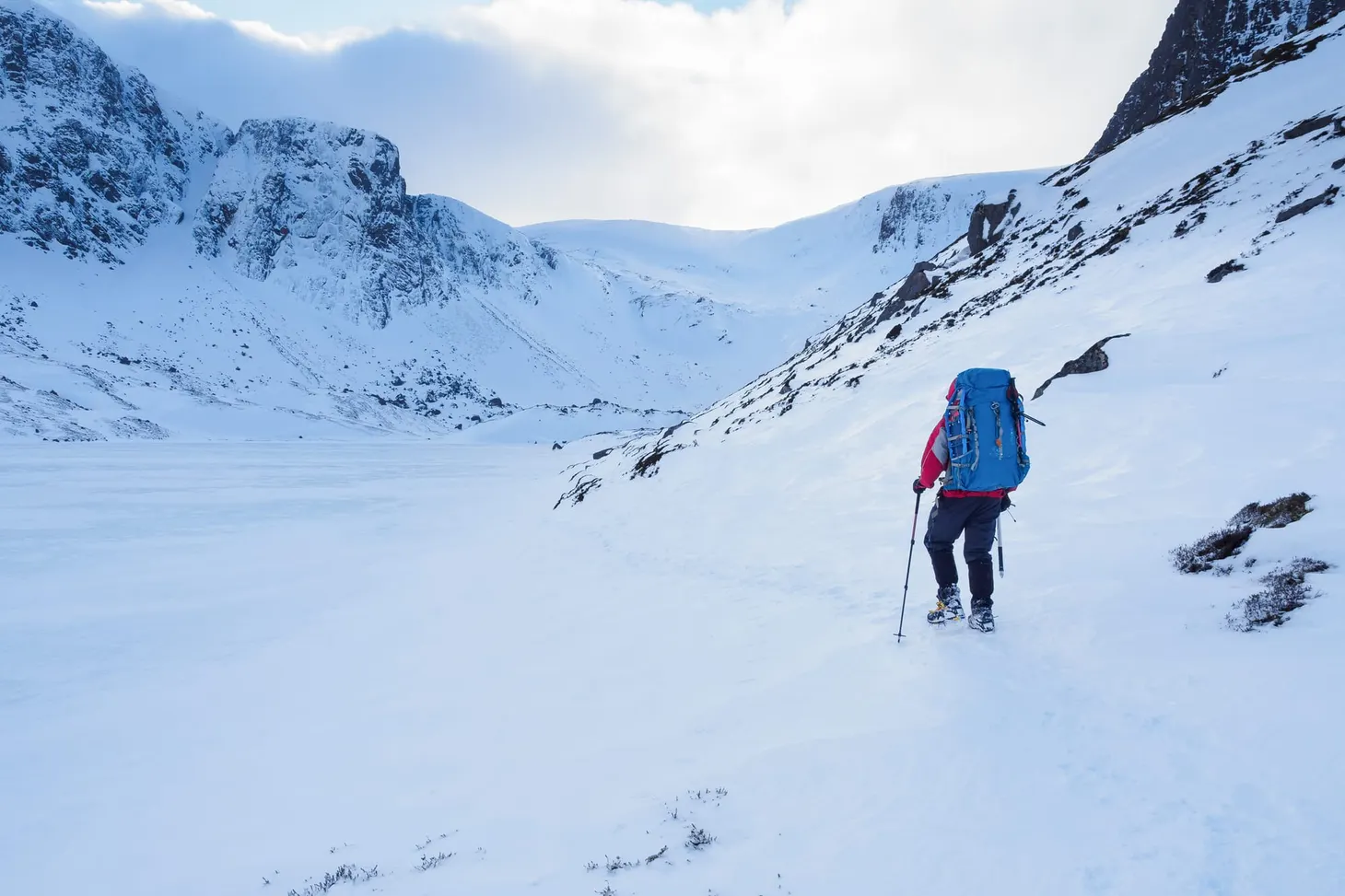
I hiked deeper into Knoydart. The terrain remained very rough as I picked my way carefully down the glen from Mam na Cloich Airde, and the guidebook warned of another potentially difficult river crossing.
 |
| Rough terrain on the way to the Finiskaig River |
The Finiskaig River was in spate and more water poured from the heavens as I contemplated the prospect of making it across the torrent. This looked much more difficult than the river I’d tackled the previous day. Unwilling to inundate my waterproof socks (which had kept my feet warm and dry up until that point), I took the Sealskinz off and put my shoes back on barefoot, rolling my trousers up as I had done the previous day.
This time the current was deep and powerful. It was knee deep before I had crossed more than a third of the width, and I concentrated on finding secure foot placements. When it got to waist deep I turned in to the current and leaned against my poles to secure myself against the fierce pressure. This felt far more serious than anything I’d come across so far – an early test, I thought at the time, to deter the unprepared. Knoydart has its defences.
I made it across the river and sat on a rock while I tried to dry my feet off with my towel. It was still raining so I didn’t get them completely dry, but dry enough to shove my Sealskinz back on.
 |
| Loch Nevis |
Grey views of Loch Nevis lured me on. The terrain remained unrelentingly rough until I got down to the shores of the loch, where I poked my head into Sourlies bothy to take a look at the place.
Mark and Brian, the northbound CWT hikers I’d first met on day two, were still at the bothy but just packing up when I arrived. I got my stove out to make some coffee while we talked about our adventures so far. After leaving Corryhully, they’d been forced to camp late at night in a bog – they hadn’t quite made it as far as A’Chuil bothy – and had struggled to make it to Sourlies the next day. They were finding the trail just as challenging as I was.
We arranged to meet at Barisdale later that evening. I’d originally planned to pitch my tent at the camping field, but given the wet weather another bothy stay was starting to seem more and more attractive.
 |
| Making a brew at Sourlies |
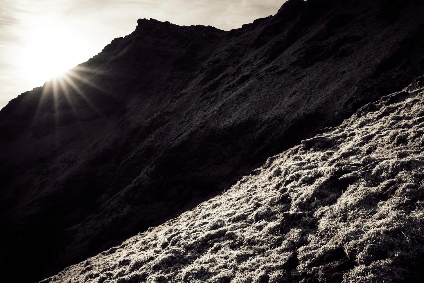
The walk from Sourlies to Barisdale was one of the early highlights of the trail. After crossing a small headland, I navigated to a very dodgy-looking bridge over the River Carnach, then followed the trail upriver. Despite the rain and low cloud, this glen was spectacular and at several points it reminded me of the Lost Valley in Glen Coe. But Mam Unndalain proved to be a difficult pass in the conditions and the weather really battered me as I crossed over the bealach. Another day hiking in fleece, gloves, and full waterproofs!
 |
| Near the River Carnach |
By the time I reached Barisdale I was very glad of the bothy and its facilities. It’s more like a bunkhouse than a classic bothy, complete with a small charge for overnight stays. Those eleven miles since my wild camp at Lochan a’Mhaim had felt more like twenty, given the roughness of the ground and the horrendous weather.
There was a lively crowd at Barisdale. Mark and Brian eventually turned up very late at night, after I’d gone to bed.
 |
| At Barisdale, glad for the chance to dry off |
Day 5 – June the 7th
7 miles
That’s right – just seven miles! Apart from my two rest days, this was the shortest day of my entire trip. There is a good logistical reason for this. Kinloch Hourn is at trail mile 56; the next natural stopping point is Shiel Bridge, mile 65. I’d heard there were few good places to camp in between, and I didn’t fancy trying a 16-mile day so early in the trail, considering how challenging I had found the 11-mile legs through Knoydart.
 |
| Easy walking on the first section |
After promising to meet Mark and Brian at Kinloch Hourn, I set off along the landrover track beside Barisdale Bay. It felt good to be hiking on a firm surface again but I couldn’t help but feel that the track detracted from the wildness of the surroundings – something I had really appreciated since crossing over into Knoydart. The track petered out soon enough, though, and I found myself on an up-and-down path traversing rough hillsides to the south of Loch Hourn.
 |
| Loch Hourn |
The guidebook says this is a very rough section of trail but, actually, it was a breath of fresh air for me. The weather had begun to improve, there were no big changes in elevation, and the terrain underfoot was far easier than the bushwacking and vertical bog I’d struggled with the previous day. Aware that I only had a few miles to cover that day, I took my time and enjoyed the atmospheric views.

It was raining again by the time I made it to Kinloch Hourn. The tea room provided an amazing respite from the weather and I don’t think I have ever appreciated a fire, pot of tea and slice of cake so much at any other point in my entire life! I chatted with the owner of the tea room, who seemed surprised that I had every intention of hiking on and completing the trail. He had spoken to a lot of hikers who had bailed out at that point.
 |
| Drying out again at Kinloch Hourn |
I wasn’t going to bail out. Knoydart had been tough, but I’d expected it to be tough, and I’d coped just fine. To be honest, the thought of giving up on the trail hadn’t even occurred to me – I was enjoying myself too much!
After phoning my partner Hannah at the public phone box (a much-needed contact with home, since I’d been out of signal reception for days) I pitched my tent at the field beside the river. The midges appeared almost as soon as the rain stopped. But the rain didn’t return, and I took the opportunity to dry out my damp gear. By the time I went to sleep I was feeling very positive about the next stage of the trail ahead. I didn’t, however, see Mark and Brian arrive, and in fact I never saw them again after our meeting at Barisdale bothy. I don’t know whether they went on to complete the trail without catching up with me, or whether they ended up going home early.
 |
| Riverside camp at Kinloch Hourn |
Day 6 – June the 8th
9 miles
Bright sunshine and, unbelievably, blue skies greeted me when I woke early the next morning. Could it be that the long-promised warm spell was finally here? Hardly daring to believe my luck, I struck camp and began the walk to Shiel Bridge.
 |
| A pleasant section of the trail, but the pylons did spoil the illusion of wildness a little |
The guidebook warned that this section involved some rough off-path navigation and a high pass – the highest, in fact, of the whole trail. Maybe it was because the weather was fine, or maybe I was starting to find my trail legs, but I found that day far easier than expected. The route followed good paths for some distance before a straightforward river crossing and then some off-path ascent in Coire Mhalagain. I passed beneath the huge snow patches of The Saddle. The terrain felt far more open than the complex crags of Knoydart and the walking was everywhere much, much easier.
 |
| On the way up to the pass |
 |
| The Forcan Ridge of the Saddle |
Just beneath the summit of the pass, where the snow-dashed edge of the Forcan Ridge looks as formidable as any Alpine arete and the mountains of Kintail stretch out in a vista far beneath, I was obliged to cross the first and only patch of snow on the CWT. I imagine this patch must have been a bit more challenging four weeks previously, but on that day a few metres of careful step-kicking saw me past it easily enough.
The path then aimed for the bealach between Sgurr na Forcan and Meallan Odhar where, a couple of years before, I’d stopped for breath before beginning the excellent scramble of the Forcan Ridge. The arete appeared foreshortened from that viewpoint but another excellent view of The Saddle presented itself from Meallan Odhar. I was very glad that the clouds had lifted and I could enjoy the feeling of striding amongst classic peaks. Too often in Knoydart I had been trapped in the grey mist, unable to see much at all beyond the bog in every direction.
 |
| The mountains of Kintail |
 |
| A good path for the last mile |
The descent to Shiel Bridge was initially trackless but gradually I picked up the traces of an old path. After a final easy river crossing, and the best path of the day for the last mile or so, I arrived in Shiel Bridge and set up my tent in the little campsite near the petrol station. Then I went to the pub and devoured an enormous quantity of fresh food.
The first distinct section of the Cape Wrath Trail – 65 miles from Fort William to Shiel Bridge – was complete. I’d done it in six days and still had two days’ worth of food to spare. I could easily have trimmed a day or two off that time if necessary, especially if I’d have run the final two days together, but due to the terrible weather I think my schedule made sense even if my daily mileage ended up being pretty low.
Nevertheless, I had walked 65 miles without a blister, I was feeling fit, and if my new-found ‘hiker hunger’ was anything to go by then I was adapting well to life on the trail.
In the next blog post I’ll cover days 7 to 10, up to mile 115 at Kinlochewe.

Alex Roddie Newsletter
Subscribe here to receive my occasional personal newsletter in your inbox. (For the fun stuff, please consider subscribing to Alpenglow Journal instead!)