The Cape Wrath Trail is a long-distance hiking route in Scotland. It links Fort William with Cape Wrath, the farthest northwest point of the British mainland. Renowned as one of the toughest long-distance walks in the UK, it is not waymarked, has no single recognised route, and there is frequently no actual path underfoot. Due to its informal nature, the length of this trail varies. Most thru-hikes are around 230 miles in length.
My hike of the Cape Wrath Trail took place between June the 3rd and June the 22nd 2015, and consisted of eighteen days of walking and two rest days. My route was 241 miles in length and was based on the itinerary laid out in the popular Cicerone guide by Iain Harper, with a few small modifications. I used the new Harvey Cape Wrath Trail maps for navigation.
The CWT is one of the finest foot journeys of its kind in the UK and takes the hiker through some magnificent wild locations. Its tough and frequently trackless nature makes the route I took potentially tricky in poor weather, requiring good navigational skills, a high level of fitness, and the ability to cope with hazards such as the crossing of swift-flowing rivers. But it’s also truly magnificent. In this series of blog posts I will tell the story of my CWT adventure.
After a tough stint of hiking through the rough bounds of Knoydart, I’d been looking forward to my first rest day. Shiel Bridge made a natural place to pause: there’s a shop to restock provisions, a pub for food and beer, and an excellent cafe just down the road (the Jac-O-Bite).
I made good use of my day off, baking damp gear in the sun, eating a massive Highland breakfast at the cafe, and replenishing my supplies. I decided that I would need three main meals (ended up getting Pasta-n-Sauce as usual), breakfast mix (muesli on this occasion, although I’d started the trail with a mixture of peanut M&Ms and trail mix), and trail food for two days. The small shop at the petrol station wasn’t cheap but it had everything I needed.
The Sealskinz had leaked on day 4 but were still
a little damp
Day 8 – June the 10th
17 miles
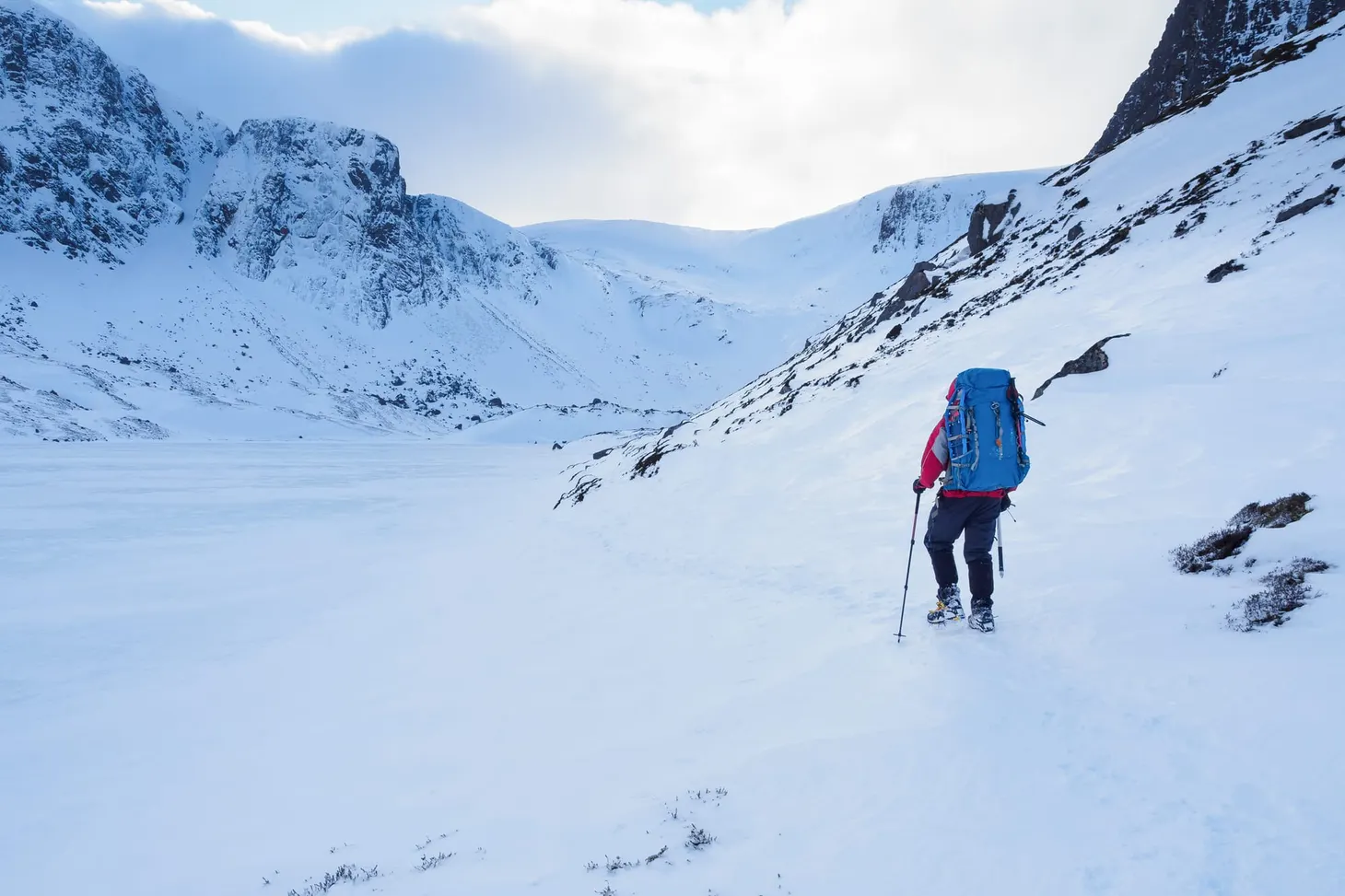
I’d been looking forward to this leg of the trail for a while. I had arranged to meet my friend John Burns at the remote Maol-Bhuidhe bothy, and he’d promised to bring in fresh food and wine to save me from subsisting on dried rations all the time. Maol-Bhuidhe is 17 miles from Shiel Bridge, but with the considerably better weather and the promise of easier trails I felt very confident of being able to tackle the extra distance.
The walk began from Morvich, where a good trail led through mixed forest before striking off up the open hillside.
Pleasant walking from Morvich
The path to the Falls of Glomach
A straightforward climb and a crossing of open moorland led me to the top of the Falls of Glomach. Astoundingly, I’d hiked without getting my feet wet until that point – the dry weather and straightforward paths made an enormous difference, and I was flying along the trail compared to the slow pace I’d managed in Knoydart.
I’d been looking forward to seeing the Falls of Glomach. It certainly didn’t disappoint. The guidebook actually mentions that ‘The waterfall here cascades more than 100m straight down into the ravine, the largest drop of any waterfall in the UK.’ While it is more than 100m straight down (113m, in fact), it turns out it isn’t the highest in the UK; that honour belongs to Eas a’Chuil Aluinn, over a hundred trail miles north.
Are you looking for a more in-depth guide to hiking the Cape Wrath Trail? The best resource online today is this excellent planning guide from Outdoors Father, including crucial details on logistics, river crossings, alternative routes, and more. Get your copy here.
Biggest or no, the Falls of Glomach was a highlight of the CWT experience. It’s a little tricky to see from the top – you have to scramble down some rocky switchbacks to reach the best viewing platform, then climb back up to find the very faint path that traverses into the enormous canyon beyond.
The canyon
Here’s a short video I took from the viewing platform:
I enjoyed the canyon almost as much as the waterfall itself. The trail clung to the edge of precipitous cliffs, weaving a cunning route between rock outcrops and stands of woodland. There were a few boggy sections (and a knee-mashing descent) but nothing as rough or as challenging as Knoydart had been.
The trail then dropped down to Glen Elchaig where it took up a firm landcover track running east through the estate. What this section of the trail lacked in wildness it made up for in sheer speed and ease of travel. I made rapid progress through Glen Elchaig and soon I had begun the gentle ascent from Iron Lodge that would lead me into the much wilder lands to the north.
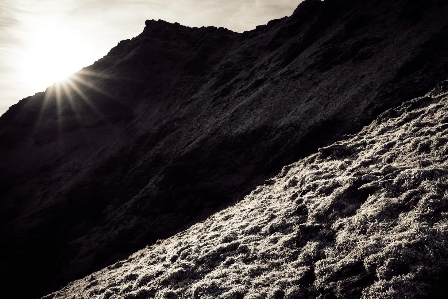
The remains of cornices on the east face of Faochaig (868m)
This section of trail was a joy. With the landrover tracks of the lower glen behind me, I could enjoy the increased sense of open space and wildness yet still walk on good paths for a while. The sun was shining, I was feeling fit and strong, and before I knew it I had caught up with John at the crossing of a burn. We walked the rest of the way to Maol-Bhuidhe together.
I’d known John for a couple of years but we had never actually met in person (a common state of friendships in the Twitter age!) We share a love of the Scottish peaks, an appreciation of bothies, and are both students of mountaineering history. John’s interest in the history of the hills is expressed by writing and performing one-man plays including A Passion for Evil (about Aleister Crowley)and, most recently, Mallory – Beyond Everest (an intriguing take on the George Mallory story, featuring a much older character who survived Everest in 1924). He is also working on a book about his decades of experience in the hills.
We made good time to the bothy, which is located in the midst of a stunning area of wild land. Beautiful peaks surround it on all sides, many of which are only accessible by long walks – or a stay in the bothy itself. Two other hikers were already at the bothy with their gear spread outside, making a brew, and greeted us with cups of tea when we arrived!
Me at Maol-Bhuidhe
The stage was set for a memorable evening. The two hikers were backpacking south, gradually ticking off a number of mountains as they went, and in the long conversation that followed we found that all four of us had a lot in common: a shared love of the hills, of climbing and winter mountaineering, and we even knew many of the same places and people. Such serendipity is common in bothies, places where like-minded people gather and chat as if they’ve been friends for years, even if they had never met before. I’ve often thought that bothy culture is how all society should be. The world would be a happier place if more people treated their fellow humans as they do in bothies.
John had hauled in a veritable feast: fresh bolognese (made with bacon!), spaghetti, olive bread, pate, chocolate cake, and a box of red wine. The food was much appreciated and afterwards we all enjoyed a drink or two around the fire. John had also brought in a firelog, which burned for hours in the absence of other fuel. I loved my lightweight pack while hiking, but carrying in a few luxuries certainly has its compensations!
Day 9 – June the 11th
16 miles
It was hot and humid when we emerged from the bothy the next morning. The two hikers were heading for the hills, John was heading home, and I had a few miles of rough bushwacking ahead of me. After saying farewell to my friends I began the day’s walking.
Looking back to Maol-Bhuidhe
The first section of the CWT from Maol-Bhuidhe gave me a choice: go north of Beinn Dronaig or south. The north route has a path for more of its length but you have to cross a wire bridge. I don’t like wire bridges; I decided to take the south route, which looked wilder on the map. I followed an unnamed river (an outflow of Loch Cruoshie) for some miles over rough and boggy terrain, loving the wildness of my surroundings, spoiled only by an ancient deer fence quietly rusting into the ground. After some distance I followed a rising traverse line (careful navigation required here) until the beginnings of a very faint stalker’s path that led directly to Bendronaig Lodge. The terrain was rough but, again, I remember thinking this is nothing compared to Knoydart!
Beautiful wild land south of Beinn Dronaig
I really enjoyed that leg of the trail. I think it perfectly captures what the CWT is all about: an adventurous cross-country backpacking route that requires good hill skills and fitness, visiting the best wild places instead of slavishly following the easiest paths.
But it was a hot day, the hottest so far, and the heat took a little of the spring out of my steps. I took every opportunity to splash through clear running water to keep my feet cool.
‘All this wilderness, and it’s mine to enjoy!’
Eventually I reached Bendronaig Lodge, an estate bothy of the Attadale Forest. I poked my nose in to have a look. It was the only bothy I have ever seen with a flushing toilet! I chatted to two cyclists who had slept there overnight, and they confirmed it was a comfortable place to stay.
Bendronaig Lodge
The Attadale Forest was, as usual for the estates in the area, equipped with hard-track roads. I made rapid progress west before breaking away from the landrover track and climbing the pass of Bealach Alltan Ruaridh. The terrain suddenly felt different – conditions had been dry all day, but I noticed the terrain becoming far more arid as the geology began to change. I saw my first glimpses of the Torridonian giants on the horizon. It remained very hot.
The CWT just past the Bealach Alltan Ruaridh
Before too long I was descending to Strathcarron where a drink in the pub (and half an hour on their wifi) restored me enough to contemplate another few miles to the bothy just up the glen.
The descent to Strathcarron
A dry streambed – astonishing to think how wet it had
been only days before
I enjoyed the walk from Strathcarron to Coire Fionnaraich. A pleasant initial stretch along the riverside, through woodland, led to an easy climb on a good path that led into the heart of Torridon. Again, the terrain was everywhere exceptionally dry. I’d hiked with wet feet as far as Bendronaig Lodge, but my socks had pretty much dried out by Strathcarron and overall I think this was the driest day on the entire trail.
Looking back to Strathcarron
The footbridge near Coire Fionnaraich
There’s a bothy at Coire Fionnaraich but for once I decided not to take advantage of it. In such fine weather it seemed a shame not to sleep out in the open. After exploring the bothy and adding my name to the bothy book, I set up the Notch on the grass outside – and was immediately attacked by a large and hungry cloud of midges. I cooked dinner inside the bothy before returning to my tent.
I slept well that night. It had been a good day on the trail.
Day 10 – June the 12th
17 miles
I’d always wanted to go to Torridon, but had never actually managed to get there until day ten of the Cape Wrath Trail. I was looking forward to crossing this grand mountain range and exploring the wilderness at the back of Beinn Eighe.The trail was wonderful right from the door of the bothy, and the terrain became wilder as I climbed. The path remained excellent for several miles.
Looking back the way I’d come
The first ‘wow’ moment came when I crossed the rocky terrain at the head of the bealach and saw the mountains of Torridon up close for the first time. Liathach and Beinne Eighe formed an impenetrable wall in front of me. I could hardly believe how very different the landscape was compared to the Knoydart backcountry. Both are beautiful but quite distinct.
Liathach presenting a glowering wall of rock
I descended in an enchanted reverie, my eyes greedily seeking out every pinnacle and every view of those classic peaks. I had wanted to climb Liathach and Beinn Eighe for years; the opportunity wouldn’t present itself on this trip, but I knew I would have to return.
After crossing the road at the bottom of Glen Torridon, I began to climb another pass. This track ascended between Liathach and Beinn Eighe, reaching an elevation of about 450m. Plenty of other walkers were on this trail; I must have met twenty-odd other people on my way up to the top of the pass. I’d become used to walking for entire days without seeing another person so this was something of a surprise! To my amusement, several of the people I spoke to mistook me for a day hiker, and refused to believe that I could survive a night in the wild with such a small pack.
At the start of the second ascent of the day
The path around the back of Beinn Eighe was magnificent and certainly makes it into the top five points of the whole trail. The contrast between Liathach’s grim bastions and the shining slopes of Beinn Eighe delighted me, despite the low cloud, but only after I had reached Loch Coire Mhic Fhearchair were the views at their best. I could see out over the wilderness of the Flowerdale Forest, a postglacial haven of mountain and water and rock. Having the freedom to roam in such places is why I love backpacking.
The path disappeared at NG 939 611 and one of the most technically difficult sections of the trail began. I was aiming for a faint stalker’s path at NG 979 625 that would take me to Kinlochewe, but in order to get there I had to traverse a long stretch of trackless and exceedingly rough terrain.
The rough stint round the back of Beinn Eighe begins. Didn’t look
so bad at first, but it got much steeper.
The route was based on contouring around Beinn Eighe, sticking roughly to the 400m contour. I’m no stranger to the navigational technique of contouring, but despite excellent visibility I found it very challenging that day. The terrain was steep, extremely rocky, and the slopes of Beinn Eighe were incredibly complex in places – a bewildering tangle of contour lines and moraine ridges, everywhere sprinkled with boulders of all sizes from cricket ball to small house. Sticking strictly to 400m quickly proved impractical and I had to navigate an up-and-down course, using 400m as a rough guide to keep me on track. Too low and vast bogs awaited; too high and the terrain became precipitous. The narrow band in the middle was hard enough but very much the lesser of three evils.
It was tough going – some of the toughest ground I’d ever hiked over – but interestingly at no point did I wish for more supportive hiking boots instead of my barefoot-style trail shoes. It was vital to be able to feel the ground beneath me and rely on my own ankle strength and reflexes to keep me afoot. I’m convinced that splinting my feet in heavy boots would have resulted in blisters, aching feet, or even injury.
Progress slowed to about 1 mph and at times it felt frustrating, especially when I checked the GPS and found I’d descended too far or climbed too high. But the opportunity to hike through such splendid mountain landscape was all the reward I needed. The northern side of Beinn Eighe quite simply blew me away with its serene beauty and rugged wildness. I was reminded of much bigger mountains I had seen and climbed in Jotunheimen, Norway.
The majestic northern fortresses of Beinn Eighe
Eventually, after one final huge bog, I found the stalker’s path and climbed another pass before dropping down to Kinlochewe. It was after 9 p.m. by the time I arrived in the village, very tired, and made enquiries at the hotel bar about the bunkhouse next door. It was full, unfortunately, but after pitching my tent at the campsite I was asleep in minutes.
I’d completed the fifty miles from Shiel Bridge to Kinlochewe in three days – a greatly improved pace compared to the mileage I’d achieved through Knoydart, despite some challenging terrain. My trail fitness was improving. Unfortunately the relatively good weather was not to hold; more rain came in overnight, and I resigned myself to the likelihood that the month-long spell of fine weather long forecast would probably never materialise.
In the next blog post I’ll describe days 11 – 14 on the Cape Wrath Trail, covering trail mile 115 – 167.
Happiest on a mountain. Writer, story-wrangler, digital and film photographer. Editor of Sidetracked magazine. Machine breaker.
Alex Roddie Newsletter
Subscribe here to receive my occasional personal newsletter in your inbox. (For the fun stuff, please consider subscribing to Alpenglow Journal instead!)
Looking for a film camera for your adventures? Balking at the cost of a new Pentax 17? Look no further than the Olympus Trip 35 or XA2... but which is best?
💡A reminder that I am now cross-posting entries on both alexroddie.com and Substack. For more info, read
Five years ago, with the first Covid lockdown imminent and a perfect forecast, I decided to seize the opportunity to complete a long-dreamed-of Cairngorms traverse in perfect winter conditions...
🌄Author's note: A version of this story was first published by The Great Outdoors magazine in 2021.
For someone who grew up in the flatlands and was only able to get to the hills occasionally, the dream of living in the mountains was always a seductive one. My first chance came in 2008 when I was 22 years old. In 2008, I was uncertain about a lot