Three winter glens in the Cairngorms
Alex Roddie makes the most of a poor winter forecast, avoiding the summits to take on a challenging two-night solo journey through Glens Feshie, Geldie and Dee to finish up in the Lairig Ghru.
This feature was first published on UKHillwalking, January 2017.
Early winter can be a tough time of year for backpacking in the Scottish Highlands. Days are short, nights are long, and conditions underfoot can be unpredictable. Although there may well be snow, chances are that it’s unconsolidated. Bogs may be unfrozen, rivers may be in spate. If conditions on the tops are just too poor, here’s a worthwhile low-level route in the Cairngorms that still packs in plenty of excitement and dramatic views.
The Cairngorms is an area I return to again and again, drawn by the vast open spaces and sweeping contours. It isn’t like Glen Coe or Lochaber, where the mountains are sharp and spiky and most walkers seem to be focused on summits; in the Cairngorms, valley walks can be just as rewarding as Munro-bagging forays.
That’s why I wasn’t disappointed when the weather failed to improve and I decided to avoid the tops. This valley circuit turned out to be a cracking three-day backpacking tour of the Cairngorms, well worth it at any time of year but arguably at its best in the challenging conditions of early winter.
About the route
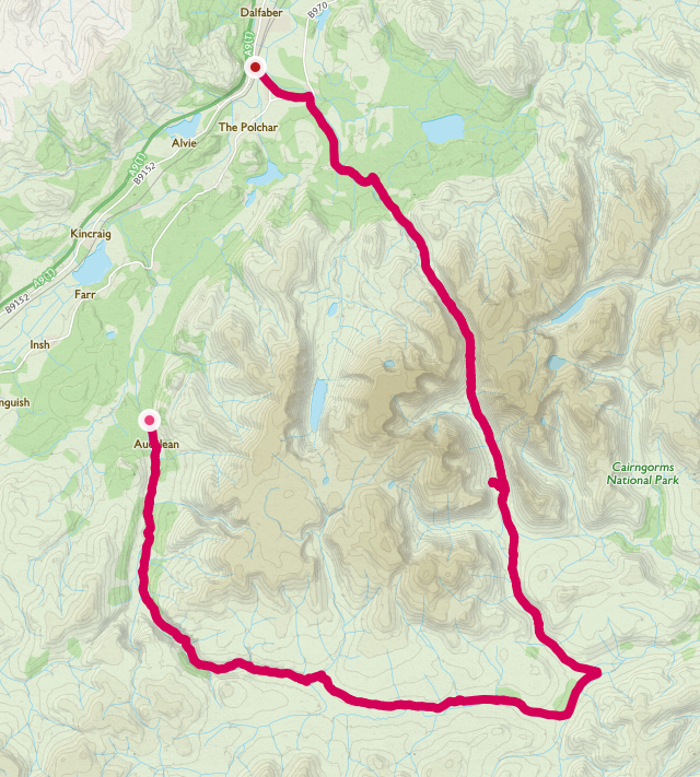
Distance: 37.28 miles / 60km
Starting point: Glen Feshie car park. Limited parking available at the end of a narrow road
Finishing point: Aviemore
Highest point: The Lairig Ghru, 835m / 2,739 feet
Total ascent: 1,229m / 4,032 feet
OS map sheets: Landranger 36 & 43 / Explorer OL57
Harvey map sheets: Cairngorms & Lochnagar British Mountain Map
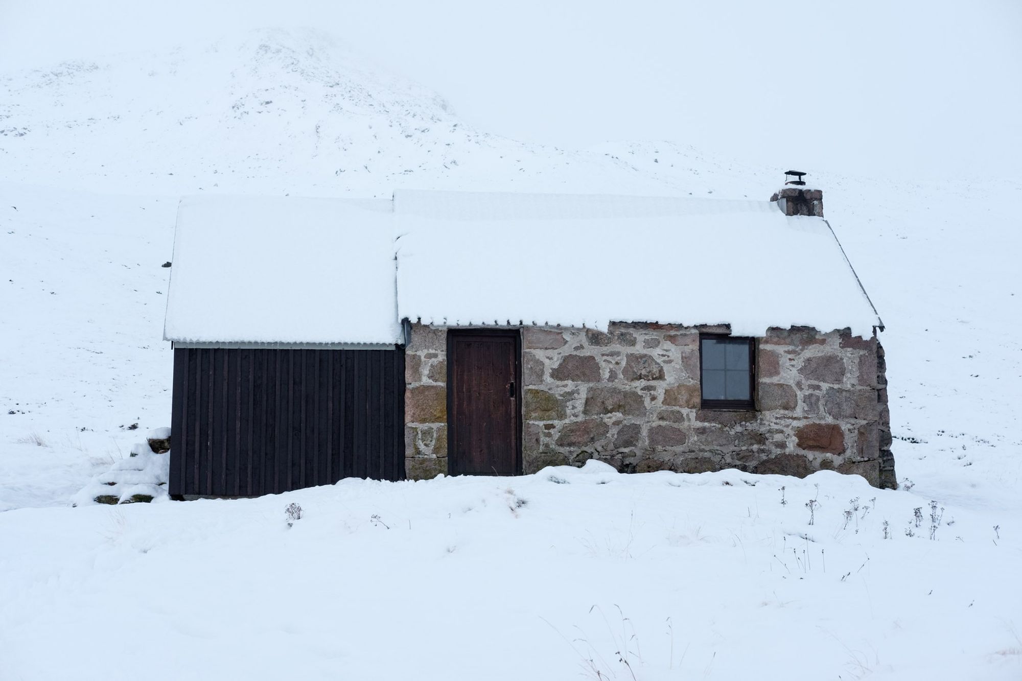
Route notes: A circuit encompassing three glens, Feshie, Geldie, and Dee, finishing with a descent through the Rothiemurchus Forest. The route does not go onto the tops, and there are no major river crossings, making it potentially suitable for the worst weather, or for newcomers to winter backpacking. There are two bothies on the route: Ruigh Aiteachain and Corrour. If you stay at a bothy, adhere to the Bothy Code and don’t cut live wood. I recommend that you carry a tent and camping equipment even if you intend to stay at a bothy; you may find it full or locked.
Day one: Glen Feshie (6 miles)
Glen Feshie is a uniquely beautiful and special place. This glen was once a deer forest, its trees under threat by a high population of red deer. But in 2004 all that changed. A programme of intense deer management brought the population down to a sustainable level, and today the forest is well on the way towards recovery, with new growth sprouting everywhere. Walking through Glen Feshie is like walking through an echo of genuine wilderness. There are no large predators here, and much biodiversity has already been lost, but there’s a hopeful feeling – that progress is being made in the right direction.
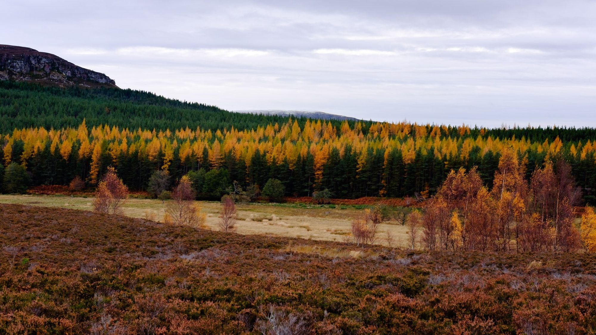
The path to the the bothy, Ruigh Aiteachain, is popular and well maintained, but the river has damaged it in several places thanks to severe flooding in recent years. I knew from a previous visit that it’s necessary to stay on the east bank of the river as you travel south, due to a missing bridge. Careful to avoid the most eroded areas, I crossed the ford at NN 850954 where the Allt Garbhiach has gouged out a new course for itself and destroyed part of the footpath. I kept going, past curves and gravel banks in the river, through stands of ancient pines draped in moss and lichen. The forest was silent, waiting for the heavy snowfall forecast for later on that afternoon. Bright autumn colours still showed in many places. This was a landscape caught on the boundary between two seasons.
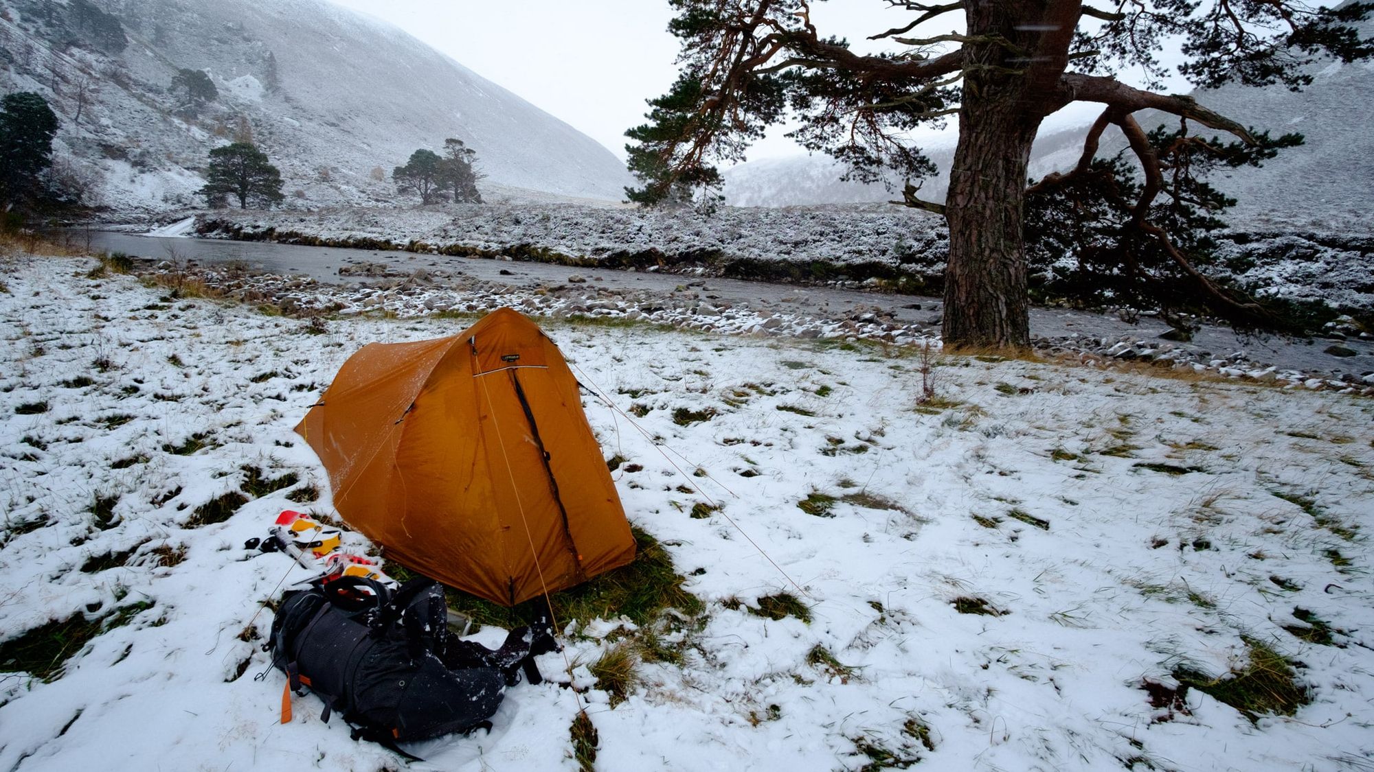
By the time I reached the meadows beneath Creag a’ Chreagain, I was starting to think about camping. Although early in the day, the sky had filled in and the first few snowflakes were whipping past on a strengthening breeze.
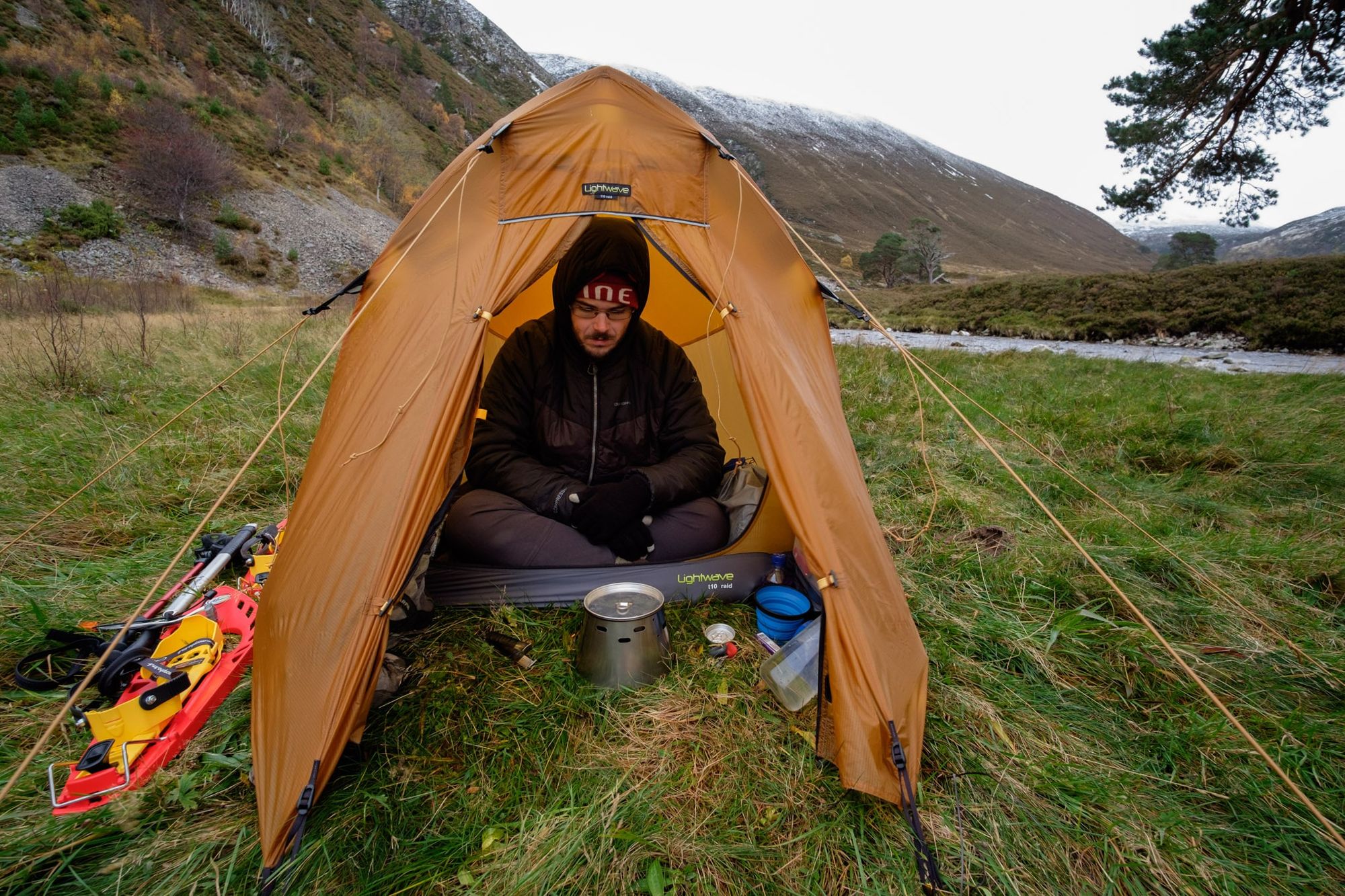
It was a stormy night. Snow blasted in from the east and built up around the edge of my flysheet. When I peered out through the door in the early hours my head torch picked out a maelstrom of swirling flakes. The sound of the nearby river lulled me back to sleep.
Day two: a long trail to Corrour (18.7 miles)
I woke to find a transformed landscape. Overnight, uniform whiteness had blanketed the colours of the forest. It was still snowing hard as I struck camp and packed away my soggy shelter.
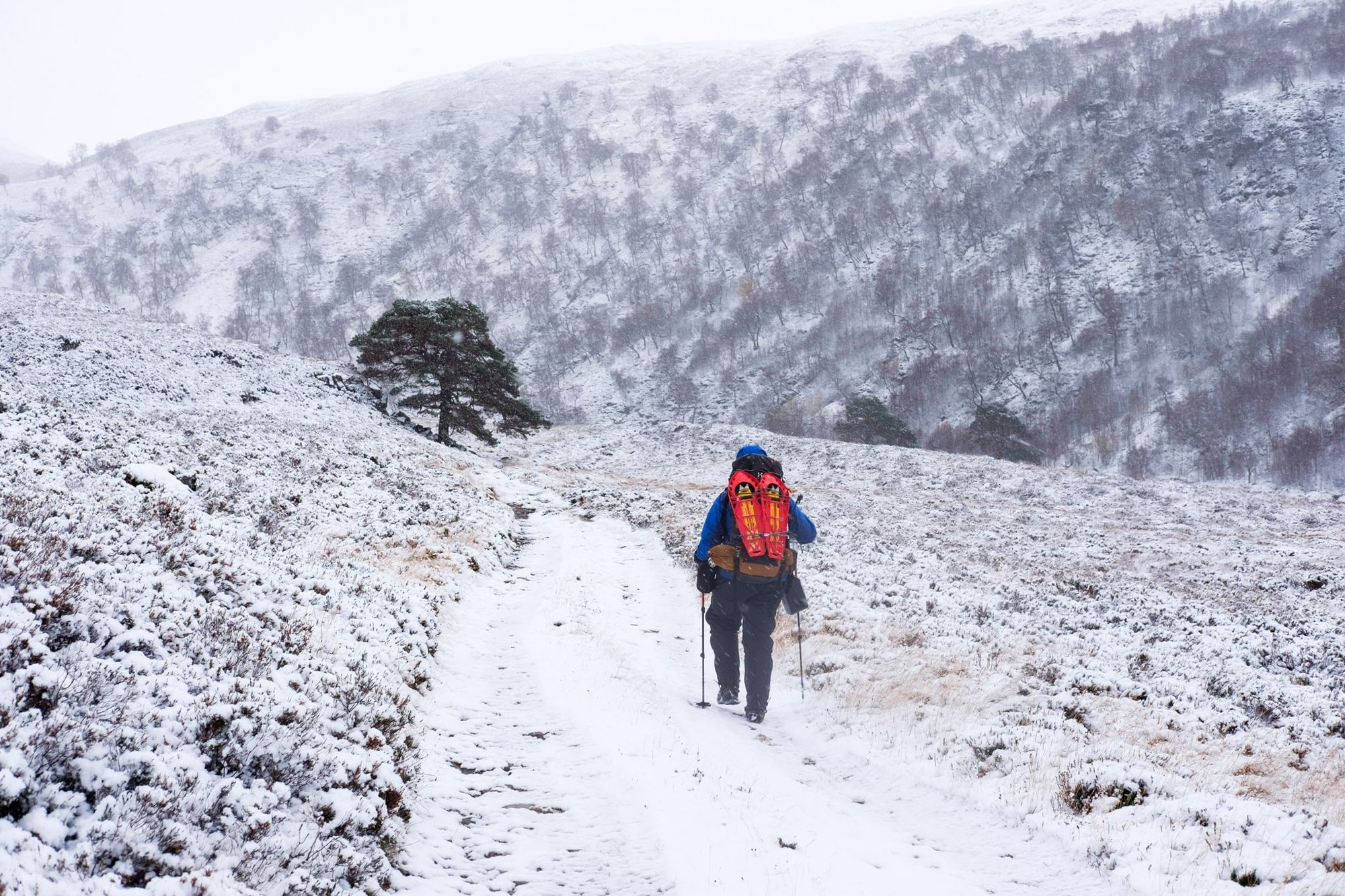
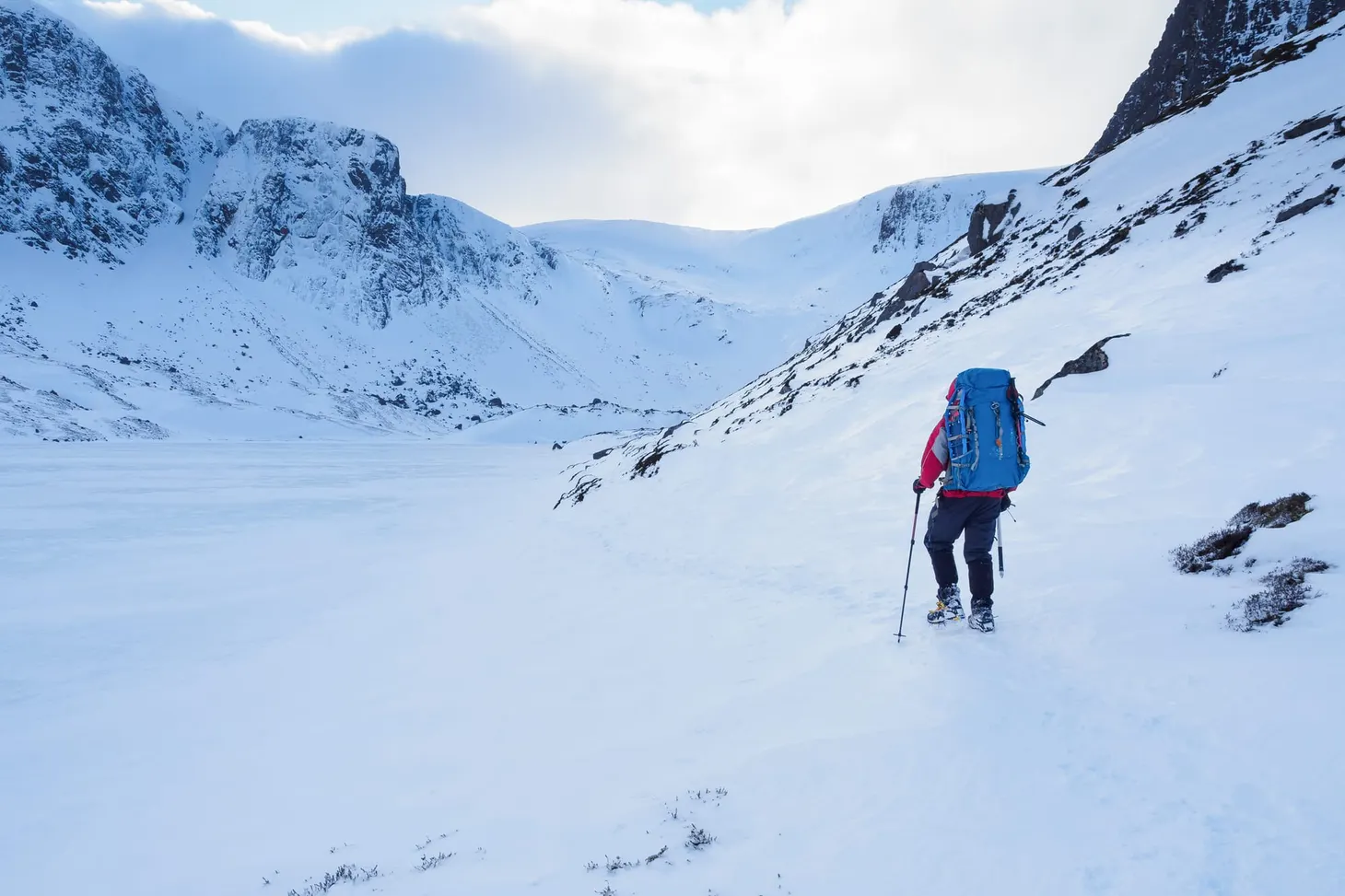
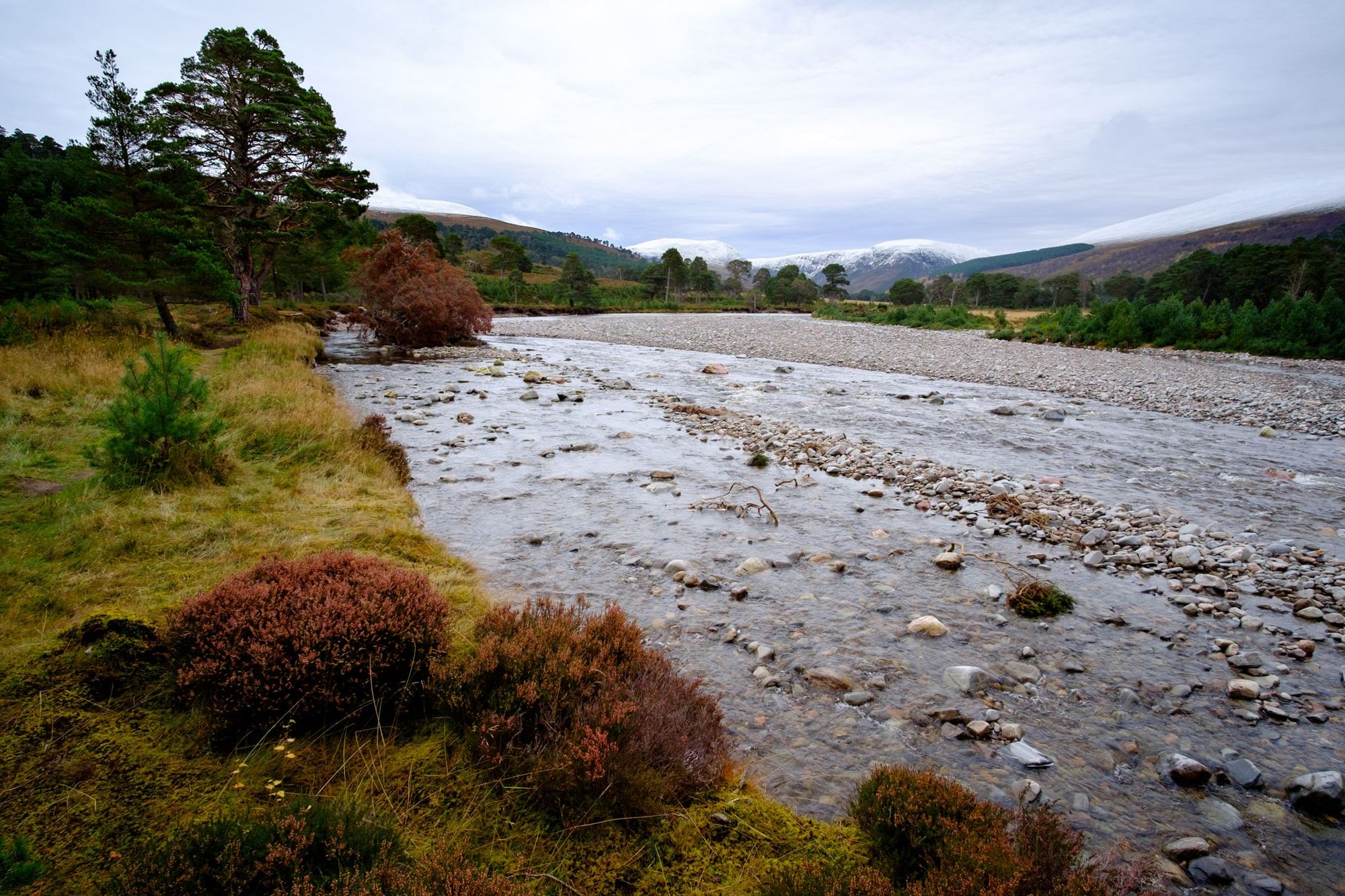
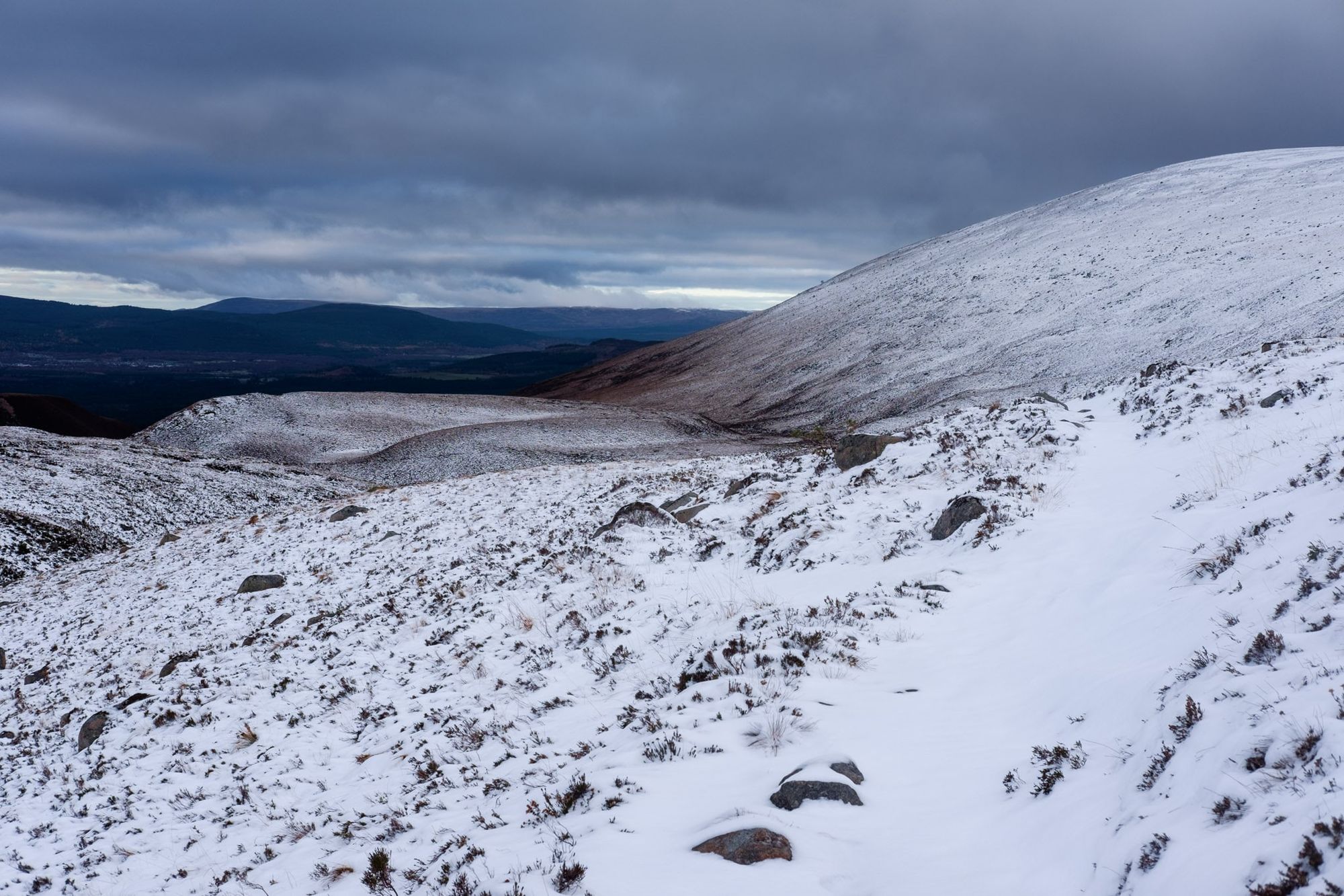
After some rough ground on a steep hillside, I found a good path and tried to keep my pace consistent on the easy terrain, well aware that I had many miles ahead of me but only so many daylight hours. The trees gradually died back as the glen narrowed and the river became younger, livelier, leaping in cataracts over boulder jams. As I left Glen Feshie and started following the Geldie Burn, the good paths seemed to run out and bog-hopping became the order of the day – but this time a few inches of soft new snow concealed the bogs, and avoiding the muddiest areas became a challenge. I felt a bit silly marching along with snow shoes, ice axe and crampons attached to my rucksack. It was still snowing hard, with a brisk wind, and I knew I wouldn’t be going anywhere high.
When I passed the ruined building at the confluence of the Geldie Burn and Bynack Burn, deep in the heart of the Cairngorms, I knew I had a decision to make: find somewhere nearby to camp, or press on to Corrour bothy? Corrour is one of my favourite bothies, in a dramatic location at the foot of the Devil’s Point, but sunset was only an hour or so away and I could see a lot more snow up in Glen Dee. I decided to make for the bothy – being up in the mountains after dark felt like the right way to enjoy this route.
Maybe it’s because I was starting to feel the long miles with a big pack, but that final stretch to Corrour was tougher than I remembered it being. As the path climbed, the snow deepened until it completely obscured the way ahead and I was fighting through deep drifts, following a compass bearing by torch light. The mountains loomed as gigantic shadows against a darkening sky. There was a powerful sense of being alone in an indifferent and self-willed landscape – a place where I had to completely rely on my experience, navigational skills and equipment. That’s a big part of hillwalking’s attraction for me, and it’s rare for a low-level route to feel so committing.
Corrour was dark and empty when I reached it, a rectangular smudge barely visible in the driving snow. I’d started to worry that I would miss the bothy in the dark and be forced to camp in miserable conditions (there are few good camping spots in Glen Dee at the best of times due to the boggy terrain). Relief flooded through me as I stomped up to the front door and kicked snow from my boots. I’d have a roof over my head after all.
Day three: the Lairig Ghru (13.8 miles)
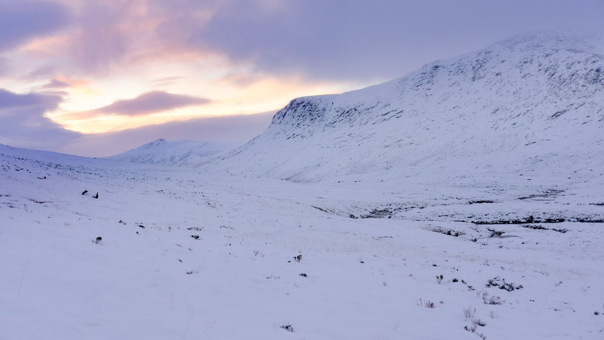
The Lairig Ghru is a popular route linking Aviemore with Braemar. It’s also one of the most dramatic mountain passes in Scotland. Cutting through the mountainous core of the Cairngorms, the Lairig Ghru passes beneath the crags of Cairn Toul and Braeriach, places where the snow rarely melts even in midsummer. In winter, despite the relatively easy trail underfoot, this is a serious and remote place. The highest point of the pass is often under deep snow.
The landscape was silent as I left the bothy. More snow had fallen overnight, wiping out my tracks back to the bridge over the river. Navigation would not be difficult in daylight but I knew I had a lot of wading ahead of me, and I decided to strap on my snow shoes before I got going.
There’s something magical about being the only person in the midst of such vastness. I’ve walked the Lairig Ghru several times, summer and winter, and I’m always struck by the sense of monumental solitude. The mountains feel colossal. When uniform snow carpets the landscape, this feeling is magnified. As I negotiated increasingly deep snowdrifts, I paused to watch and listen, marvelling at how the Devil’s Point was so effectively camouflaged against the white sky yet still loomed huge above Corrour bothy.
Getting to the top of the pass was tough. The wind became savage, driving sleet and wet snow into my face. I found myself sinking up to my knees, and snowdrifts had started to blow across the river, concealing dangers beneath. Beyond the Pools of Dee, at the highest point, I encountered finely sculpted walls of snow that had drifted across the path, six or nine feet deep. In the flat lighting I could hardly see them until I’d walked over the edge and was tumbling down the other side. I soon learned to probe the ground with my poles and tread warily.
The weather eased soon after I started to descend. By the time I could see Aviemore in the distance, I was feeling the effects of my full-body fight with the weather. Behind me, the mountains glowered under a cap of cloud, and I felt good about my decision not to venture onto the tops. But I didn’t feel as if I’d missed out on the full Cairngorms experience. There was ice in my beard and in my water bottle, snow caked to my snow shoes, and by the time I reached Aviemore my GPS showed over 37 miles since I’d started walking in Glen Feshie. One wild camp, a night in one of my favourite bothies, and dramatic snowy views – I’d say that’s a walk worth doing.
All photos © Alex Roddie. All Rights Reserved. Please don’t reproduce these images without permission.

Alex Roddie Newsletter
Subscribe here to receive my occasional personal newsletter in your inbox. (For the fun stuff, please consider subscribing to Alpenglow Journal instead!)