Tour of Monte Rosa day 7
08/09/2015
This is part of a series of blog posts live from the Tour of Monte Rosa, a 100-mile backpacking route in the Alps.
The Tour of Monte Rosa trail blog series
Day 1: Zermatt to Täschalp
Day 2: Europaweg stage 1
Day 3: Europaweg stage 2 and the Grächenwald
Day 4: the Balfrin Höhenweg
Day 5: the Monte Moro pass and the Vallee Quarazza
Day 6: Colle del Turlo and Alagna Valsesia
Day 7: the Alencoll and a night above 3,000m
Day 8: the ascent of Testa Grigia
Day 9: the Theodul Glacier and return to Zermatt
Location: Lateltin CAI bivouac hut on the 3,132m summit of Pentespetz, above the Pentecoll / Colle Pinter. Trail mile 72.
Mileage: 11
It’s been quite a day on the Tour of Monte Rosa – my greatest amount of ascent in a day so far on the TMR, and in fact the most ascent I’ve done in a day, ever! Altogether today I have climbed 2,230m and descended 1,200m. And yes, I can feel every single one of those metres.
I started the day by climbing the final section of the Alencoll. Do you remember my complaints about the ski infrastructure that ruined the wild feeling of the cirque? Well, ski machinery and paraphernalia continued to stick out of the ground at regular intervals all the way to the col itself, and then on the other side there were more ski pistes, managed by Gressoney instead of Alagna, presumably. None of these pistes were on my map. I tried to ignore them and focus on my surroundings, which were impressively rugged and mountainous, but it was a little difficult when the pistes gouged chunks out of the TMR itself in places and forced diversions down loose cliffs.
As I descended, I passed from the ski slopes to the tourist infrastructure near the Gabietsee. I entered what I can only describe as a building site. Earth-moving equipment was everywhere, ugly new hill tracks criss-crossed the landscape (none of which were marked on my map), and the overall feeling was of a mountain wilderness exploited ruthlessly for profit. It depressed me more than a little. I know that’s what parts of the Alps are like, but I’d been so enthralled by the beautiful wilderness earlier in the trail that the contrast was harsh and unwelcome.
The descent to Gressoney was extremely steep and followed, variously, an abandoned narrow-gauge railway track, a chairlift, and another ugly switchback hill track down to the valley floor. Again there was earth-moving machinery and building works everywhere. It’s great that the economy of the valley seems to be booming, but not what my wilderness-craving hiker brain wanted to see.
It’s safe to say that the Alencoll is my least favourite Alpine pass. Looking on the bright side, things started to improve as soon as I arrived in Gressoney.
Gressoney la Trinité struck me as being an attractive little Alpine town, which is expanding for the benefit of the population but retains almost all of its historic and authentic features. It has not, in short, gone ‘full tourist’ like Zermatt and Saas Fee.
Unfortunately I didn’t spend long in the town as time was pressing, and I managed to time my arrival to coincide with the mid-day closure of virtually all businesses, but it made a favourable impression. I also found some free wifi to let me upload yesterday’s TMR update.
The next task for the day was the ascent of the Pentecoll (Colle Pinter in Italian, but marked on my Swisstopo map as Pentecoll). This is a 1,100m+ climb from the village, and I’d already climbed over 700m followed by a long and gruelling descent. What’s more, my objective wasn’t even the Pentecoll – I wanted to make for a bivouac cabin at over 3,100m, above the pass, to give me a chance to climb the Testa Grigia the next day.
This time last year I wouldn’t even have considered such an ascent – not after climbing 1,700m+ day in, day out. But the TMR is teaching me that I can cope with these climbs just fine, even while carrying a thru-hiking pack. So I started walking into the forest.
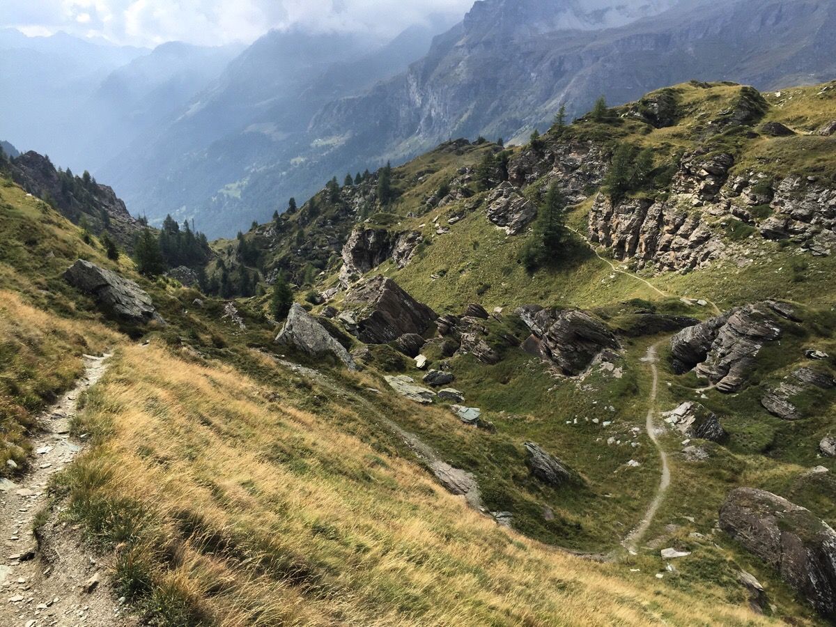
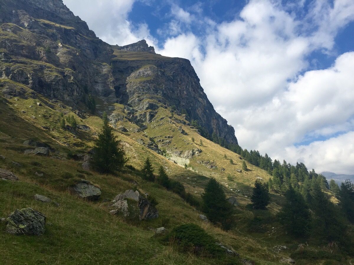
The mountain scenery was gorgeous as I began the ascent of the Pentecoll, but unfortunately it was somewhat lost on me as the paths on the ground bore little resemblance to the paths on the map. I’m using a Swisstopo map, and I can only conclude that the survey was conducted decades ago. I’ve noticed inaccuracies ever since crossing over to Italy, but today was without doubt the worst. I tried to follow a path marked on the map and ended up bushwhacking across steep forested hillside. If a path had ever existed there, it didn’t today. Higher up, paths were depicted on the wrong sides of major watercourses. Somehow I managed to get into the upper cirque, by which point the route to the col was obvious.
It’s just as well I’d found the right path by then, because hill fog rolled in and visibility dropped to zero. By the time I’d reached the summit of the Pentecoll at over 2,700m, I was already pretty tired – but I still had another 300m or so to climb.
That final climb was very taxing. It goes straight up the mountainside and soon took me into rocky and loose terrain, with some steps of easy but very friable scrambling. I was very glad of the yellow path markers painted at frequent intervals on the rocks. By the time I reached the Lateltin bivouac, it was already getting dark.
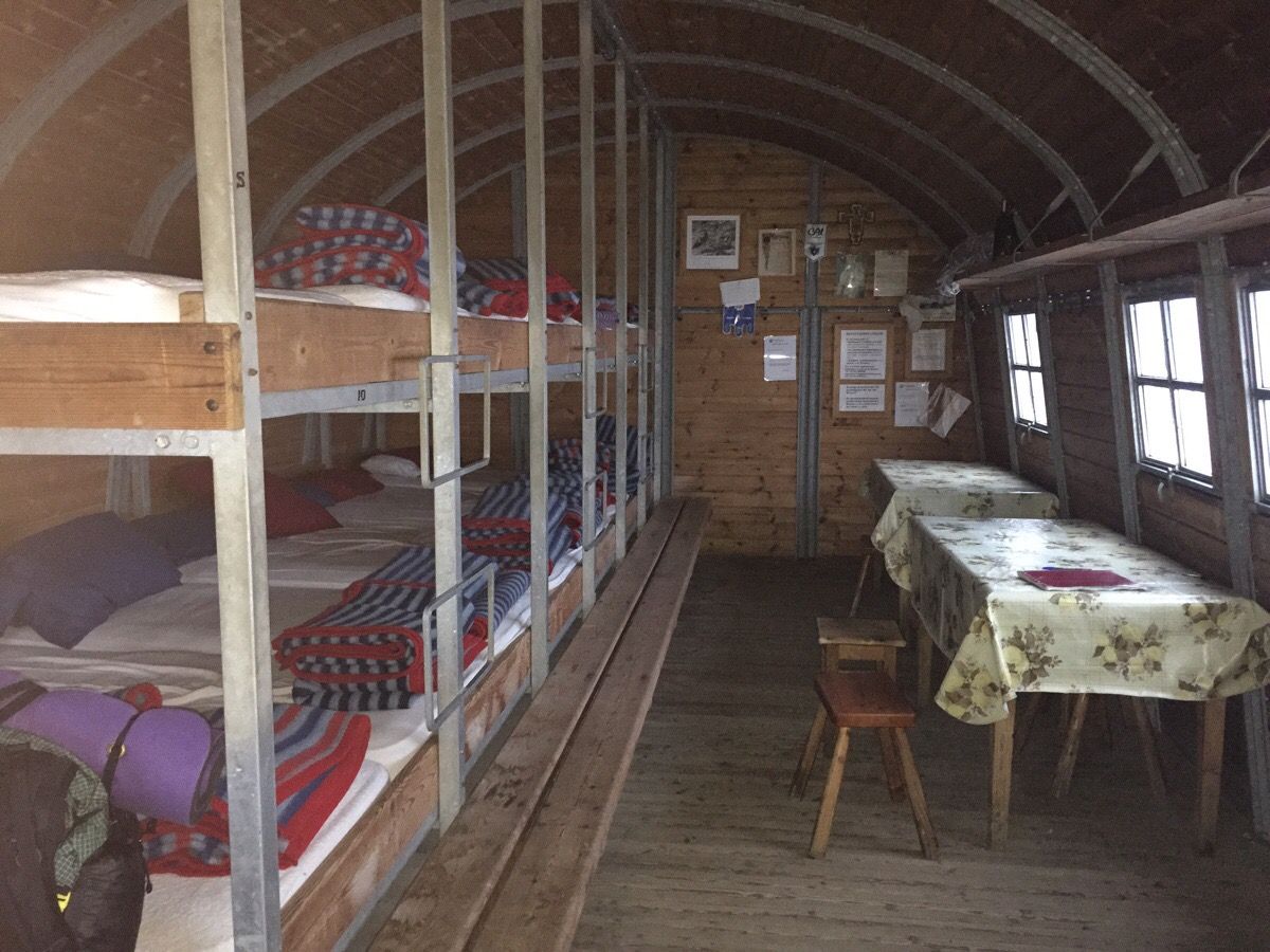
I’m sitting at the table in the Lateltin hut as I type this. The CAI know how to maintain an unlocked mountain shelter – it’s immaculate inside, with bunks for fourteen, loads of space, and a decent store cupboard. The fact that it’s essentially a metal can bolted to the side of a 3,132m mountain is neither here nor there; if this were a bothy, it would be the best bothy in Scotland.
My plan for tomorrow depends on the weather. I’m going to set my alarm for 7 o’clock; if it’s clear, I’m going to climb the nearby Testa Grigia, which apparently offers superb early morning views of the Lyskamm and Monte Rosa massif. If the hill fog doesn’t shift, I’m going to descend to Champoluc.
I’ve crossed my penultimate pass on the Tour of Monte Rosa. I have one left, the highest and hardest of all: the Theodulpass, well over 3,000m and with a glacier at the top. Tomorrow is going to be another tough day, but most of the hard work is behind me.
The Tour of Monte Rosa trail blog series
Day 1: Zermatt to Täschalp
Day 2: Europaweg stage 1
Day 3: Europaweg stage 2 and the Grächenwald
Day 4: the Balfrin Höhenweg
Day 5: the Monte Moro pass and the Vallee Quarazza
Day 6: Colle del Turlo and Alagna Valsesia
Day 7: the Alencoll and a night above 3,000m
Day 8: the ascent of Testa Grigia
Day 9: the Theodul Glacier and return to Zermatt

Alex Roddie Newsletter
Subscribe here to receive my occasional personal newsletter in your inbox. (For the fun stuff, please consider subscribing to Alpenglow Journal instead!)