Preparations for hiking the Jotunheimstien
I’m in the final stages of planning my next long-distance trail, which begins on the 18th of July 2017. Here I’d like to share a few notes on my route and the gear I’ve selected for this trip.
Once again, plans have changed. I originally intended to do a circuit of the Hardangervidda plateau, but for various reasons I changed my mind; I’m in the mood for something longer and more linear, walking towards a defined goal. Besides, there remains a lot of melting snow on the Hardangervidda and after the bad weather on my last Scottish trip I’m not really in the mood for challenging river crossings.
The Jotunheimstien
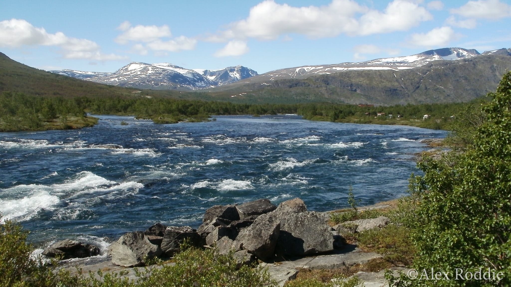
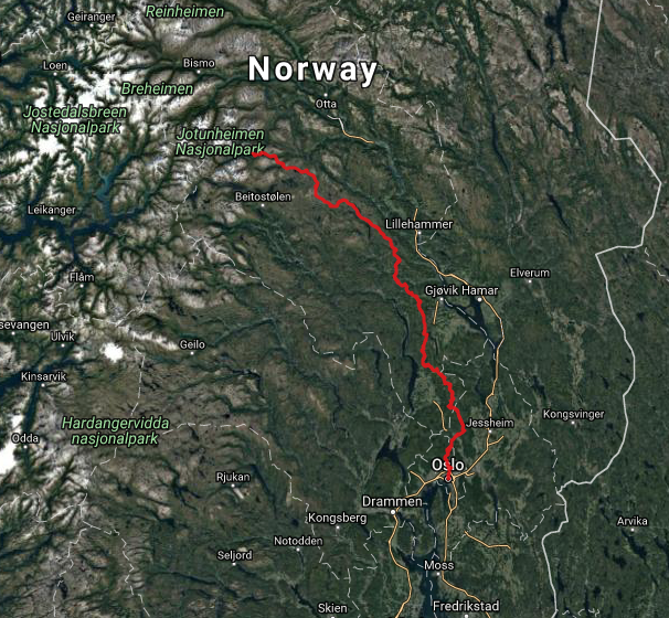
The Jotunheimstien1, which means Jotunheim Path, is of an altogether different character. It extends 200 miles from Oslo to Gjendesheim in the Jotunheimen National Park. Much of the route passes through forests and rough pasture until it enters the first wilderness area, Langsua. From this point onwards it’s a mountain trail although it never climbs much above 1,500m.
This route appeals to me because it’ll take me through parts of Norway I’ve never visited before. And although I anticipate bogs galore, the relatively undemanding nature of the trail itself will – hopefully – enable me to work on increasing my daily mileage.
Resupply is a key challenge. The locked self-service huts with their own food stores don’t appear until well into the second half of the walk. Fortunately there are several small grocery stores along the way, or a few miles off-trail, and I don’t anticipate having to carry more than 4-5 days’ worth of food at any point.
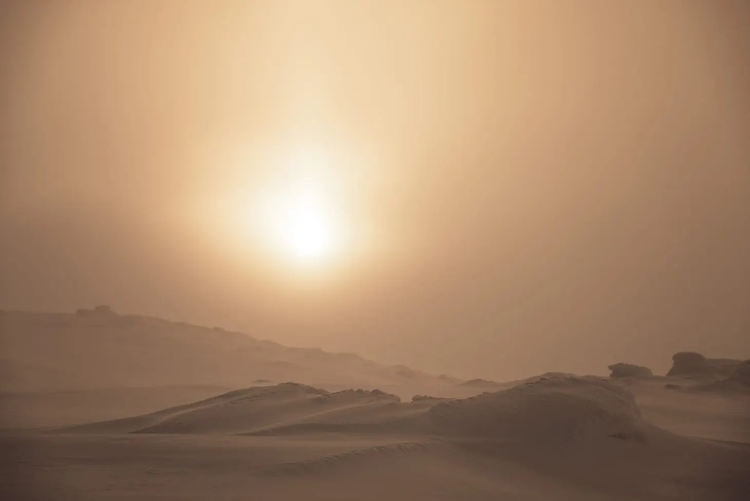
This is not a particularly serious route. Although I intend to camp under a tarp and bug net, I’ll be encountering huts every day or two, and civilisation is never very far away in any direction. At its wildest, it’s as remote as some parts of the Highlands, but it’ll give me a taste of genuine wilderness towards the end. The main challenge I’m anticipating is the bugs. This is peak mosquito season and I’m taking appropriate defences against them.
View the Jotunheimstien here in Gaia GPS.
Gear
When I was in Scotland last month I found that my pack weight had crept back up. Weight doesn’t bother me so much up to a point, but I do value having a simple setup on the trail – having few mental burdens is as important to me as having few physical ones.
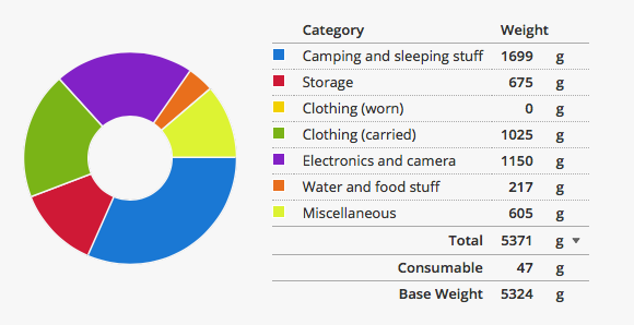
For this trip, I have reconsidered every single item. Combined with a few key additional purchases, I’ve succeeded in getting my base weight down to 5.32kg. I know that ultralight is supposedly dead but I think that, for the expected terrain and conditions, this qualifies as my first ultralight trip.
I’ve come to view ultralight as a state of mind rather than a specific target weight: selecting the right techniques and equipment – no more or less than necessary – in order to achieve your goal2.
Here are a few notes on the gear I’ve selected this time.
Shelter
I’ve recently acquired a second-hand MLD Cricket tarp. This is essentially a cross between the Trailstar and the Solomid – a beaked half-pyramid with something of the Trailstar’s variable pitching style, although much smaller. It can be pitched open and high when the weather’s fine, but battened down in a storm (although this apparently makes the shelter rather difficult to get in and out of!) The Cricket weighs approximately 400g – a decent weight saving over my Solomid XL, and a significant weight saving over my Trailstar. Since the Jotunheimstien is substantially a forest route, I don’t anticipate any problems using it.
I’ll also be taking my Solomid inner, modified to include DWR-coated walls on three sides. It’s slightly lighter than my all-mesh Weenest, and I think its draught-blocking properties could be useful on this trip. For pegs I’m going back to my trusty set of MSR Groundhogs, along with a couple of titanium nails in case I find stony ground.
Sleeping
I’m carrying the As Tucas Sestrals 167 synthetic quilt, which performed brilliantly in Scotland this summer, combined with a torso-length closed-cell foam pad (which I’ll roll up inside the pack to give it structure). This is a much thicker pad than the one I’ve taken on the last couple of trips, and will be more comfortable. I last used it in 2016; ditching it this year for a 60g weight saving was a stupid light decision.
Pack
I’ve selected the ÜLA CDT, a splendidly light frameless pack at 500g (when stripped of the bits I don’t need). I’m a huge fan of my ÜLA Circuit so I’m looking forward to using its little brother. I’m carrying ÜLA’s pack cover as well, and a pack liner.
Clothing
Clothing is similar to the gear I’d take to Scotland in July, but I’ve swapped my standard base layer for a nylon bug shirt. I am taking only a thin mid layer, the Montane Allez Micro Hoodie, and no down insulation. This will be my first trip using a rain kilt instead of waterproof overtrousers (which I always hate and am looking forward to ditching in summer).
Food and water
I am once again hiking stoveless. Going without a stove presents a few challenges (least of all the mental challenge of eating cold rehydrated glop at the end of a hard day), but I find the simplicity a huge advantage even if overall weight savings are minimal. I’m prepared to hike off-trail to bigger supermarkets if the small food stores on the trail don’t have the food I need.
For water, I’m using the Sawyer Squeeze filter. I know water in Scandinavian wilderness areas is usually drinkable, but I’m passing through a lot of agricultural land as well, and I hate faffing with purification tablets.
Electronics and camera
I’m taking my minimalist camera setup (Fujifilm X70), the small Ultrapod tripod, and a big power bank. Originally I considered taking my solar panel, but much of the route is below treeline so I decided the power bank would be a better idea. That means I’ll have to stay in one of the larger huts overnight to top it up, probably about halfway through the trip.
Navigation and miscellaneous
I am taking medium-scale maps printed from Gaia GPS covering the whole route. Since the entire route is waymarked, and I have the GPX track in Gaia on my phone, I don’t need highly detailed, small-scale topo maps.
Similarly, there is really no point in me taking a full baseplate compass (which I’ve only used about three times in the last five years anyway). I’m taking a tiny Suunto Clipper compass instead.
Other items are as minimal as possible: Opinel No.7 instead of Swiss Army Knife, stripped-down first-aid and repair kits, a small quantity of bug spray, and a headnet. There’s also the DNT hut key to let me into the locked, self-service huts along the route.
Other resources online
There are not many resources in English for this trail, but here are some links I found useful in the course of my planning:
Photos from a thru-hike in 2008
Some really handy tips on resupply and camping spots from the same hiker
List of huts along the trail, complete with links to the hut pages
An excellent trip report of a 2011 thru-hike by Thomas Gauperaa
- See this website for a full description of the route. An English translation is available. ↩
- Note that every backpacker will have a different goal. For some people it will be ‘to complete the journey with maximum comfort’; for others it will look a lot more masochistic. I’m somewhere in the middle, and for me, seeing how light I can go is part of the fun. ↩

Alex Roddie Newsletter
Subscribe here to receive my occasional personal newsletter in your inbox. (For the fun stuff, please consider subscribing to Alpenglow Journal instead!)