There comes a point in every writer’s career when the usual Google research is no longer enough. You’ve read the Wikipedia articles, you’ve chased up every ebook and textbook you can find, you’ve amassed a library of photos – but still something is missing. You become aware of the need to take a fundamental step into the unknown.
I am currently writing a novella set in Scotland in 1847, called The Forbes Challenge. I had reached that point in my research. The time had come to actually get out there and live my work, see the world as my characters would have seen it, tread the same long and lonely miles. It’s an approach that has paid off for me before and opens the door to a whole world of detail and realism.
I packed my rucksack and plotted a route from Blair Atholl to Aviemore. Including a ten mile detour to climb some mountains (which will be detailed in a future blog post), the total route measured 51 miles in length. A week ago I set out to begin my voyage.
Blair Atholl
 |
| The gatehouse of Blair Castle |
I arrived at Blair Atholl on the 1st of June. This village grew up around the Highland estate of Atholl, seat of the Dukes and Earls of Atholl for centuries. It’s a focus for my research because many of the characters in The Forbes Challenge are connected with the estate, from the 6th Duke himself to Duncan McAdie, lowliest forester. I had never visited Blair before and so wished to spend some time immersing myself in the history of this location.
The campsite I stayed at for the first night was actually located within the grounds of the castle. As I was to discover, the castle itself is simply astonishing.
 |
| Blair Castle |
I took a good look around the castle although unfortunately photography is forbidden everywhere except the ballroom. The walls are bristling with thousands of pairs of antlers, muskets, swords, paintings, and other bizarre objects – there is even a chair made entirely out of antlers! Much of this stuff is post-1847 although some of the rooms have changed little since the 18th century.
Despite the alterations, I learned a great deal of value which will find its way into my book.
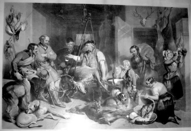 |
| The heyday of the Atholl estate |
Day 1 – Glen Tilt
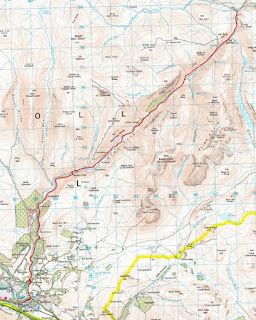 |
| Day 1 |
On the first day of my journey I walked the length of Glen Tilt between Blair Atholl and the Falls of Tarf, traditionally the northern border of the Atholl Estate (although nowadays the border is a little further north). The Falls of Tarf is also a pivotal location in The Forbes Challenge so I particularly wanted to spend the night here.
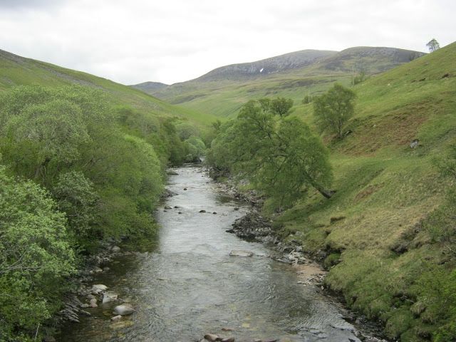 |
| Glen Tilt |
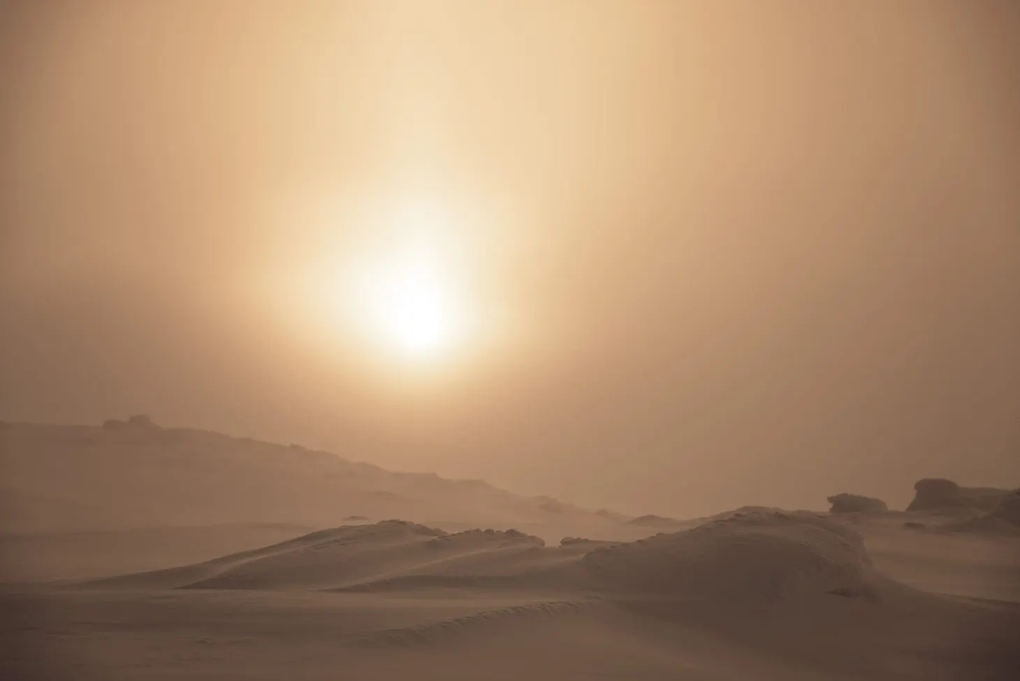
The main impression I gained on the long miles through Glen Tilt was the sheer vast scale of the Atholl estate. In the 1840s, Glen Tilt was the Duke’s special reserve; largely cleared of crofters and smallholders by that stage, it was a vast deer forest throughout which stags roamed, stalked and shot by wealthy visitors (and the Duke himself). Poaching was rife and any trespassers were dealt with harshly (for example the infamous 1847
Battle of Glen Tilt). In previous centuries the glen had been teeming with human settlements but all that was gone by the 1840s; now only a few working farms remain, although there are dozens of ruins.
The overall feeling is that it is a desolate landscape, blighted and emptied for the sake of profit and greed. Nowadays the Atholl estate does good work in preserving the natural habitats, but it was not always so noble.
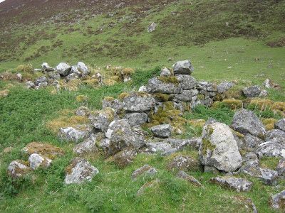 |
| A ruined shieling |
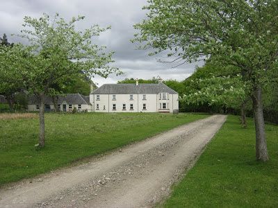 |
Forest Lodge, where shooting parties traditionally stopped
for their breakfast on their way through the reserve |
I stopped to camp overnight at the Falls of Tarf. Two hundred years ago there was a bridge over the river here, but it was demolished in 1819 to deter poachers. When Queen Victoria and Prince Albert visited Atholl in 1844 they were obliged to ford the river on horseback. Nowadays there is once again a suspension bridge for the benefit of foot traffic.
This is a key location in The Forbes Challenge and I spent a couple of hours spying out the lay of the land, making notes, and getting a feel for the place. It also made a very pleasant campsite, flat and midge-free with an abundant supply of drinking water!
 |
| Camp One |
 |
| The Falls of Tarf |
Day 2 – The Forest of Mar
 |
| Day 2 |
My second day in the Cairngorms dawned grey and windless, with a humid atmosphere in the glen. I now entered the Forest of Mar – another vast deer estate, owned in 1847 by the Earl of Fife. After the muggy air in the glens I was relieved to soon break out into the more open terrain that lies south of the big peaks either side of Glen Dee. I made rapid progress and soon passed Bynack Lodge, the first major landmark of the day.
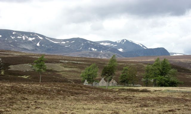 |
| The desolate ruin of Bynack Lodge |
Bynack Lodge was in use in the 1840s, inhabited by servant/s of the Mar estate
(and at that time called Croclach). By 1928 it was only occasionally occupied and as late as the 1940s it was still habitable as a bothy for mountain wanderers. Its present condition is utterly decrepit and there is a sad feeling about the location, perhaps induced by the knowledge that it was once a home but is now abandoned and lost to the wild.
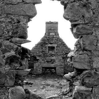 |
| Bynack Lodge |
I pressed on, fording a river which inundated my boots and necessitated a stop of half an hour to allow my socks to dry. Soon I was marching along the track which approaches the Chest of Dee, a natural water feature marking a watershed moment in the trek. I was about to enter Glen Dee itself.
 |
| Plenty of dark clouds, but the weather remained dry. |
Some of the biggest mountains in the UK are located on either side of Glen Dee: Ben MacDui, Braeriach, Cairn Toul. I had climbed all of these mountains already in previous years but had never approached them from the south before. The grandeur of the scenery gradually increased as I walked out the boggy miles and soon I was gazing up in awe at the snowfields suspended thousands of feet above me.
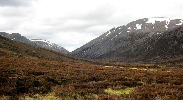 |
| Glen Dee. Ben MacDui, the 2nd highest peak in Britain, is on the right. |
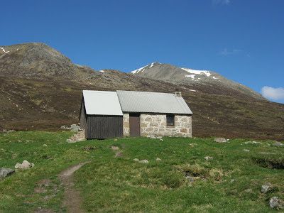
My goal for the night was an isolated bothy known as Corrour. It’s the only shelter with a decent roof for many miles and one of the most popular bothies in Scotland. Thanks to the excellent work of volunteers, it’s now a cheerful place to stay and I am fortunate to have visited Corrour on several occasions over the years.
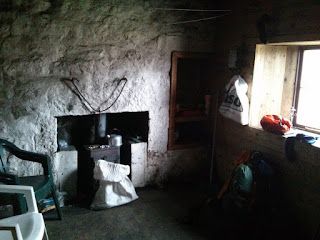 |
| The interior of Corrour |
Two other walkers were in residence that night and we chatted about mountains and whisky for a few hours before bed. I happened to have a small bottle of Talisker with me (a birthday present from James) which I shared with the other visitors.
Day 3 – Some mountains
I stopped at Corrour for a day to do some mountaineering. These are some of the finest peaks in the Cairngorms, after all, and it had been a long time since my last visit!
I will be writing up an account of the climb in a future blog post, but for now I’ll leave this picture to whet your appetite:
 |
| Still winter in the high mountains |
Day 4 – The Lairig Ghru pass
 |
| Day 4 |
The Lairig Ghru is a famous pass connecting Glen Spey with the interior of the Cairngorms. It’s a glacial trench carved out during the last ice age and forms a convenient way of accessing the terrain to the north.
It was sunny and warm when I departed Corrour at nine o’clock that morning.
 |
| Corrour. Cairn Toul is behind on the right. |
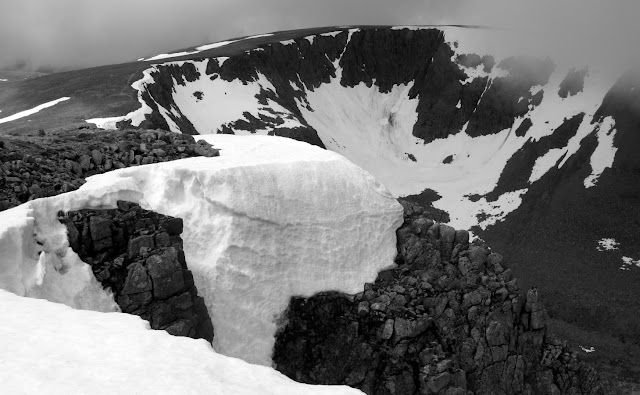
The pass takes you through some spectacular scenery, allowing easy viewing of the Braeriach snowfields, which frequently survive all year round. This year there are still some snow patches at surprisingly low altitude.
 |
| Garbh Coire, Braeriach |
The ascent to the top of the pass is easy enough for a few miles, until that is you encounter the boulderfields near the Pools of Dee. Last time I was here, in May 2010, colossal icebergs were gradually sinking into the waters – evidence of the vast depth of snow that builds up here during the winter, thanks to the avalanches that sweep the valley walls to either side. This time the snowfields had receded somewhat but were still very much in evidence.
 |
| The Pools of Dee |
From the top of the Lairig Ghru you can’t see all the way down into Glen Spey, but gradually more and more of the road onward is revealed until at last you catch a view of the miles of forest still to cross before reaching Aviemore. I was carrying a heavy pack and at this point I could feel every single mile I had walked so far. It looked like a hell of a long way to go yet!
 |
| The Rothiemurchus Forest |
On the plus side, Rothiemurchus is a beautiful forest. Although parts of the woodlands are managed, it’s descended from ancient Caledonian pine forest and has a prehistoric feeling to it. Apparently red squirrels live here although I wasn’t lucky enough to see any.By the time I finally reached Aviemore, my feet were blistered and I was looking forward to a well-deserved pint in the Old Bridge Inn (the place where all my Cairngorm adventures have traditionally ended over the years). The pint in question turned out to be Trade Winds, an old favourite of mine, and it tasted fine indeed after many miles on the road!
 |
| Cheers |
After something to eat, I decided to get the train back to Blair Atholl that night (as my ticket home was from Blair). From the train station, I caught one last glimpse of the mountain range I had crossed – distant, capped with snow – and the knowledge that I had walked all the way felt very satisfying!
 |
| A last view of the mountains |
The outcomeThis has been one of the best mountain holidays I’ve enjoyed in a long time. The weather held out for the full five days (including a previous day on Beinn a’Ghlo with James) and I managed to complete a respectable backpacking route, plus a clutch of mountains in fine condition. The only snag was my right knee, which developed a twinge on the second day, particularly when going downhill, and prevented me from extending the trip any further.In addition to the obvious pleasures (and pains!) of my voyage, I’ve picked up a mass of information which will make it into The Forbes Challenge. It’s all very well knowing the plain facts about a time or a place – anyone can look those up – but what really sets a book above all the rest is the detail. If the author has been to a place, touched it and smelled it, suffered for his art, then the words on the page will shine with meaning. This is one of the philosophies I have tried to adhere to throughout my writing career and it has transformed my work.I have no doubt at all that, when I finally finish TFC, it will be a far richer story thanks to my journey on foot from Blair Atholl to Aviemore.