The Cape Wrath Trail days 1 – 3
The Cape Wrath Trail is a long-distance hiking route in Scotland. It links Fort William with Cape Wrath, the farthest northwest point of the British mainland. Renowned as one of the toughest long-distance walks in the UK, it is not waymarked, has no single recognised route, and there is frequently no actual path underfoot. Due to its informal nature, the length of this trail varies. Most thru-hikes are around 230 miles in length.
My hike of the Cape Wrath Trail took place between June the 3rd and June the 22nd 2015, and consisted of eighteen days of walking and two rest days. My route was 241 miles in length and was based on the itinerary laid out in the popular Cicerone guide by Iain Harper, with a few small modifications. I used the new Harvey Cape Wrath Trail maps for navigation.
The CWT is one of the finest foot journeys of its kind in the UK and takes the hiker through some magnificent wild locations. Its tough and frequently trackless nature makes the route I took potentially tricky in poor weather, requiring good navigational skills, a high level of fitness, and the ability to cope with hazards such as the crossing of swift-flowing rivers. But it’s also truly magnificent. In this series of blog posts I will tell the story of my CWT adventure.
Day 1 – June the 3rd
11 miles
After the months of planning and preparation, obsessing over gear choices and lightening my pack gram by gram, it all came down to the act of taking that first step – the first step along the amazing journey that is the Cape Wrath Trail.
In recent years I’ve made a tradition of being in the outdoors for my birthday. In 2009 I climbed Tower Ridge at dawn, in 2010 I went climbing on the West Face of Aonach Dubh, and in 2013 I began a backpacking route through Glen Tilt into the Cairngorms. This year I went for a birthday meal at the Clachaig Inn, Glen Coe, with my parents and my brother James, and then I took the ferry from Fort William across Loch Linnhe to begin the first day of my CWT thru-hike.
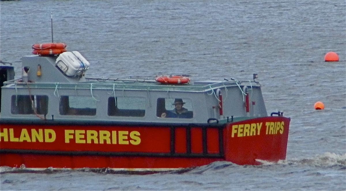 |
| My dad took this shot of me in the ferry |
It was late in the afternoon when I alighted in Ardgour, but the weather was sunny and warm and I started the walk along the lochside road enjoying the views across the water. Ben Nevis still held a considerable cap of snow. Many of the mountains I saw on my walk were dotted with snow patches although I was only forced to cross a snow patch on one occasion, at the highest point on my hike.
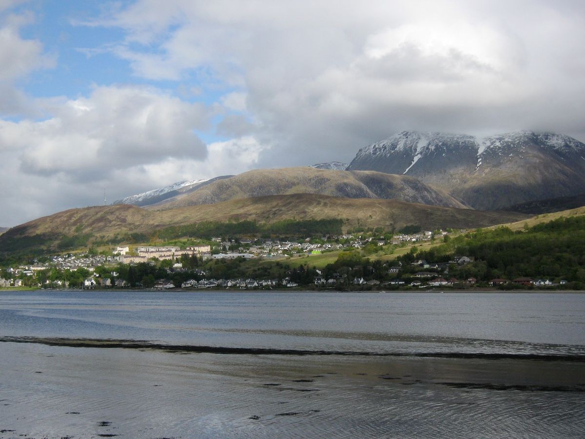 |
| Ben Nevis and Fort William from Ardgour |
After a few miles, I left the tarmac road and began to walk along the landrover track that would take me deep into the Cona Glen. This early part of the trail delighted me with its scenic woodlands, rolling hills, and variety of animal and bird life I saw along the way. The Cona Glen made a great – and easy – first stretch.
I made the mistake of passing several excellent potential campsites in the first half of the Cona Glen, which consisted of well-grazed pasture and open woodland. It was still early and I wanted to get my mileage into double figures for the first day! By the time I was ready to camp, the good pitches were behind me and I wasted time faffing about in rough and tussocky ground, swarming with ticks. At one point I found dozens of the little monsters crawling on my trouser legs; fortunately, none bit. Curiously this was the first and last time I actually saw a tick on the entire trail.
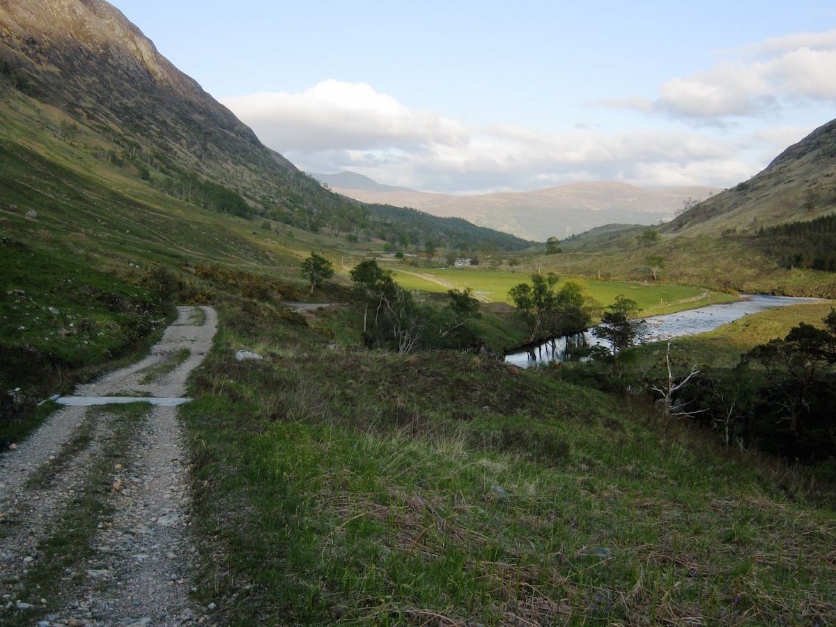 |
| The Cona Glen |
Eventually I pitched next to the locked estate shelter of Corriarach. I was feeling great after that afternoon of easy walking. Even though my pack held eight days’ worth of food, it felt light on my back – and my trail shoes made every step a pleasure. I drifted off to sleep dreaming about the wonders that lay ahead of me.
Day 2 – June the 4th
12 miles
I woke to muggy, cloudy conditions, and found that I’d managed to twist my sleeping bag completely around myself as I slept. Rain began to dot the flysheet as I packed. I consulted the guidebook, which promised some boggy and rough ground on the descent to Glenfinnan, and decided to wear my Goretex trail shoes that day. I guess I wanted to avoid wet feet for as long as I could.
I carried two pairs of shoes with me throughout the walk, but the Scarpa Spark GTX proved a poor choice: too heavy to justify carrying as camp shoes, but nowhere near as good as my Inov-8 Roclites for trail use. After the second day I never wore them for walking again. It was good to have dry footwear to change into at the end of each day, but I could have achieved that goal with a much lower weight penalty. We live and learn!
 |
| The Scarpa Spark GTX. Ok on good trails, no good on serious boggy ground. |
The Cona Glen became wilder as I walked west, leaving the hill pasture and woodland behind, entering the desolate landscape of peat and rock that walkers in Scotland get to know so well. The river was the real star of this section of the trail: the path never strayed far from it, and I became enthralled by its twists and turns, its cataracts, the numerous surprise views it offered. Sometimes grand old pines would arch over bends in the river – relics, I imagined, of some much older forest that had long since vanished beneath the bog.
 |
| The upper Cona Glen |
I followed the landrover track until it petered out at NM 905 737. At this point I began the first climb of the trail, which happened to coincide with the first boggy section … the first of many! It was raining by this point but I found the bad weather didn’t bother me as much as it would normally do when hillwalking in Scotland. Despite the promising forecast for the month, I had prepared myself for the certainty of wet days. On a long walk you’ll experience all kinds of weather.
The descent to Glenfinnan was rough, boggy, and windy. The weather felt more like October than June, and I actually stopped to put my fleece pullover on beneath my waterproof shell – unheard of for me in ‘summer’ conditions! My Goretex trail shoes performed poorly on the steep boggy descent. The lugs in the sole were not deep enough and the water sloshed around inside the shoes, unable to escape.
 |
| On the descent to Glenfinnan |
By the time I left Ardgour behind and made it to Glenfinnan at trail mile 21, I was cold and very wet. I dived into the cafe at the tourist centre and warmed myself over a cup of coffee. After a while I braved the rain again and by 3 p.m. I was walking along the landrover track under the famous viaduct.
At this point I was stopped by the Glenfinnan estate manager, a pleasant chap who was making a point of chatting to all the hikers passing along the trail that day. When I told him that I was hiking the CWT, he mentioned that he was seeing up to fifteen aspirant thru-hikers a week pass through the estate. This can’t, of course, be used as a scientific measure for how many people were on the trail – the estate manager won’t have spoken to everyone, and a good portion of hikers will choose the Great Glen variant at the start instead. However, it did surprise me; I hadn’t thought as many would be on the CWT. Consensus is that the popularity of this trail is increasing, and I saw plenty of evidence to support this as I moved north – along with plenty of evidence that a large number of hikers were dropping out.
I had stopped to sit on a rock and air out my feet when two other hikers passed me, labouring under huge rucksacks but seemingly cheerful enough. They were also hiking the CWT northbound, but had started that day in Glenfinnan, bypassing the Cona Glen section. We promised to meet up at the bothy just down the trail.
I reached the bothy a little while later. It was still early in the day, but given the foul weather I was unwilling to hike further in search of a campsite. Corryhully is managed by the Glenfinnan estate and is a cosy shelter with a good fireplace and – astonishingly – electrical sockets! I didn’t use the electricity supply but it was certainly one of the more comfortable bothies on my trip.
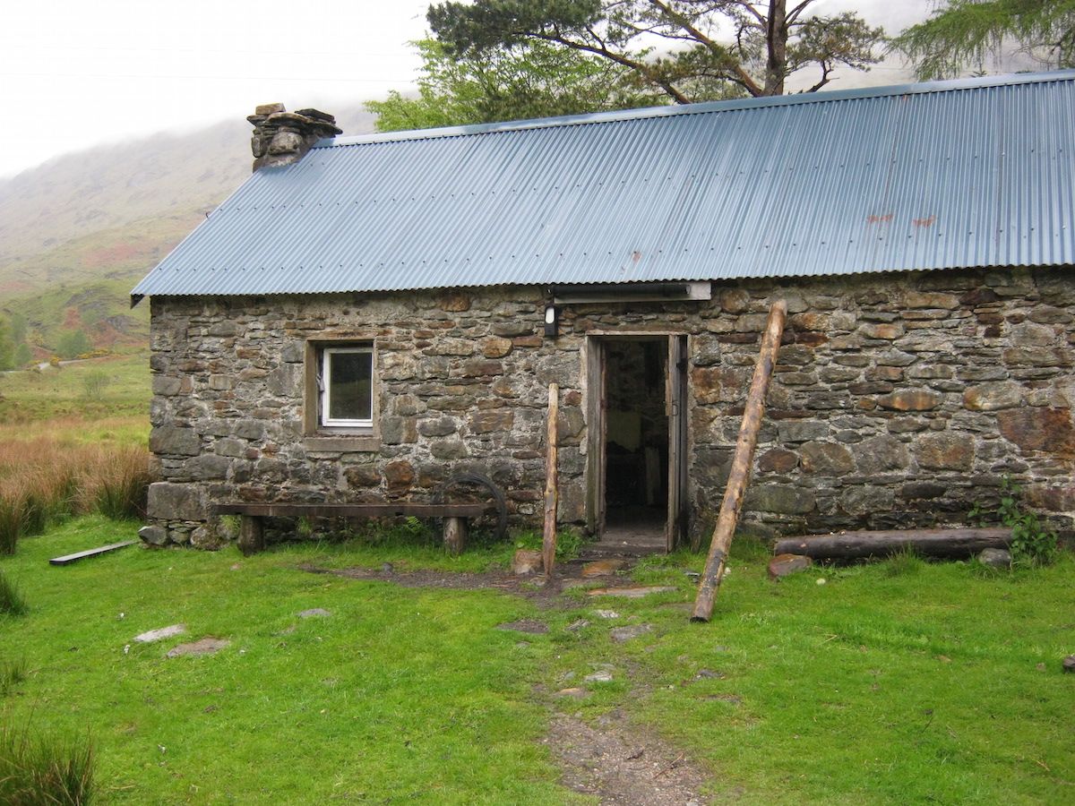 |
| Corryhully |
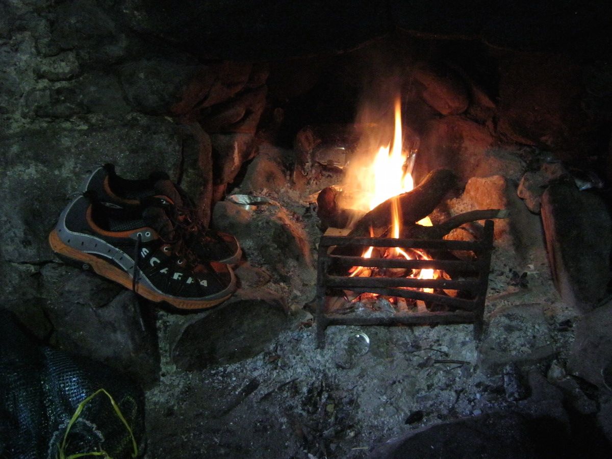
Mark and Brian, the two CWT hikers I had met earlier, were already at the bothy drying out. We chatted about the trail and about their plans for the next few days. After a while, they decided they were going to hike further and camp – Corryhully is only a few miles from the road, after all, and I guessed they wanted to achieve more miles for their first day. Meanwhile, I set to work chopping kindling, and half an hour later I had a good blaze going in the fireplace to dry out my gear.
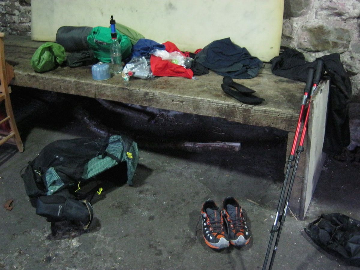 |
| The sum of my worldly goods on the trail |
… Or, at least, that was the plan. My Goretex trail shoes failed to dry at all, even after hours sitting directly in front of the fire. I had not enjoyed the sensation of my feet sloshing around in buckets of water – which could have been avoided if I’d have hiked in my quick-draining Roclites – and resolved to keep the Scarpa Sparks for camp and bothy use only. My irrational fear of wet feet had led me to put the Goretex shoes on at the start of the day, but it’s a tactic that has limited use in such conditions.
When I was making dinner, someone else appeared at the bothy – a chap in his early twenties who was studying outdoor education and spending the week walking and climbing in the area. He had been winter climbing on Ben Nevis that week and had decided that staying in a bothy was something he should do before he went home. He frequently exclaimed his delight at the facilities freely available in Corryhully as we chatted about bothy culture and how fantastic it is that the MBA maintains these wonderful open shelters for the use of mountain-lovers in all seasons.
I slept well that night in a warm and snug building, safe from the rain outside. It would prove to be the last time I’d be warm and dry for a while!
Day 3 – June the 5th
11 miles
By the time I woke ready to begin my third day on the trail, the weather had well and truly broken. Rain lashed the roof of Corryhully and the river had swollen overnight – not quite full spate, but noticeably higher and angrier than it had been the previous day.
This was the point where the trail got tough, according to the guidebook, and I was not looking forward to tackling my first major river crossing in these conditions. But when backpacking you don’t often have the luxury of taking a day off or changing your plans. You get on with it and adapt. That’s one of the best lessons the CWT taught me, but on that morning, observing the torrent eating away at the riverbanks and the spray misting into the air, it made me feel more than a little apprehensive.
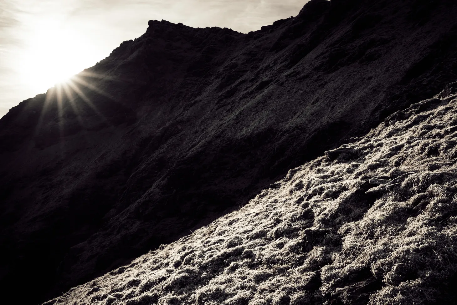
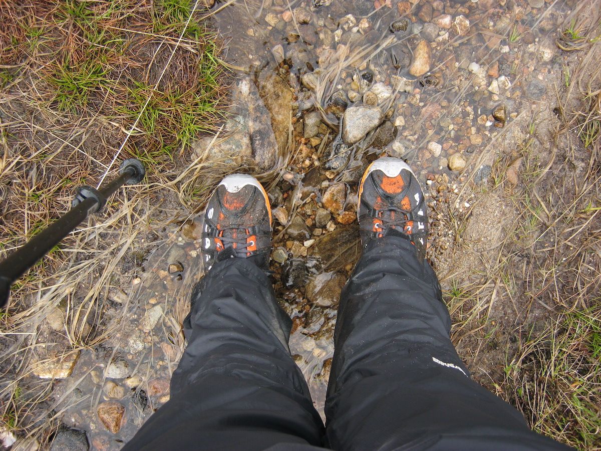
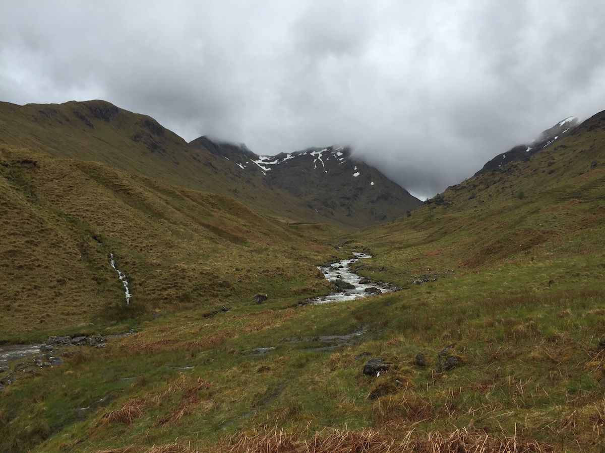
The trail crosses a pass between Streap and Sgurr Thuilm, reaching an elevation of 471m before dropping down to Glen Pean. This pass was not difficult, and even had a path for about two thirds of the way, but the high water levels made things interesting. While ascending, the path crossed and re-crossed the burn several times – easy crossings all, and since I had wisely chosen to wear my quick-draining trail shoes that day, I simply waded through and carried on when I got to the other side. Once your feet get wet subsequent wettings don’t matter.
But the descent on the other side of the bealach was something else. The path disappeared in a steep morass of swampy ground, eroded by the boots of many hikers. Water streamed from muddy ledges and the very ground I trod was a saturated sponge, releasing a litre or more of water with every step. Slosh – slosh – squelch – slosh – splat! – it got a little monotonous after a while, and I began to crave firm, dry ground.
 |
| Looking back to Streap and the pass to Glenfinnan |
Fortunately the rain eased off not long after I crossed the summit of the pass, and I noticed a reduction in the flow level of the river in a surprisingly short period of time.
The dreaded river crossing came all too soon. The guidebook recommended crossing the river at a point that looked scary to me, but after some uncertain walking up and down I found a place that didn’t look too bad. A small island divided the current into two streams: the first deeper and narrow, the second shallow but wide.
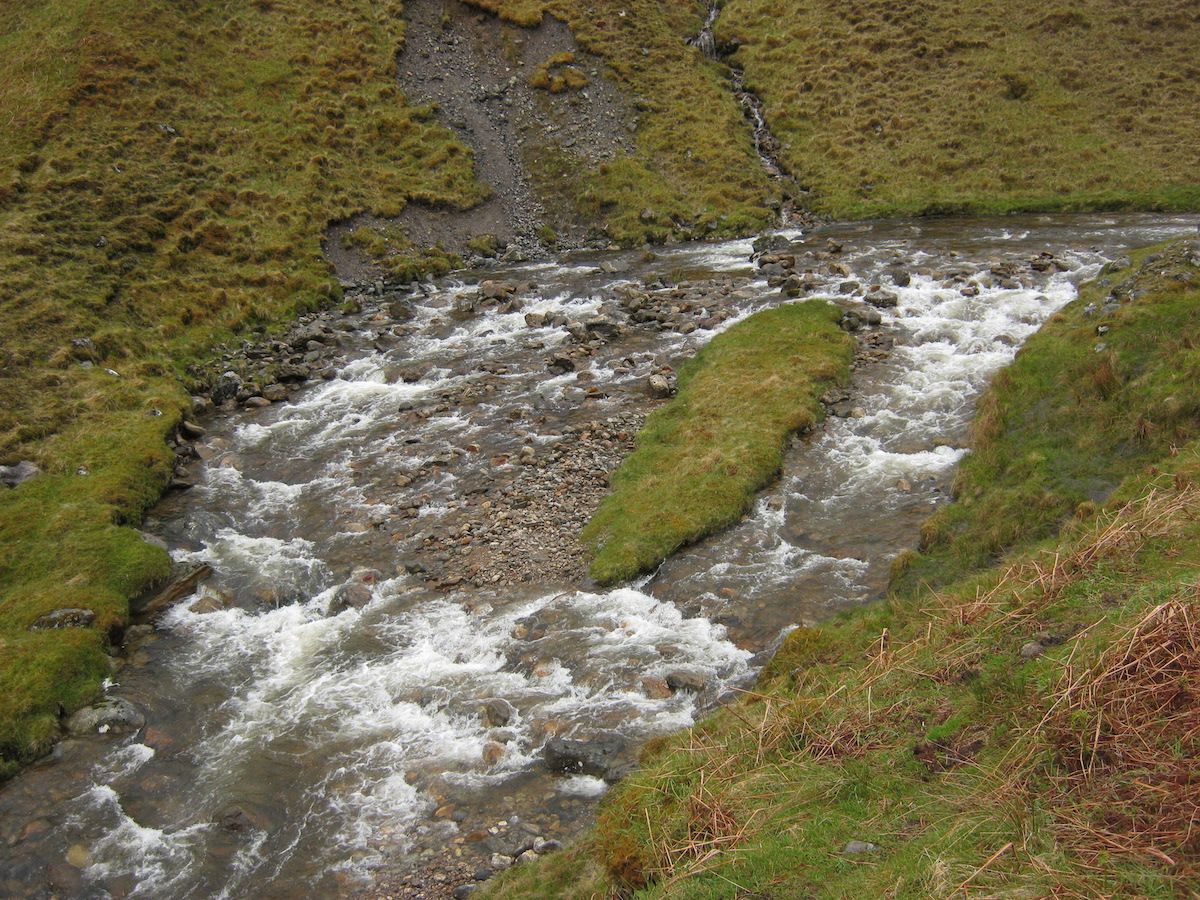 |
| The first river crossing |
After rolling up my trousers, I waded in. It was bloody cold, but the water only came up to my knees and there was little risk of being swept away. At the far bank, I was relieved at having survived my first river crossing, and it hadn’t even made me any wetter than I already was!
Further rough terrain, but improving weather, took me to the enormous bog in the bottom of Glen Pean. The CWT was diverted at this point; instead of going into the forest, dire warnings on hand-made signs directed the hiker on a winding route nearer to the river. Apparently a DANGEROUS BOG! had already CLAIMED SEVERAL PEOPLE!! and subsequent signs warned against the consequences of ignoring the previous signs.
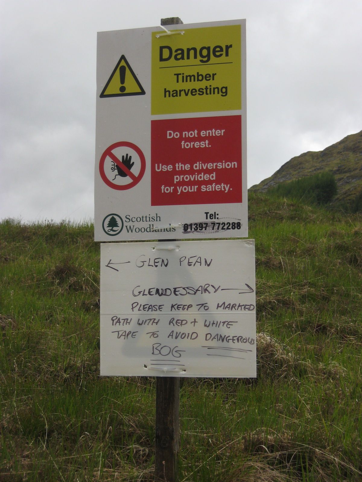 |
| Seems legit |
Of course, the diversion took me right through the middle of the bog, and I can only conclude that the landowner had a twisted sense of humour.
This was a different kind of bog. Instead of steep moss and eroded peat, this was the type of blanket bog that sits there on flat terrain, looking solid enough – until you try stepping on it. I went up to my knees a couple of times but managed to navigate around the worst of it.
The weather had actually turned hot and sunny by the time I turned from Glen Pean into Glen Dessary. Another bothy is located just along from Upper Glendessary, but it was still early in the day so I decided to keep going in the hope of finding somewhere to camp.
As before, the good tracks eventually disappeared and I found myself traversing boggy hillside above a forestry plantation, following an eroded and muddy path. It was no worse than the terrain I’d already encountered that day, however, and I made good time along that section. Huge rain squalls swept in at regular intervals, drenching me for half an hour before sunshine dried me off for another 30 minutes. This was repeated several times. The next band of rain would inevitably swoop in just after I had peeled off my waterproofs.
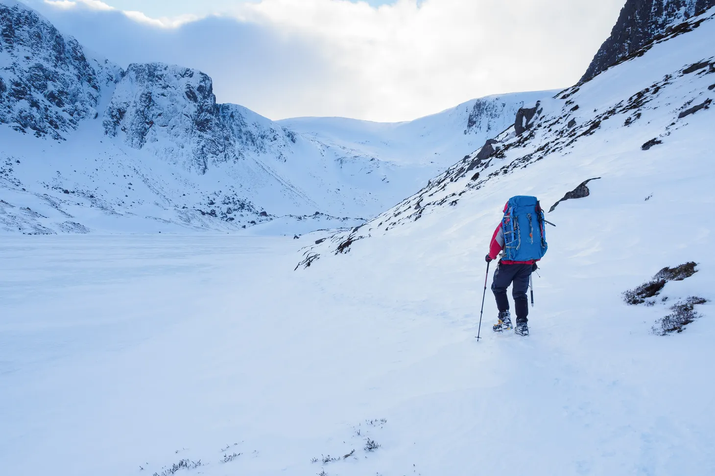
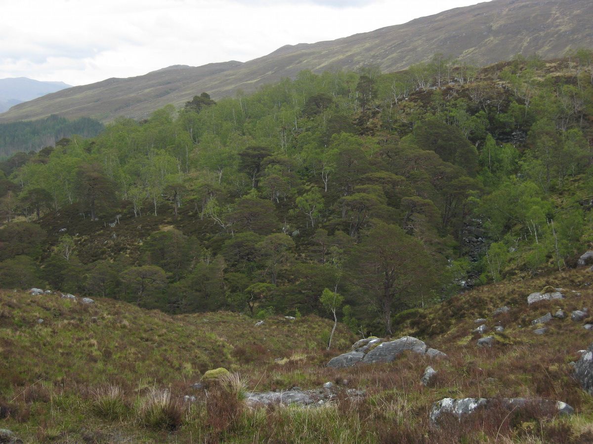
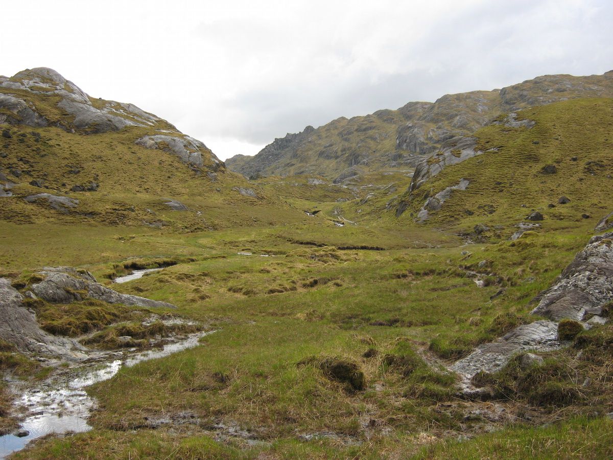
Upper Glen Dessary was a bleak and very beautiful place. I’d never been to Knoydart before but the geology of the Rough Bounds was all around me: sharp peaks, uniquely complex and rugged terrain, and a wildness that can scarcely be found in the mountains of Lochaber and Glen Coe that I know so well. There was a path marked on the map, but it was so faint underfoot by this point that I found it difficult to follow (although the fact that I was frequently goggling up at the mountain ridges above me may have had something to do with that).
 |
| My first taste of Knoydart |
I began to look for somewhere to camp. Again, few sites presented themselves. The ground was everywhere steep, or covered in stones, or tussocky, or heathery, or simply too waterlogged to support a tent – often a combination of these. I had learned years ago that it’s impossible to identify good campsites in Scotland by looking at the map, but nowhere is this more true than in Knoydart.
It was gone 9 p.m. by the time I eventually found somewhere to camp: a tiny patch of flat and only slightly waterlogged ground beside Lochan a’Mhaim, the high lake at the head of Glen Dessary. Someone had built a low stone wall around the perimeter of the pitch. In the sunshine that evening the location looked absolutely divine, beside clear waters, framed by the rugged peaks of Knoydart all around. I set up my Tarptent Notch and went down to the lochan to wash my shoes and socks (necessary when wearing mesh shoes, which tend to let in a lot of silt).
There weren’t even any midges. Heaven!
But my Knoydart wild camp didn’t remain heavenly for very long. High winds and more rain swept in overnight, and in the early hours I was kept awake as gust after gust battered my shelter from every direction. The 2mm cord between my tent and its pegging-out points slipped through the lineloks (thanks, I suspect, to a combination of wet cord and the fact that these linloks really need 3mm cord to be absolutely secure). This led to the tent vestibules losing tension and flapping about on several occasions. Each time this happened I had to readjust the lineloks.
The worst moment came at about 4 a.m. when an absolutely massive gust ripped three pegs out of the ground simultaneously and pretty much demolished my shelter. Both vestibule zips unzipped all the way to the top and in about five seconds I was trapped in a tangled mess of silnylon and a jumble of my belongings.
My first thought: Shit, that gust just ripped my shelter in two.
It was lashing it down with rain and I could hear another gust shrieking over the hill towards me. I acted instantly, tearing myself free of my sleeping bag and somehow extricating myself from the mess. In bare feet I searched the ground for the pegs that had come out – I found them three metres away in a patch of heather – and tried to get my tent up again.
It took only a moment to realise that things weren’t as bad as I had feared. The Notch had performed exactly as it was designed to: all the force of the gust had gone into pulling out the pegs and unzipping the zips, and there was no actual damage to the fabric. In such soft ground it’s a wonder more pegs didn’t come out.
I pulled my shelter back up and reinforced the pegs where I could with large stones. It was only then that I realised how wet and cold I had become in those intense few minutes. I crawled back into my shelter and got into my sleeping bag, not caring if the down got wet; temperatures were low for the time of year, and it was more important to warm up again.
Somehow I managed to get back to sleep. When I woke at eight, the events of the night didn’t seem so bad: my tent was still up, I hadn’t lost or damaged any of my precious equipment, and even my sleeping bag was only slightly damp. However, I resolved to replace my tent pegs with longer and more secure ones at the first opportunity, and also made a note to replace the cord on my tent when I got home.
The first section of the trip – Fort William to Knoydart – was over, and I’d received a taste of the challenges ahead. Over the next few days I would tackle the crossing of Knoydart itself.
In the next blog post I will tell the story of days 4 – 6, up to my arrival in Shiel Bridge.
Alex Roddie Newsletter
Subscribe here to receive my occasional personal newsletter in your inbox. (For the fun stuff, please consider subscribing to Alpenglow Journal instead!)