A Haute Route Pyrenees section hike, summer 2016
In When Plans Change I wrote about how my hiking plans for summer 2016 had fallen through. Here’s what I’m doing instead.
My main requirements for a long European walk this summer are:
- It has to be adventurous;
- It has to take about three or four weeks to complete (I can’t really justify being away for longer);
- There have to be big mountains;
- Overall costs have to be fairly low;
- I have to be able to write about it for the magazines I contribute to.
Sounds easy, right? The Nordkalottleden ticked most of the points on that list, but – due to how late I’d left the planning – costs were spiralling and I would have ended up completely skint by the end of the trip. So I started to look closer to home, and that’s when I realised that a route on my ‘maybe next year’ list could be the perfect choice for this summer’s long European walk.
The Haute Route Pyrenees
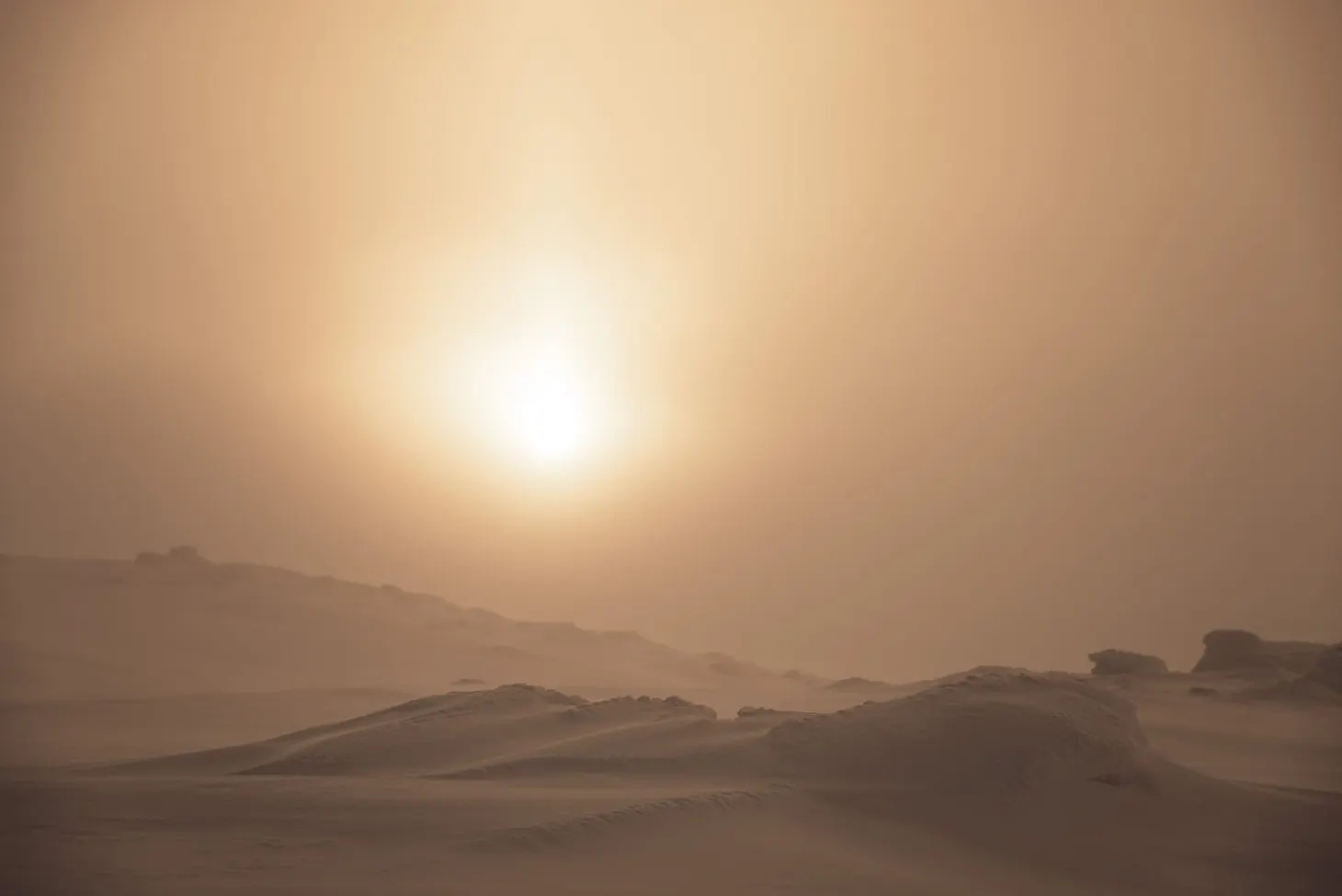
The Haute Route Pyrenees (HRP) is a grand traverse of the Pyrenean mountain chain from the Atlantic to the Mediterranean. Although the total mileage cannot be specified due to the numerous possible variants, it’s commonly regarded as being approximately 500 miles long. The HRP sticks to the high ground sandwiched between the established long-distance walking trails GR10 and GR11; as such, it’s more of a long-distance mountaineering route than long-distance backpacking, with several 3,000m summits along the way or available as short detours. This is a challenging route.
I have never been to the Pyrenees, but I do have some relevant family history. My grandad, Fred Clarke, fought in the Spanish Civil War as a volunteer in the International Brigade, but in order to reach Spain he had to cross the Pyrenees on foot. His crossing was somewhere towards the arid eastern end, near Perpignan, away from the big mountains – but of course he had no walking gear of any kind! In fact, he had left the UK dressed as a tourist in order to avoid raising suspicion. Stories like this are common in wartime, of course, but it always stuck in my memory and I have wanted to visit the Pyrenees since childhood.
More recently, I’ve been inspired by reading the blog of David Lintern, who thru-hiked the HRP in 2011. And one of the first Sidetracked web articles I read upon joining the Sidetracked team was the tremendously powerful Bare on Night Mountain. David’s been very patient in answering my questions and has helped me with my preparations a great deal.
My section of the HRP
My original plan was to thru-hike the entire route. Based on my normal average pace of 15 miles a day, I expected to be able to complete it in about 35 days. But a little more research revealed that this might be a tough pace to keep in the high mountains. Some people take up to 45 days to hike the entire trail, and I don’t have 45 days at my disposal. Last year on the Tour of Monte Rosa (which has a similarly brutal gradient profile) I averaged around 10 miles a day.
So I started thinking about doing a section of the HRP instead of the whole thing, and the more I looked into this idea the better it sounded. Although hiking the entire trail would be great, the western end, near the Atlantic, is relatively low and pastoral; the eastern end, near the Med, is a lot more arid. The best alpine landscapes are concentrated more or less in the middle.
Armed with the Joosten guide, a set of maps kindly loaned to me by David, plus the free Topo Pireneos digital maps1 which I loaded into Garmin Basecamp, I started planning my section hike of the Haute Route Pyrenees.
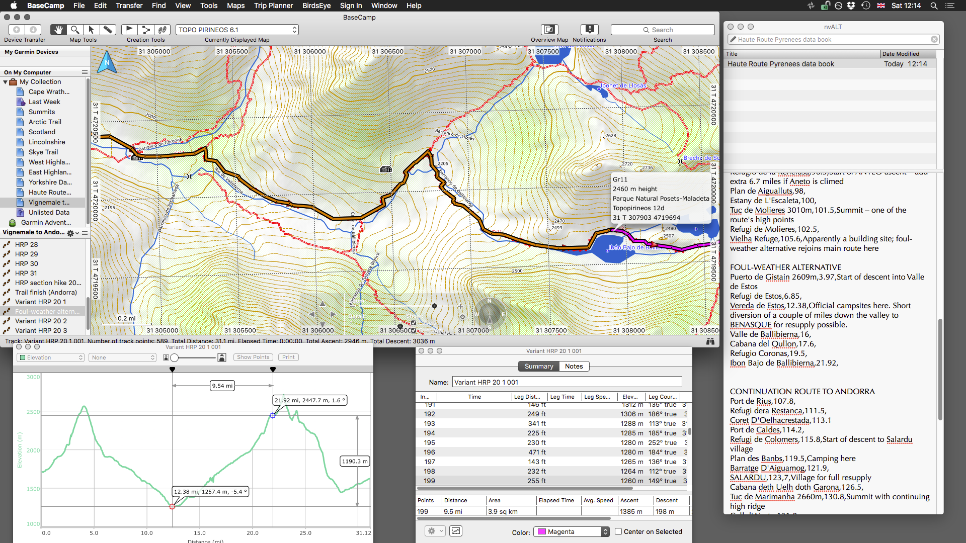
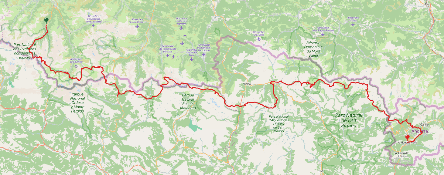
I won’t bore you with too much detail here, but my route corresponds with the central sections of the HRP. I’m accessing the trail from the small town of Cauterets in France, and leaving it in Andorra via the GR11. My route is approximately 200 miles in length and offers me a number of opportunities for optional fly-by peak-bagging missions on my way towards Andorra. I fly out from the UK on the 13th of July.
- These maps look a bit rough around the edges, but they actually contain a wealth of data relevant for the HRP or GR10/11 hiker: contour lines, marked trails, refuges, campsites, and more. ↩

Alex Roddie Newsletter
Subscribe here to receive my occasional personal newsletter in your inbox. (For the fun stuff, please consider subscribing to Alpenglow Journal instead!)